

Roughly 116,000 merchant vessels are crossing the world’s oceans right now. You can track ships in the ocean for free, in about 15 seconds, because most of them constantly broadcast their identity, position, speed, and heading via a system called AIS.
Open MarineTraffic or VesselFinder, type a vessel name, and you’ll see a dot on a map. Simple. But that dot is a transmission, not a verified location. In December 2025, at least 14 sanctioned tankers used fake AIS data to fabricate port calls that never happened.
The tools are free and fast. Understanding what you’re actually seeing, and what you’re not, takes a few more minutes. That’s what this guide covers.
How to Track a Ship Right Now
Open any public AIS-based tracker. Search by the ship’s name, its IMO number (a permanent seven-digit ID assigned to the hull), or its MMSI (a nine-digit number tied to the radio equipment). You’ll get the vessel’s last-reported position, course, speed, destination, route history, and estimated time of arrival. No account needed on most platforms. The whole process takes about 15 seconds.
On the map, you’ll see color-coded symbols representing vessel types. Green typically means cargo. Red means tanker. Blue means passenger. Orange often indicates fishing. Each symbol may include a directional line showing course and speed. Click on any symbol to pull up the full data card: name, flag, dimensions, classification, last port, next port, and ETA.
Before you read too much into that data card, three caveats:
- The position shown is the last one the tracker received, not necessarily the ship’s position right now. Offshore vessels may have updates that are minutes or hours old.
- Destination and ETA are entered manually by the ship’s crew. They can be wrong, outdated, or blank.
- Speed over ground comes from GNSS, which is usually reliable. But a ship at anchor in a strong current can show apparent movement that isn’t real.
Tracking a cruise ship your family is on? The free map is more than enough. Making a logistics, insurance, or compliance decision? Those caveats matter. Here’s why.
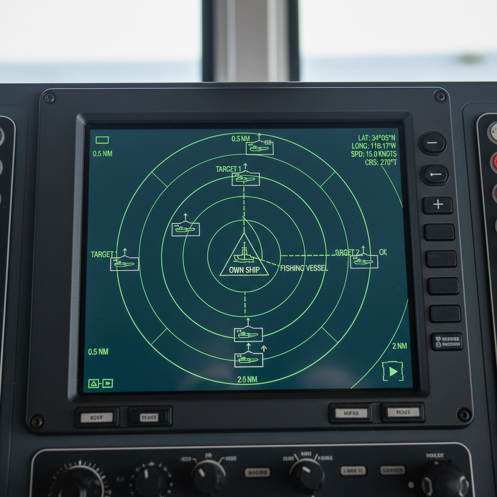
How AIS Works: The System Behind Every Ship Tracker
AIS is a VHF radio broadcast system. The IMO adopted the carriage requirement in 2000, and by the end of 2004 it applied to all international voyaging ships of 300 GT and above, cargo ships of 500 GT and above domestically, and all passenger ships. The system exchanges identity, position, course, speed, navigational status, and safety information between equipped vessels, shore stations, and aircraft.
The hardware is straightforward: one VHF transmitter, two receivers, a GNSS module for position and timing, and connections to onboard navigation sensors. The US Coast Guard describes a self-organizing time-slot system where one position report fits into one of 2,250 slots every 60 seconds. Ships coordinate automatically to avoid transmitting over each other.
Here’s the five-stage pipeline that turns a radio broadcast into a dot on your screen:
- The ship’s GNSS receiver determines position and time. Bridge systems add heading, speed, navigational status, and destination.
- The AIS transponder selects a time slot and sends a VHF packet. A moving cargo ship transmits every few seconds. A vessel at anchor may transmit every three minutes.
- Coastal antennas receive the signal when the ship is within radio range. Satellites capture it when they’re overhead and the ship is in their footprint.
- A data provider joins messages to a vessel identity, filters implausible position jumps, resolves MMSI or name changes, and constructs route and port events.
- A map, app, API, or data feed delivers a position, history, ETA, or behavioral analysis to the end user.
The essential takeaway: AIS is cooperative data. The system reports what the ship transmits. If the crew enters the wrong destination, the map shows the wrong destination. If the transponder is off, the ship is invisible. If someone manipulates the signal, the map tells a story that never happened.
Why Ships Vanish from the Map
You’re tracking a container ship. It left Rotterdam, showed up steadily through the English Channel, then disappeared somewhere past the Bay of Biscay. No signal for hours.
Most likely: nothing dramatic. The ship sailed beyond the range of coastal AIS antennas.
Terrestrial AIS operates on VHF. Its typical reception range at sea is about 20 nautical miles, depending on antenna height. Once a vessel passes that horizon, shore-based stations stop hearing it.
Satellite AIS extends coverage into the open ocean. Receivers on low-Earth-orbit satellites listen for AIS transmissions globally. But the satellite’s footprint covers an enormous area (roughly 2,000 kilometers in radius, per Kpler’s documentation), which means it hears thousands of ships at once. Signals collide. Messages get lost. Research on satellite AIS detection confirms that dense traffic increases collision probability, and that longer observation intervals improve the chance of receiving at least one clean message from any given ship.
The practical result: “live” ship tracking is live near the coast. In the open ocean, it’s closer to “last observed, possibly hours ago.” A ship can be perfectly safe, transmitting normally, and still not appear on your map because no satellite has passed overhead recently or its messages were drowned out.
Other reasons a ship might vanish from a tracker:
- Transponder malfunction or intentional shutdown.
- High traffic density in the area causing signal collisions beyond what a satellite can resolve.
- The provider’s data pipeline filtered or delayed the observation.
- The ship intentionally went dark to avoid detection (more on that later).
| Tracking Layer | Strength | Main Limitation |
|---|---|---|
| Terrestrial AIS | High-frequency updates near coasts, ports, and traffic lanes | About 20 nautical mile range; no coverage offshore |
| Satellite AIS | Open-ocean observation; wide-area fleet monitoring | Message collisions in dense traffic; gaps between satellite passes |
| LRIT | Global ship identification for maritime security | Regulated system; not publicly accessible; different purpose from AIS |
| Radar, SAR, optical imagery | Independent physical verification; can detect ships without AIS | Expensive; weather-dependent; processing and tasking delays |
| IoT asset trackers | Tracks specific containers, equipment, or cargo aboard | Requires device deployment; separate from vessel-level tracking |
Free Ship Tracking Tools Compared
Every public tracker uses AIS data. The differences are in interface, features, satellite coverage, and what sits behind the paywall. Here’s an honest look at the main free options in 2026:
| Platform | Strengths | Limitations | Best For |
|---|---|---|---|
| MarineTraffic | Largest user base; 350K+ vessels daily; mobile app with augmented reality; satellite AIS on paid tier | Full satellite coverage and historical data require subscription | General-purpose tracking; port arrivals; vessel photos |
| VesselFinder | Clean interface; weather overlays (wind, waves, temperature); container tracking feature | Similar paywall on satellite data; nautical charts premium-only | Quick lookups with weather context |
| Voyage Radar | No account required; voyage history playback; 400K+ vessels; educational content on AIS | Ad-supported; less polished interface | Research; incident investigation; learning AIS |
| ShipFinder | Ship-spotting community; multi-platform mobile apps; social features | Smaller dataset; less feature depth for professionals | Hobbyists and ship spotters |
| SeaRates | Integrated with logistics tools; search by vessel name, IMO, or MMSI; ETA-oriented display | Primarily designed for freight users | Cargo owners and freight forwarders |
A note on what “free” means in practice. Every platform offers basic position lookups at no cost. The moment you need satellite coverage in open ocean, historical route data beyond a few days, fleet monitoring, or API access, you’ll hit a paywall. That’s not a complaint. Satellite data and normalization infrastructure cost real money to operate. Just know where the free tier ends before you rely on it for a commercial decision.
When a Dot on the Map Is Not Enough
A family tracking a cruise ship needs a dot on a map. A fleet operator, commodity trader, or compliance analyst needs something else entirely: context.
Consider what happened during the Red Sea crisis. By mid-February 2024, 586 container vessels had been rerouted away from the Bab-el-Mandeb strait. The OECD’s International Transport Forum measured the scale: a 55% drop in strait transits, a 130% increase around the Cape of Good Hope, roughly 8,500 extra nautical miles per round trip, and about 10 additional days each way.
A free tracker could show you that a specific ship was near South Africa instead of Egypt. It couldn’t tell you how many vessels had rerouted, what that meant for your container’s ETA, how port congestion was building downstream, or what it would cost in charter rates and inventory buffers.
That’s the job of enterprise maritime intelligence platforms. Services like Kpler MarineTraffic, Lloyd’s List Intelligence AIS SeaOrbis, and S&P Global AISLive combine terrestrial and satellite AIS with port data, vessel registries, cargo context, and predictive models. Lloyd’s List Intelligence reports multi-source coverage of the commercial fleet, including 12,000 ports, 16,000 terminals, and 43,000 berths. S&P Global’s AISLive advertises positions for more than 580,000 AIS-equipped ships within shore-based coverage areas. Those are vendor claims, and they should be tested against your specific routes, vessel classes, and latency requirements. But the pattern is clear: the value shifts from “where is the ship?” to “what does that position mean for my operation?”
The global ship-tracking market is projected at $6.3 billion in 2026, heading toward $15 billion by 2034. That growth isn’t powered by hobbyists. It’s driven by organizations that need position data tied to ownership, cargo, risk, ETA, and behavioral history.
AIS Spoofing and Dark Ships: The Trust Problem
AIS was designed for maritime safety, not for enforcement or compliance. It’s a cooperative system: the ship decides what to transmit, and the receiver accepts what it hears. That design breaks down when someone has a reason to lie.
In December 2025, the US Treasury sanctioned a group of tankers involved in Iranian oil trade. Lloyd’s List Intelligence later reported that at least 14 of those tankers had broadcast fake AIS data showing port calls at Khor al Zubair, Iraq, during the first half of the year. Those calls never happened. The ships fabricated an entire AIS narrative to disguise their actual movements.
Earlier that year, in April 2025, OFAC issued formal guidance for shipping and maritime stakeholders on detecting and mitigating sanctions evasion. AIS manipulation is now a compliance concern, not a fringe curiosity.
The “dark ship” problem extends beyond sanctions. Vessels engaged in illegal fishing, smuggling, or unauthorized transshipment routinely turn off their transponders to operate undetected. To close that gap, ICEYE and Spire combine satellite AIS with synthetic-aperture radar imagery to find vessels that aren’t broadcasting. If AIS says an area is empty but radar shows a ship sitting there, something needs explaining.
For most casual users, spoofing isn’t a daily concern. But for anyone making a decision that involves money, safety, or regulatory exposure, the principle is worth internalizing: AIS tells you what was said. It does not tell you what’s true. Corroborate with port records, vessel registries, satellite imagery, and behavioral analysis before treating a dot as proof.
Ship Tracking vs. Asset Tracking: The Gap That Costs Real Money
Here’s something the ship-tracking conversation almost always misses: knowing where the vessel is tells you nothing about where the container, ULD, or piece of equipment on that vessel ends up after discharge.
AIS tracks ships. It does not track the 40-foot container on deck three, the unit load device in the cargo hold, or the reusable packaging that cycles between your facilities and your customers. The ship docks. The container gets unloaded. And then, for most organizations, visibility goes dark.
That’s the difference between shipment tracking and asset tracking. Shipment tracking follows a consignment from origin to destination. Asset tracking follows the physical asset through its entire lifecycle: transit, delivery, dwell, return, reuse. The first job ends at the port. The second one never stops.
I’ve watched this gap quietly drain companies of millions. Containers sitting idle at terminals for weeks because nobody tracked dwell time. Reusable transport assets lost at customer sites because tracking stopped at delivery. Equipment pools shrinking month over month because the only visibility was vessel-level AIS, and nobody instrumented the assets themselves.
Learn more about tracking your equipment fleet effectively.
If your operation depends on containers, pallets, or equipment that move by ocean, the ship’s AIS position is only one layer. The layer underneath it is an IoT device on the asset itself: something that reports location, movement, and status regardless of which vessel it’s on, which port it’s at, or whether it’s sitting forgotten in a yard somewhere.
That’s what we build at Datanet. Our ocean equipment tracking devices are designed for exactly this problem: tracking the assets that AIS can’t see. If your container pool or equipment fleet feels invisible the moment it leaves the ship, that’s the gap asset tracking closes.
Questions about closing that gap? Talk to our team or reach us at info@datanetiot.com.

Frequently Asked Questions
How do I track a specific ship in the ocean?
Open a free AIS platform like MarineTraffic, VesselFinder, or Voyage Radar. Search by the ship’s name, IMO number, or MMSI. You’ll see its last-reported position, speed, course, route history, and estimated arrival time. No account is needed for basic lookups.
Is ship tracking really real-time?
Near the coast, terrestrial AIS can deliver updates every few seconds. In the open ocean, satellite AIS introduces delays ranging from minutes to hours, depending on satellite pass frequency and traffic density. “Live” on most platforms means “last received,” not “right this second.”
Can I track every ship in the ocean?
No. AIS is mandatory for international vessels of 300 GT and above, cargo ships of 500 GT and above domestically, and all passenger ships. Smaller boats, military vessels, many fishing craft, and ships with disabled or manipulated transponders may not appear. A database entry doesn’t guarantee a current position observation.
Why did a ship disappear from my tracking map?
Most commonly, the ship sailed beyond coastal antenna range (about 20 nautical miles) and hasn’t been captured by a satellite pass yet. Other causes include transponder malfunction, intentional shutdown, high traffic density causing signal collisions, or data pipeline filtering. In rare cases, deliberate AIS manipulation.
What is the difference between AIS, GPS, and LRIT?
GPS (or another GNSS) determines the ship’s position onboard. AIS broadcasts that position along with identity and navigation data to other ships and shore stations. LRIT is a separate, regulated satellite-based system used by governments for maritime security tracking. They solve different problems: positioning, cooperative awareness, and security identification.
Can AIS data prove where a ship actually was?
AIS is evidence of what was transmitted, not proof of physical presence. For decisions involving sanctions, insurance, or collision investigation, corroborate AIS with port records, satellite imagery, radar, vessel registries, and behavioral analysis. The December 2025 spoofing cases demonstrated that entire AIS narratives can be fabricated.







 +1 508 292 2210

2 Responses