

Over 60,000 aircraft engine parts with forged release certificates shipped to airlines worldwide between 2019 and 2023. If GPS trackers had been on every one of those boxes, every coordinate would have been perfectly accurate. None of it would have caught the fraud.
That gap between “visible” and “verified” is exactly why the question of what to consider when tracking aircraft assets runs deeper than most procurement teams expect. “Aircraft asset” itself means at least six different things: a widebody in cruise over the Pacific, an engine in transit to an MRO shop, a ULD cycling between three continents, a calibrated torque wrench, a pushback tractor on the ramp, a checked bag. Each needs different hardware, different data, different update intervals, and a completely different regulatory treatment.
The programs I’ve seen deliver measurable ROI get one thing right on day one: they define the asset and the decision that data must support before they pick the tracker. The ones that don’t end up with expensive hardware sending coordinates nobody acts on.
Here are the considerations that separate a deployment that pays for itself from a dashboard nobody opens:
- Define the asset class before selecting hardware
- Understand which regulatory gates apply to your specific assets
- Match signal technology to the decision the data must support
- Plan for GPS degradation, not just GPS coverage
- Separate location tracking from airworthiness verification
- Test interoperability across organizational boundaries
- Build the business case around avoided cost, not tracking specs
- Design data ownership and access control from day one
Define the Asset Before You Choose the Tracker
This sounds obvious. In practice, it is the step most procurement teams skip.
The word “asset” in aviation covers an enormous range, and each category has a different identifier, a different custodian, a different required response time, and a different regulatory footprint.
| Asset type | Typical identifier | Core tracking question | Who acts on the data |
|---|---|---|---|
| Aircraft (in flight) | ICAO 24-bit address, tail number | Where is it now? Is it in distress? | Airline OCC, ATC, lessor |
| Engine or life-limited part | Serial number, part number | Where is it, and is its documentation valid? | MRO, engineering, records |
| ULD (container or pallet) | IATA ULD code | Where in the cycle is it? Loaded or empty? | ULD owner, ground handler, airline cargo |
| Maintenance tooling | Tool ID, calibration number | Is it in the hangar? Is calibration current? | MRO toolroom, quality assurance |
| Ground support equipment | Fleet or asset number | Is it available? Does it need service? | Ramp operations, fleet management |
| Checked baggage | 10-digit IATA tag number | Did it make the transfer? | Baggage ops, passenger services |
A GPS tracker on a ULD tells you where the container is. It says nothing about whether the engine inside it has a valid release certificate. A live flight feed shows you the aircraft’s position every second. It cannot tell you where the tow tractor that’s supposed to meet it at the gate is parked.
Start with the decision, not the device. When this data point arrives, who will act on it? What will they do differently? If nobody has a clear answer, you don’t need a tracker yet. You need a workflow.
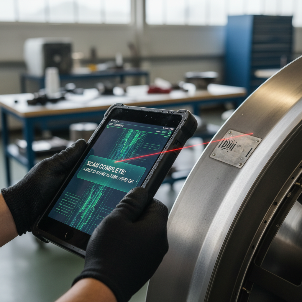
Know Which Regulatory Gates Apply to Your Specific Asset
Aviation tracking carries regulatory weight that logistics or fleet tracking in other industries does not. But not every asset triggers the same rules. One of the most expensive mistakes I encounter is over-certifying hardware for assets that never go airborne, or under-certifying devices that do.
Here is how the regulatory landscape breaks down by layer:
ICAO’s Global Aeronautical Distress and Safety System (GADSS) established two distinct obligations for aircraft. Normal flight tracking requires position reports (latitude, longitude, altitude, time) at intervals of 15 minutes or less. Autonomous distress tracking (ADT) demands reports at least every 60 seconds and must function even if the aircraft loses electrical power. These requirements apply to newly produced airplanes above 27,000 kg. They are aircraft-level requirements. A cargo tag or a ULD tracker does not need to satisfy them.
In U.S. controlled airspace, ADS-B Out is mandatory in designated areas and broadcasts GPS-derived aircraft position roughly once per second. This is an aircraft avionics system. It is not the same thing as deploying an IoT asset tracker.
For physical devices installed on aircraft structures or components, FAA Advisory Circular 20-162B addresses the airworthiness approval of passive, battery-assisted, and active RFID tags and sensors. It requires a safety assessment of potential malfunction and demonstration that powered tags will not interfere with aircraft electronics.
For cargo trackers shipped inside the aircraft (not installed on it), the rules shift to airline-specific policies and IATA dangerous-goods regulations around lithium batteries. Lufthansa Cargo’s guidance on customer-owned tracking devices is instructive: it requires technical assessment for each new device, mandates that transmission be disabled during flight, and flags battery-condition risks. Approval with one carrier does not carry over to interline segments automatically.
A DO-160G certified tracker like the Thingfox T2 is built for this airborne environment. But if your assets are GSE vehicles on the ramp or tools inside a hangar, that level of certification is unnecessary cost. Match the regulatory gate to the actual operating environment of your asset, not to a generic “aviation” label.
Choose the Signal Based on the Decision It Must Support
Too many RFPs specify “real-time GPS tracking” as a blanket requirement across all asset classes. Real-time GPS for a widebody crossing the Atlantic makes sense. Real-time GPS for a dolly that never leaves the apron drains battery life and budget for no operational gain.
Each signal technology serves a specific environment and decision type:
| Technology | Best suited for | Strength | Watch out for |
|---|---|---|---|
| ADS-B (ground and space-based) | Aircraft position surveillance | High-frequency updates. Expanding global coverage via satellite-based ADS-B reception. | Not a deployable tracker. It is an aircraft avionics output requiring equipped aircraft and a receiver network. |
| Satellite communications (SATCOM) | Aircraft tracking, GADSS compliance, remote-area coverage | Position and alerting independent of ground infrastructure. | Installation approval, power requirements, operating costs. A SATCOM terminal alone is not automatically GADSS-compliant. |
| Cellular and GNSS telematics | GSE, vehicles, powered equipment, high-value shipments | Frequent location updates, condition monitoring, maintenance alerts. | Coverage gaps on ramps and inside buildings. Network roaming across borders. Airport RF restrictions. |
| RFID (passive or battery-assisted) | Part identification, tool inventory, ULD custody events | Fast scanning, no GPS receiver needed per item, low per-unit cost. | Requires reader infrastructure. Metal enclosures degrade reads. Missed reads create false gaps in visibility. |
| BLE beacons | Indoor asset location, proximity detection | Low power, zone-level positioning inside hangars and warehouses. | Limited range. Requires gateway infrastructure. Not a standalone outdoor solution. |
Most aviation operations end up needing at least two of these working together. An airline tracking ULDs might use RFID for custody events at load and unload, onboard readers for in-flight visibility (as Air Canada, Unilode, and OnAsset demonstrated in their 2025 collaboration), and cellular/GNSS trackers for ground-side logistics between stations.
Efficient asset tracking also supports sustainability goals by optimizing routes and reducing wasted movements—learn more about what is carbon footprint and how tracking contributes to reduction efforts.
The right question is not “which technology is best?” It is “what combination covers the decisions I need to make, across every environment where my assets actually operate?”
Our asset tracking device catalog covers cellular, GNSS, and satellite hardware options to help you build that layered stack.
Plan for GPS Degradation, Not Just GPS Coverage
Two years ago, the GPS conversation in aviation was about coverage holes in remote regions. Today it is about trust.
The FAA has documented that weak, unauthenticated GNSS signals are vulnerable to both jamming (drowning the signal in noise) and spoofing (feeding false coordinates to a receiver). In March 2026, EASA and EUROCONTROL published a joint action plan addressing GNSS interference with updated crew guidance, joint monitoring, and longer-term avionics resilience work.
For tracking buyers, this shifts the procurement question. “What is the update rate?” is no longer enough. You need to ask:
- How does the platform handle stale data? Does it show the last known position with a clear timestamp, or does it silently display a coordinate that may be hours old?
- How does it flag a suspected spoofed position? Is there any independent check against what the GNSS receiver reports?
- What happens when GNSS goes dark entirely? Is there a fallback (cell tower triangulation, manual check-in, reader-based events)?
On the aircraft surveillance side, Aireon’s VECTOR product compares an aircraft’s self-reported ADS-B position with an independent reference derived from satellite reception timing. When the two diverge, it indicates potential GNSS degradation. That is a second layer of verification, not a silver bullet, but it signals where the industry is heading: independent position cross-checks, not blind trust in a single source.
For asset trackers on the ground or in cargo, the implications are more practical. A cellular/GNSS tracker showing a container at coordinates in a conflict zone when it is actually sitting on a ramp in Frankfurt is worse than no data at all. Your platform needs to surface data-confidence indicators, not just pins. And your team needs a manual fallback procedure for when the map lies.
Location Does Not Prove Airworthiness
This is the consideration I find most teams overlook entirely. And it may be the most consequential one.
Knowing where a part is tells you nothing about whether it is legitimate. The UK Serious Fraud Office’s prosecution of AOG Technics revealed that over 60,000 aircraft engine parts were sold with forged Authorized Release Certificates between 2019 and 2023, with estimated losses exceeding GBP 39.3 million across affected companies. A GPS tracker on every one of those boxes would have shown perfectly accurate locations. None of it would have caught the forged paperwork.
A tracking system that captures only coordinates leaves a critical gap in the chain of custody. What aviation parts operations actually need is a verified link between the physical identifier (serial number, part number, RFID tag) and the documentation trail (release certificates, maintenance history, installation records, authorized signatures).
In October 2025, Boeing, Southwest Airlines, and Aeroxchange completed a battery shipment with a digital FAA 8130-3 certificate. Southwest received the part in Dallas and verified the encrypted electronic record through Aeroxchange’s eARC system. The digital certificate authenticates the signer and protects document integrity. It is an early example, not a scaled industry solution yet, but it signals where parts tracking must go: verified digital provenance traveling with the physical asset, not just a dot on a map.
When you evaluate a tracking system for aviation components or serialized parts, ask: does it integrate with our maintenance records system? Can it reconcile a physical scan with an airworthiness document? If the answer is “no, it just shows location,” you are solving half the problem.
Tracking Breaks Where Organizations Stop Sharing
The hardest problem in aviation asset tracking is not technical. It is organizational.
A ULD might be owned by Unilode, loaded by a ground handler in Amsterdam, carried by an airline to Singapore, unloaded by a different handler, and returned empty three weeks later on a competitor’s flight. A bag checks in with one carrier and transfers through a hub operated by another. A leased engine returns from an MRO provider to a different lessee than the one that sent it.
Every handoff between organizations is a potential visibility gap. The data confirms it.
SITA’s 2026 baggage report found that 24 million bags were mishandled in 2025 despite a 23% drop in overall mishandling rates. Transfers accounted for 39% of those cases. That is not a scanning problem. It is a data-sharing problem: SITA reports that more than 40% of airlines and roughly a third of airports still do not share data on its WorldTracer platform.
IATA Resolution 753 requires airlines to track bags at four custody points: acceptance, loading, transfer, and delivery. Yet IATA’s own 2025 assessment found only 29% of assessed airlines had tracking implemented at both hub and network levels. 46% had not started at all.
The lesson extends well beyond baggage. ULD tracking, cargo tracking, even GSE shared across airlines at a common-use airport: the technology works within one organization. It breaks at the boundary between two.
When you evaluate a solution, test the handoff. Ask: when our asset crosses to a partner, a handler, an MRO provider, or another carrier, does the event still get captured? Who has access? Who is responsible for acting on an exception? If those questions do not have answers in the contract, the coverage map is showing you a fiction.
Build the Business Case Around Avoided Cost
The asset tracking pitch that works in aviation is not “look at this dashboard.” It is “here is what we stopped losing, stopped buying, and stopped wasting time on.”
Denver International Airport operates nearly 1,430 ground assets: snowplows, sweepers, vehicles, electric carts. After deploying vehicle telematics across the fleet, the airport used utilization data to reassign equipment rather than purchase replacements, reportedly avoiding $400,000 in acquisition costs. That is one airport, one provider case study, not a universal forecast. But it illustrates the right metric: avoided capital expenditure, not tracking spend.
In MRO, HAECO implemented RFID-based tool tracking and reduced daily toolbox inventory checks from 20 minutes to under three minutes. That is an 85% time reduction per check. It is a labor and foreign-object-debris (FOD) control metric, not a “number of tags deployed” metric. For more on how GPS tracking improves aircraft maintenance operations, see our detailed analysis of maintenance workflow benefits.
At the industry level, SITA estimates baggage mishandling costs airlines $6.3 billion annually, roughly $260 per mishandled bag. Even a partial improvement in transfer visibility translates into significant recovery.
Before you deploy anything, baseline these numbers for your operation:
- Average time to locate a specific asset (tool, ULD, vehicle, component)
- Assets purchased to replace items that were “lost” but actually misplaced or stuck in a return loop
- Downtime caused by waiting for an asset whose location was unknown
- Penalty or cost exposure from missed handoffs, late ULD returns, or compliance gaps
- Labor hours spent on manual inventory counts and toolbox checks
Deploy against those baselines. Measure against those baselines. If a vendor cannot help you define what success looks like in operational dollars before you sign, the vendor is selling hardware. Not a solution.
Account for Data Ownership, Privacy, and Access Control
The more visible your assets become, the more pointed the questions about who gets to see what.
For aircraft position data, the FAA offers two relevant programs. LADD (Limiting Aircraft Data Displayed) filters FAA-distributed flight information from public display by participating tracking sites. The PIA (Privacy ICAO Address) program provides eligible operators with an alternate temporary ICAO aircraft address under specified U.S. operating conditions. Neither program guarantees that every independent receiver or third-party dataset stops observing a broadcasting aircraft. They are bounded privacy tools, not invisibility.
For leased assets, the question cuts deeper. A lessor wants to monitor aircraft utilization, route patterns, and maintenance compliance. A lessee may view that exact same data as commercially sensitive or operationally intrusive. Who owns the tracking data generated by a device installed on a leased engine? The answer needs to live in the lease agreement, not surface during a dispute.
Design role-based access from day one. Define who can view position data, who can view sensor and condition data, who can access maintenance records, and who can export or share. In aviation, where competitive intelligence, safety implications, and regulatory obligations all converge around asset visibility data, this is not a phase-two feature. It is a deployment requirement.
If you are mapping out an aircraft asset tracking program and need help matching the right hardware, connectivity, and integration to your specific asset mix, reach out to our team. We build these stacks across airlines, MROs, freight forwarders, and airport operators. The conversation starts with your assets and your decisions, not our catalog.

Frequently Asked Questions
What qualifies as an “aircraft asset” for tracking purposes?
It can mean the aircraft itself, an engine or serialized component, a ULD, a maintenance tool, ground support equipment, or checked baggage. Each has a different identifier, custodian, regulatory requirement, and optimal tracking technology. Always define which asset class you are solving for before selecting hardware.
Do all aviation asset trackers need DO-160 certification?
No. DO-160 environmental testing applies to equipment carried on or inside the aircraft during flight. GSE on the ramp, tools in a hangar, or ULDs tracked only at ground touchpoints can use standard industrial-grade trackers. Match certification to the asset’s actual operating environment, not to a generic aviation label.
Is ADS-B the same as GPS asset tracking?
No. ADS-B Out is an installed aircraft avionics system that broadcasts GPS-derived position roughly once per second to ground and satellite receivers. IoT asset trackers use cellular, satellite, RFID, or BLE networks for different asset types and different decisions. They are complementary systems, not interchangeable ones.
How does GPS spoofing affect asset tracking decisions?
GNSS spoofing feeds false coordinates to receivers, potentially showing assets at incorrect locations. EASA and EUROCONTROL published a joint action plan in 2026 addressing the growing threat. When evaluating a platform, ask how it flags stale or suspect positions and what fallback procedures exist when GNSS data is unreliable.
Can a GPS tracker prove an aircraft part is airworthy?
No. Location data confirms where a part is, not whether its documentation is valid. The AOG Technics fraud demonstrated this clearly: over 60,000 parts with forged certificates had perfectly trackable locations. Airworthiness requires linking physical identifiers to verified release certificates, maintenance records, and authorized signatures.
What is the most common reason aviation asset tracking projects underperform?
Organizational boundaries. Tracking tends to work within a single company but breaks when assets cross to a handler, MRO provider, or partner airline. Only 29% of IATA-assessed airlines had Resolution 753 baggage tracking at both hub and network levels. Success depends on contracting for data sharing and exception handling at every handoff point, not just deploying tags.









 +1 508 292 2210
