

GPS does not reliably work through metal. A continuous conductive enclosure reflects and absorbs the satellite signals a receiver needs to compute a position. That’s physics, not a product deficiency.
But if you’re asking this question, you probably aren’t running a thought experiment. You’re trying to track something made of metal, or stored inside something made of metal: a shipping container, a ground support cart, an airfreight ULD, heavy equipment on a job site. And you’ve noticed the tracker you mounted inside it stopped reporting.
The good news: this is a solved problem. Not by forcing GPS signals through steel, but by understanding where the antenna needs to sit and how the system architecture should work. Here’s what actually happens at the physics level, what it means for your specific use case, and how to get reliable positioning on metal assets.
What Happens When GPS Signals Hit Metal
GPS satellites orbit roughly 12,550 miles above Earth, broadcasting timing signals on the L1 frequency at 1575.42 MHz. By the time those signals reach ground level, they’re extraordinarily weak. The GPS interface specification defines a minimum received L1 C/A power of -158.5 dBW, equivalent to about 10-16 watts. One ten-quadrillionth of a watt. Your receiver is already working with almost nothing.
Metal is a conductor. When an electromagnetic wave hits a conductive surface, free electrons in the material generate opposing currents that reflect and absorb the incoming energy. This is the Faraday cage effect in practice. Purdue’s electromagnetic theory coursework shows that at GPS frequencies, the skin depth in steel is fractions of a millimeter. Even a thin steel panel absorbs virtually all the signal energy before it reaches the other side.
The FAA explains that a GPS receiver needs signals from at least four satellites to determine latitude, longitude, altitude, and correct its internal clock. Block those signals, and no processing power in the receiver can compensate.
Does this mean every piece of metal kills GPS? No. Real enclosures aren’t sealed copper spheres in a physics lab. Shipping containers have corrugated walls with seams, rubber door gaskets, and ventilation gaps. Vehicles have windshields and plastic trim. An American Journal of Physics analysis explicitly distinguishes the effects of finite size, gridding, and openings on electromagnetic shielding performance. A continuous metal box and an open-sided metal canopy are fundamentally different barriers.
But “some signal might leak through gaps” is not the same as “reliable tracking.” For operational asset visibility, you need consistent, repeatable position fixes. Knowing where something was six hours ago rarely solves the problem you actually have.
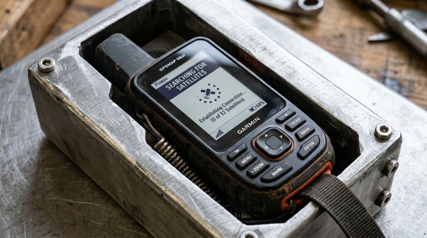
Blocked vs. Bounced: Two Failures That Look Identical
Metal causes two distinct GPS problems. Most troubleshooting conversations collapse them into one, which leads to the wrong fix.
Complete signal blockage is straightforward. Metal between the antenna and the sky prevents satellite signals from reaching the receiver. No signals, no fix, no position report. The tracker goes silent.
Multipath interference is more dangerous precisely because it looks like success. Satellite signals bounce off metal surfaces, arriving at the antenna via indirect paths carrying incorrect timing information. The receiver computes a position, but GPS.gov identifies reflected signals and nearby structures as causes of degraded positioning accuracy. Instead of no fix, you get a wrong fix. Your container shows up 50 meters from its actual location on the yard map.
For logistics operators and fleet managers, multipath is often the worse outcome. A missing position is obviously a problem. A wrong position looks like valid data until someone dispatches a truck to the wrong stack.
The diagnostic difference drives the solution. Zero fixes? The problem is obstruction. Move the antenna to an exposed location. Erratic positions that jump around? Multipath. Increase clearance from large reflective surfaces. The recommended minimum distance from metal walls or stacked containers is about 0.5 meters (20 inches) when geometry allows it.
Why Your Phone Still Shows a Location Inside a Metal Building
This is the myth that derails more tracker deployments than any spec sheet.
You walk into a steel warehouse, open your maps app, and see a blue dot. Obvious conclusion: GPS works through metal. But your phone isn’t necessarily using GPS at all in that moment.
Modern smartphones use Assisted GPS (A-GPS), which blends satellite signals with cellular tower data, Wi-Fi network locations, and Bluetooth beacons. When satellite reception degrades, the phone seamlessly switches to network-assisted positioning. That blue dot might represent a Wi-Fi trilateration estimate, not a satellite fix. Apple’s AirTag works the same way: it displays current or last-known locations using Bluetooth detection through the Find My network, not by pushing GPS through whatever material surrounds it.
NIST compared Wi-Fi RTT and UWB ranging in obstructed indoor environments and found that Wi-Fi produced position estimates at all 10 tested locations, while UWB implementations managed only 2 or 3. Broader coverage with Wi-Fi, better accuracy with UWB where it worked. Neither technology automatically solves metallic obstruction in environments without supporting infrastructure.
A standalone GPS tracker on a container in a port yard has no Wi-Fi network to fall back on. Mid-ocean, there are no cell towers. In a remote rail siding, there’s no Bluetooth mesh. The smartphone comparison breaks down completely in the environments where asset tracking matters most.
Containers, Vehicles, and Equipment: What Works Where
Fifteen years of deploying trackers on metal assets has made one thing clear: the physics are consistent, but the applications aren’t. Here’s what I’ve seen work (and fail) across different operating environments.
Shipping containers
A standard ISO container is corrugated steel. GPS does not pass through the walls. Full stop.
ESA’s Cont-Trak trial, which tracked containers between Europe and North America through Halifax, placed GPS and satellite terminals on the containers’ outer hulls and used UHF relay links between stacked containers when one terminal lost satellite visibility. They engineered around the steel. They didn’t try to signal through it.
In 2026, the same approach holds at massive scale. Major carriers are equipping millions of containers with IoT devices and still assessing data quality and accuracy across their fleets. None of these programs claim GPS penetrates steel. They describe systems designed to work with the metal, not through it.
A subtlety that catches buyers off guard: Maersk’s Captain Peter documentation reveals that container data is sometimes recorded locally and retrieved when communications resume. A complete journey trace on your screen can coexist with hours-long gaps in real-time visibility. Always check the position timestamp, not just whether the map shows a dot.
Vehicles and fleet equipment
Cars and trucks work because the antenna typically has a path to the sky. A roof-mounted antenna sits above the metal, not behind it. A dashboard unit receives through the windshield. Tuck a tracker under the steel floor pan or inside a metal toolbox bolted to the bed, and reception vanishes.
u-blox’s ZED-F9K dead-reckoning module takes a different approach: it fuses GNSS with a six-axis inertial measurement unit and wheel-tick data to bridge temporary satellite outages. Driving through a tunnel, the system continues estimating position using motion sensors. This is sensor fusion for continuity, not metal penetration. Park under a steel roof for hours, and drift accumulates until the solution becomes unreliable.
Ground support and industrial assets
Metal-bodied forklifts, GSE carts, ULD containers, maintenance tooling, reusable pallets. These are the assets where the “does GPS work through metal” question comes up daily in my work. For shorter-range identification on metal assets where GPS isn’t practical, operators sometimes explore whether RFID tags work on metal as a complementary technology.
The pattern never varies: external mounting with clear sky view works. Internal mounting inside a metal body fails. The devices that succeed share consistent traits. They mount on the outside. They carry environmental ratings matched to the operating conditions (vibration, temperature, moisture). And they report via a cellular or satellite link independently validated for the coverage area.
How to Get Reliable GPS Tracking on Metal Assets
The fix isn’t a stronger GPS chip. It’s antenna placement and system architecture matched to the operating environment.
Start with the most reliable intervention: move the antenna outside the metal. Garmin’s antenna installation instructions state it plainly: the antenna should have satellite visibility and should not be shielded by metal objects. This isn’t a limitation of one manufacturer’s product. It’s a radio-frequency reality that applies to every GNSS receiver ever built.
Then use the metal as a ground plane instead of a ceiling. u-blox documents that a suitable metal surface beneath a patch antenna actually improves performance by reflecting satellite signals upward into the antenna element. A magnetic-mount tracker on top of a steel equipment housing benefits from this effect. The same tracker underneath that housing receives nothing. Metal is simultaneously an obstacle and a design resource. It depends entirely on which side of the antenna it sits.
Hardware selection matters too. For airfreight and aviation, the Thingfox T2 carries DO-160 certification with antenna geometry optimized for metal ULD containers and cargo environments. For rugged industrial tracking, devices like the Oyster3 and Oyster Edge use compact external-mount housings that keep the GNSS antenna exposed while protecting electronics from impact, water, and temperature extremes. You can browse the full asset tracking device catalog here.
Test in actual operating conditions, not on a bench. A tracker that acquires satellites at your desk won’t necessarily perform the same way mounted on a forklift between metal racking, in a congested container stack, or on equipment that sits 14 hours a day inside a steel hangar. Test with typical cargo loaded, with doors and enclosures closed, in the actual facility.
Finally, separate positioning from reporting. Your tracker needs two independent radio links: one to satellites for position, one to a cellular or satellite network for data transmission. Metal can obstruct both. A device might get a GPS fix through a container door gap but fail to transmit because the cell signal is also attenuated. Or it might report a position that was acquired hours ago. Always check the position timestamp, not just whether the platform displays a dot. Keep in mind that most GPS trackers need a subscription for cellular or satellite data transmission, separate from the satellite positioning itself.
Will Stronger Signals or New Technology Fix This?
Partially. Eventually. And not as a substitute for correct installation.
Dual-frequency GPS (L1 plus L5) improves accuracy by correcting ionospheric distortions. GPS.gov explains this as an atmospheric correction, valuable for precision applications. It does not create a propagation path through a conductive enclosure. Better atmospheric correction helps when the signal arrives. It can’t help when the signal doesn’t arrive at all.
Alternative satellite constellations are more interesting for resilience. Some next-generation LEO constellations are designing signals described as up to 100 times stronger than GPS, and early demonstrations have shown indoor acquisition inside concrete office buildings. That’s a meaningful demonstration of increased link margin. But a concrete building with windows is not a sealed steel enclosure. Indoor concrete reception and through-metal reception are different engineering problems with different solutions.
On the maritime front, alternative LEO-based positioning is being integrated into assured-navigation platforms for GNSS-denied maritime environments. This addresses interference and spoofing scenarios, which are increasingly frequent: EASA and IATA documented a 220% increase in GPS signal-loss events between 2021 and 2024.
The broader trend is diversification: multiple constellations, inertial backup, alternative PNT sources, tighter sensor fusion. All of this improves system resilience. None of it changes the fact that conductive enclosures attenuate radio signals. Get the antenna where it can see the sky first. Then layer in the resilience technologies that your threat model requires.
One observation from the field: if your tracking gaps happen after delivery, at the yard, or during the return cycle rather than in transit, the problem likely isn’t GPS signal strength. It’s that your visibility architecture stops at the shipment boundary. Shipment tracking ends at delivery. Asset tracking follows equipment through the entire lifecycle: deployment, dwell, return, reuse. If your container pool goes dark after handoff, that’s the gap worth closing. Our team can help you figure out where the visibility actually breaks.

Frequently Asked Questions
Can I track a GPS device inside a sealed metal toolbox or safe?
Not reliably. A sealed conductive enclosure attenuates GPS signals below usable levels. Mount the tracker externally, use a device with an external antenna, or accept that position updates will only occur when the container is opened and the antenna gains sky access.
Does aluminum block GPS differently than steel?
Both are conductive and attenuate GPS signals effectively at the thicknesses found in industrial applications. Aluminum has higher conductivity, which changes the theoretical skin depth, but at 1.5 GHz both materials block satellite signals through any practical panel thickness. For tracking purposes, treat them the same way: keep the antenna on the sky-facing side.
Why does my car’s GPS work if the roof is metal?
Because the antenna isn’t receiving through the metal. Roof-mounted antennas sit above it. Dashboard devices receive through the windshield. The metal roof can actually improve a roof-mounted antenna’s performance by acting as a ground plane. GPS doesn’t pass through the steel; it reaches the antenna around it.
Does a GPS tracker drain battery faster when blocked by metal?
Yes. When a receiver can’t acquire satellites, it continues searching, drawing more power than a quick successful fix. Prolonged search cycles in obstructed environments accelerate battery drain significantly. This is another reason to mount trackers with clear sky exposure: better positions and longer operational life between charges.
What’s the difference between the location on my phone and a standalone GPS tracker?
Your phone blends GPS, cell towers, Wi-Fi, and Bluetooth to estimate position, seamlessly switching between sources. A standalone GPS tracker relies on satellite signals for positioning and cellular for reporting. When your phone shows a location inside a metal building, it’s probably using network-assisted positioning, not satellite GPS.
Can a GPS repeater solve indoor or in-container coverage?
GPS repeaters exist but operate under strict regulatory constraints. In the U.S., indoor GPS reradiation requires site-specific federal authorization. In the UK, Ofcom licenses GNSS repeaters for fixed indoor installations only. They serve controlled test environments, not general-purpose container yards or warehouses. Check local regulations before pursuing this path.







 +1 508 292 2210

One Response