

The difference between GPS and GNSS trips up even experienced procurement teams. I’ve seen RFPs that specify “GPS tracking” when the operation actually needs multi-constellation coverage, and others that demand “full GNSS” without understanding what that does to battery life or cost.
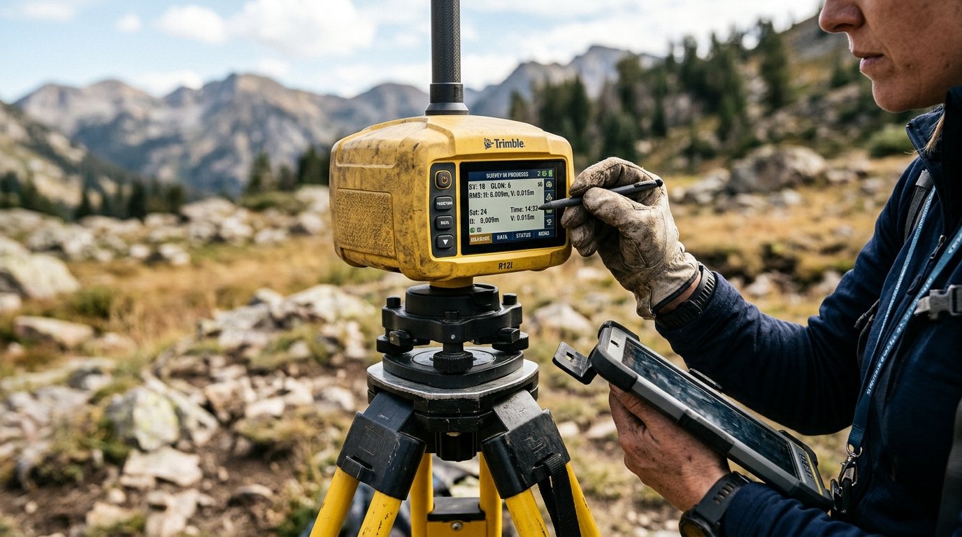
Here’s the short version. GPS is one satellite navigation system, built and operated by the United States. GNSS is the umbrella term for all satellite navigation systems combined. A GPS receiver uses one constellation. A GNSS receiver can use several. That distinction shapes accuracy, reliability, battery consumption, and cost in ways most spec sheets don’t make clear.
GPS Is a System. GNSS Is the Category.
GPS stands for Global Positioning System. It is a positioning, navigation, and timing (PNT) utility maintained by the U.S. Space Force, with about 31 operational satellites, a network of ground control stations, and the receivers in your devices. The civilian signal is free, worldwide, no subscription required.
GNSS stands for Global Navigation Satellite System. It is not a product or an upgrade. GPS.gov defines GNSS as the umbrella covering every satellite navigation system: GPS itself, Europe’s Galileo, Russia’s GLONASS, China’s BeiDou, and regional systems like Japan’s QZSS and India’s NavIC.
Think of it this way. GPS is to GNSS what “FedEx” is to “courier services.” One is a specific provider. The other is the entire category.
When a spec sheet says “GNSS receiver,” it means hardware designed to receive signals from multiple satellite systems. When it says “GPS receiver,” it might mean GPS-only, or it might mean multi-constellation hardware wearing a familiar label. Apple’s iPhone 17 Pro specs list “precision dual-frequency GPS” as a feature, then quietly support GPS, GLONASS, Galileo, QZSS, BeiDou, and NavIC. Six systems. One “GPS” label.
If you’re buying a consumer gadget, that naming convention rarely causes trouble. If you’re specifying tracking hardware for a fleet, a container pool, or MRO tooling, it causes expensive confusion. “GPS” and “multi-GNSS” are not interchangeable specs.
The Four Global Constellations and Their Regional Cousins
Four satellite systems provide worldwide coverage today. Two more serve specific regions. Here is the current operational picture:
| System | Operated By | Coverage | Status |
|---|---|---|---|
| GPS | United States (Space Force) | Global | Fully operational since 1995. ~31 satellites. |
| Galileo | European Union | Global | Initial services 2016. Navigation-message authentication (OSNMA) operational since July 2025. |
| GLONASS | Russian Federation | Global | Independent system, commonly paired with GPS in commercial receivers. |
| BeiDou (BDS) | China | Global | Formally commissioned 2020. |
| NavIC | India (ISRO) | Regional (India + ~1,500 km) | Civilian interoperable signals. |
| QZSS | Japan | Regional (East Asia/Oceania) | Complements GPS; not a standalone global system. |
A receiver locked onto all four global constellations can access well over 100 satellites at any given time. A GPS-only receiver works with roughly 31. In the open, that difference may not matter much. In a port stacking area, an airport apron surrounded by ground support equipment, or a dense urban corridor, the additional satellites can be the difference between a clean position fix and a gap in your tracking data.
There is a geopolitical layer worth understanding, too. The EU built Galileo explicitly to avoid dependence on U.S. military-controlled GPS. China and Russia followed the same logic with BeiDou and GLONASS. Each government wants sovereign positioning capability that cannot be switched off by another nation’s defense department. For commercial users, this competition is a net positive: more independent systems means more signals available to your receiver.
More Satellites Don’t Guarantee Better Accuracy
This is where the conversation goes sideways. People assume that “GNSS” automatically means more accurate than “GPS.” It does not.
GPS.gov cites typical smartphone accuracy within a 4.9-meter radius under open sky. That’s a realistic baseline for consumer-grade equipment in good conditions. But accuracy depends on a chain of factors, not just the constellation count:
- Receiver quality and processing algorithms
- Antenna design and physical placement on the asset
- Signal reflections (multipath) off metal surfaces, buildings, or stacked containers
- Atmospheric conditions, especially ionospheric delay
- Satellite geometry at the moment of the fix
- Whether correction services (RTK, PPP, SBAS) are applied
A corrected GPS-only solution using RTK can deliver centimeter-level accuracy. An uncorrected multi-GNSS receiver in a challenging environment might give you 10 meters on a good day. The architecture and corrections matter more than the acronym on the label.
For asset tracking, the practical point is this: a multi-GNSS tracker does not “fix” poor antenna placement or bad mounting. It improves the odds of acquiring a satellite fix in obstructed environments. Valuable, but different from precision.
Multi-Constellation vs Multi-Frequency: Two Separate Upgrades
Most GPS-vs-GNSS articles blur these together. They are distinct capabilities, with different benefits and different costs.
Multi-constellation means your receiver can use satellites from GPS, Galileo, GLONASS, BeiDou, and potentially regional systems. The benefit: more satellites visible at any moment, improving positioning availability when parts of the sky are blocked.
Multi-frequency means your receiver processes signals on more than one frequency band. GPS transmits on L1, L2, and L5 (approximately 1575, 1227, and 1176 MHz). Observing signals on multiple frequencies allows the receiver to measure and largely remove ionospheric delay, one of the single biggest error sources in satellite positioning.
You can have a multi-constellation, single-frequency receiver (affordable, solid improvement in urban canyons and ports). You can have a dual-frequency, GPS-only receiver (strong atmospheric correction, limited satellite pool). The best modern receivers offer both. The energy and cost implications differ.
Garmin’s SatIQ technology makes the trade-off tangible. Multi-band reception consumes more battery, so the system dynamically selects modes depending on the environment. Under open sky, GPS-only delivers comparable accuracy with less energy drain. Under heavy canopy or urban obstruction, it escalates to multi-band.
For battery-powered tracking devices, this is not theoretical. It directly determines how many months a tracker runs before needing a battery swap. If your asset cycle is six months and your tracker dies at four, the positioning spec on the data sheet is irrelevant.
When GPS Fails: Real-World Cases Worth Knowing
Theory is useful. Field failures are more instructive.
John Deere, May 2024. A severe solar storm disrupted satellite navigation during planting and spraying season. Deere reported that its older StarFire SF3000 and SF6000 receivers were most affected, while the newer SF7000 Series handled the event better by pulling corrections from multiple satellite groups and discarding degraded signals. The lesson: receiver generation and firmware mattered as much as constellation access. Multi-GNSS hardware is not immune to space weather.
Finnair and Tartu Airport, 2024. GPS interference disrupted the Helsinki-Tartu route. The fix was not more satellite constellations. Tartu Airport restored an independent ground-based navigation capability using distance-measuring equipment (DME) in lower airspace. Finnair resumed service from June 2, 2024. The point: adding GNSS constellations addresses satellite-level availability. A physically independent navigation source addresses a different class of failure (jamming, spoofing, deliberate interference).
The scale of this problem is growing. IATA reported a 220% increase in GPS signal-loss events between 2021 and 2024, recommending that operators maintain a minimum network of traditional navigation aids as backup. For asset tracking, the same principle applies: do not build a visibility system with a single point of failure.
Signal Authentication: What OSNMA Does and Doesn’t Solve
Galileo declared its Open Service Navigation Message Authentication (OSNMA) operational on July 24, 2025. Compatible receivers can now verify that navigation messages actually came from Galileo satellites and were not modified in transit.
That sounds like a spoofing fix. It is not a complete one. The official OSNMA information note distinguishes between authenticating navigation messages (which OSNMA does) and authenticating measured signal ranges (which it does not). OSNMA does not prevent all spoofing scenarios, and it does nothing against jamming.
For tracking operators, the practical implication: authentication is a layer of protection, not a solution. If your assets move through regions with known GNSS interference (the Baltic, parts of the Middle East, conflict-adjacent airspace), your tracking architecture needs detection and fallback mechanisms beyond what any single satellite feature provides. DHS recommends treating positioning resilience with the same identify-protect-detect-respond-recover framework used in cybersecurity.
What This Means for Asset Tracking
If you’re tracking ULDs across airline networks, ground support equipment on the apron, containers in a port, or tooling through an MRO cycle, the GPS-vs-GNSS question is a proxy for a different decision: what level of positioning reliability do you need, at what battery cost, across which environments?
A GPS-only tracker works well for assets spending most of their time outdoors under clear sky. It is simpler, cheaper, and draws less power. A multi-constellation GNSS tracker improves fix rates where buildings, equipment stacks, or structures block parts of the sky. A hybrid approach (GNSS outdoors, Wi-Fi or cellular positioning indoors or in obstructed areas) covers the widest range of scenarios.
The question I ask clients every week: where does your asset spend the most time being invisible? If the answer is a warehouse, a maintenance bay, or a dense stacking zone, adding satellite constellations alone won’t close that gap. You need a positioning strategy that accounts for the entire cycle. Para áreas remotas sem cobertura celular, considere também soluções de satellite IoT como complemento à navegação por satélite.
This ties into a more fundamental distinction. Shipment tracking cares about origin to destination. Asset tracking cares about the full lifecycle: dwell, return, maintenance, reuse. GPS vs GNSS is one piece of that puzzle, but it sits inside a larger question about visibility architecture. If your container pool or equipment fleet goes dark after delivery, the right tracking hardware is the first step. The right positioning strategy is what makes it work.
How to Specify Positioning When Buying a Tracker
Five questions that separate a spec-sheet comparison from an informed purchase:
- Which constellations does the device actually support? “GPS tracker” might mean GPS-only or multi-GNSS. Don’t assume. Ask for the receiver chipset documentation.
- Single-frequency or multi-frequency? Dual-frequency helps in environments with heavy signal reflection. It also costs more energy. Match the capability to the operating environment.
- What is the positioning fallback? Does the tracker use Wi-Fi or cell-tower positioning when satellite signals are weak? This matters for indoor and semi-enclosed environments far more than constellation count.
- What’s the battery life at your intended reporting interval? A manufacturer’s “5-year battery” claim assumes infrequent reporting. If you need updates every 15 minutes, that number changes dramatically. Get projections for your actual use case.
- What happens with the data? The GNSS receiver gets a position. The connectivity module sends it. The platform makes it visible. A great satellite fix is pointless if the data arrives 12 hours late or sits in a dashboard nobody monitors.
When we help clients design a tracking deployment, positioning is one variable among several. Connectivity, battery, form factor, certification (DO-160 for airfreight, for instance), and platform integration all determine whether you actually see your assets when it counts.
Frequently Asked Questions
Is GNSS always more accurate than GPS?
No. Multi-constellation coverage improves satellite availability, not guaranteed accuracy. A corrected GPS-only solution using RTK can outperform an uncorrected multi-GNSS receiver. Accuracy depends on the receiver, antenna, correction services, and operating environment, not just the number of constellations your device can see.
Does my phone use GPS or GNSS?
Most modern smartphones use multiple constellations even when labeled as “GPS.” Apple’s iPhone 17 Pro supports six satellite systems despite marketing the feature as “precision dual-frequency GPS.” Check your specific model’s technical specifications rather than relying on the name.
Can GPS satellites track my location?
No. GPS satellites are one-way beacons that broadcast signals but receive nothing from your device. Tracking only happens when your device calculates its position and transmits that data through cellular or other networks. The privacy question is about the device and its software, not the satellites.
Does using more constellations drain the battery faster?
It can, but the impact depends on receiver design, enabled frequency bands, and how often the device requests a fix. Some implementations dynamically switch between GPS-only and multi-band modes based on the environment. For tracking devices, always compare battery life under identical reporting intervals rather than mismatched maximum-runtime claims.
Why do countries build their own satellite navigation systems?
Sovereignty. GPS is controlled by the U.S. military, GLONASS by Russia, BeiDou by China. Each government wants positioning capability that cannot be denied or degraded by a foreign power during a crisis. For commercial users, this means more available satellites and greater redundancy.
What should I look for in a tracking device: GPS or GNSS?
Look past the marketing label. Ask which constellations the receiver supports, whether it offers multi-frequency capability, what fallback positioning (Wi-Fi, cellular) is available, and what the battery life is at your actual reporting interval. The right answer depends on your operating environment and asset cycle, not the acronym.








 +1 508 292 2210

2 Responses