

A GPS receiver computes position just as accurately in the Sahara as it does in a Houston parking lot. Open-sky accuracy sits at roughly 4.9 meters on a standard receiver. The satellite constellation does not check whether a cell tower exists nearby.
So when a GPS tracker for remote locations goes dark, GPS almost never caused it. The failure is in the second radio, the one that tries to send position data back to your dashboard. That radio depends on cellular infrastructure, satellite uplinks, or local gateways. Pick the wrong one for your terrain, and your device computes a perfect position fix that nobody ever sees.
I have watched this play out on container routes through Central Asia, mining sites in West Africa, and livestock programs spanning tens of thousands of hectares in Australia. The asset vanishes from the screen. Not because positioning failed. Because the data link did.
This guide covers the five decisions that actually determine whether remote tracking works or quietly becomes an expensive data logger sitting in a pelican case somewhere.
GPS Works Everywhere. Your Data Link Doesn’t.
GPS is passive and receive-only. Your tracker listens to timing signals from satellites roughly 20,200 km overhead and calculates its own position. It transmits nothing to those satellites. The FAA puts basic GPS accuracy at approximately 7.0 meters, 95% of the time. Trees, canyons, metal enclosures, and multipath reflections degrade that, but the core fix still happens.
Transmission is the variable. A cellular tracker (LTE-M, NB-IoT, Cat-M1) needs a terrestrial tower within range. A satellite tracker needs line of sight to a LEO or GEO constellation. A LoRaWAN device needs a gateway within a few kilometers. Each link has a different cost, power demand, latency, and failure mode.
The market confusion comes from treating “GPS tracker” as one category. It is not. It is a positioning engine, plus a communications radio, plus a power system, plus a cloud platform. When any one of those four breaks, the whole system goes silent. In remote locations, the communications radio breaks first. Almost every time.
That reframes the buying question. You are not shopping for GPS accuracy (largely commoditized). You are shopping for a reliable data path from the field to your screen.
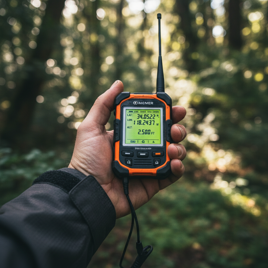
Four Ways to Get Data Out of a Remote Site
Every remote tracker ultimately answers one question: how does this position report reach the platform? Four architectures work today, each with real trade-offs worth understanding before you commit to hardware.
| Link type | Coverage | Power impact | Recurring cost | Best fit |
|---|---|---|---|---|
| Cellular (LTE-M, NB-IoT) | Where towers exist | Low to moderate | Low ($2–10/mo typical) | Roads, farms, industrial zones with verified signal |
| LEO satellite (Iridium, Globalstar) | Global or near-global | Moderate to high per transmission | Higher (airtime fees vary widely) | Oceans, deserts, polar routes, international freight |
| Private LoRaWAN | Site-specific, 10+ km per gateway in open rural terrain | Very low | Gateway + backhaul investment | Mines, ports, ranches, campuses you control |
| Store-and-forward | Logs locally, uploads when a link returns | Low while logging, variable during burst | Depends on uplink type | Assets moving between covered and uncovered zones |
Satellite: the default assumption, but not always the right one
Satellite is the reflexive answer to “no cell coverage.” In genuinely unserved terrain (open ocean, polar routes, deep desert), it is the correct one. Iridium’s 66-satellite LEO constellation provides pole-to-pole coverage. Globalstar covers most populated latitudes.
But satellite airtime costs more than cellular. Transmission draws more power. And both constellations require a clear view of the sky. Satellite providers explicitly warn that terrain, buildings, and hills can block signals, and that message success varies with location and conditions. Dense canopy, steel containers, and canyon walls defeat a satellite uplink just as easily as they block cellular.
The operational question is not “does satellite cover my route?” It is: does my device have enough sky view, battery budget, and retry capacity to actually deliver the message from the exact spots where silence costs money?
LoRaWAN: underrated for controlled sites
If your assets operate within a defined perimeter (mine, port, ranch, industrial campus), a private LoRaWAN network can outperform satellite. One solar-powered gateway covers kilometers of open terrain. Endpoints draw microamps. Battery life stretches to years.
The catch: the gateway still needs backhaul. At a mine with fiber, that is trivial. At a truly isolated station, you can backhaul the gateway itself over satellite, creating a layered architecture where hundreds of low-power tags feed into one satellite-connected hub. The per-device cost drops dramatically.
Store-and-forward: the pragmatic middle ground
Many assets spend most of their time in cellular coverage and briefly transit through dead zones. A tracker with store-and-forward logs fixes locally during the gap, then bursts them to the platform when coverage returns. No real-time alerts during the dark segment, but a complete route history once the asset resurfaces.
For logistics corridors where the remote segment is short and a delayed report is tolerable, this approach is dramatically cheaper than full satellite.
Power, Cadence, and Sky View: The Trade-Off That Kills Deployments
Every GPS fix consumes energy. Every satellite transmission consumes more. The relationship between update frequency and battery life is not linear. It is punishing.
Garmin’s inReach Mini 2 battery table demonstrates this clearly: at a 10-minute high-detail tracking interval, endurance is up to 5 days in favorable conditions and as few as 2 days in moderate tree cover. That is a consumer messenger. Industrial satellite trackers face the same physics with larger batteries and external antennas.
The question to answer before ordering hardware: what is the minimum reporting frequency that supports your operational decision?
- A shipping container on an ocean crossing usually needs a report every 4 to 6 hours for route-deviation detection.
- A vehicle in a high-theft corridor might need 5-minute intervals during transit and hourly check-ins at rest.
- A stationary remote wellhead or generator set could report once or twice a day and still deliver full value.
Design the cadence around the decision, not the spec sheet. Then size the battery (or add solar) to sustain that cadence across the entire deployment cycle without human intervention.
Sky view deserves equal attention. Both GPS reception and satellite transmission require line of sight to the sky. Dense canopy, steel container interiors, narrow valleys, and underground environments degrade or block signals. I have seen fleet managers procure 200 satellite trackers based on a coverage map, then discover 30% message failure in the forested segments of their actual routes. Test where the asset actually operates. A coverage map drawn at headquarters is not a field guarantee.
And there is a newer risk: GNSS interference itself. A joint IMO, ICAO, and ITU statement in March 2025 raised grave concern about increasing satellite-navigation jamming and spoofing, especially in conflict and sensitive regions. A well-designed tracker should report signal quality and flag stale data rather than silently displaying the last known position as if it were current.
Where Remote Trackers Earn Their ROI
The use cases that justify satellite or hybrid connectivity share one trait: the cost of losing visibility exceeds the cost of maintaining it. IoT Analytics estimates 3.7 billion asset-tracking devices globally, about 20% of all connected IoT endpoints. GPS appears in 77% of the technology mix. The question is not whether organizations track; it is whether they track through the remote segments where risk concentrates.
Container logistics at scale
In early 2024, Hapag-Lloyd announced it had installed 1 million tracking devices on its dry-container fleet. The stated goal: close blind spots on routes that span oceans, deserts, and port queues where cellular is unreliable at best.
This is asset tracking, not shipment tracking. The device stays on the container through multiple cycles, not just one trip. For container pool operators, a reusable asset that goes dark after delivery becomes invisible dwell time, unplanned replacement cost, and lost cycle efficiency. The tracker pays for itself by shortening cycle time and reducing the pool size required to serve the same freight volume.
Livestock and agriculture
Ceres Tag has been used to track 7,500 cattle across 67,000 hectares in Australia, Norway, South Africa, and Botswana via satellite-connected ear tags. The value goes beyond location: geofence alerts when animals leave boundaries, unusual movement suggesting injury or predation, and the elimination of days-long physical searches across massive properties.
The design lesson here is that a full satellite modem on every animal is overkill. A low-power tag reporting to a solar-powered LoRaWAN or Bluetooth gateway, which then backhauls over satellite, is usually the more durable and cost-effective architecture.
Mining, energy, and remote infrastructure
Remote wellheads, pipeline valve stations, generator sets, and heavy equipment often sit beyond cellular reach for their entire operational life. The tracker is not just providing a dot on a map. It delivers status: tank levels, valve positions, vibration, temperature. GPS confirms the asset has not been moved (or has been stolen), while sensor payloads drive preventive maintenance.
Industrial enclosure ratings (IP67+), external antenna ports, wide operating temperature, and sensor I/O matter more here than tracking interval. A device that reports once a day but lasts five years on battery is worth more than one that tracks every minute and dies in three months.
Search and rescue
NOAA reports 411 U.S. rescues in 2024 and more than 63,000 people rescued worldwide since 1982 through the SARSAT distress-beacon system. Satellite messengers like Garmin’s inReach add two-way messaging and continuous tracking to the SOS function, giving rescue teams real-time context rather than a single distress coordinate.
For field operations in aviation, mining, or remote construction, the distinction matters. A personal locator beacon (PLB) is a dedicated emergency device. A satellite messenger handles both operations and emergencies. A fleet asset tracker is neither. Match the device to the response plan, not the spec sheet.
Why Hybrid Beats Satellite-Only for Most Fleets
In most real deployments, assets do not spend 100% of their time beyond cellular. A truck crosses the Andes but starts and ends in Lima. A container spends two weeks at sea and four weeks in port. Ground support equipment moves between a well-connected airport apron and the occasional remote airstrip.
A satellite-only tracker pays satellite airtime rates even when cellular is available. That is waste. A hybrid device uses cellular where it can (cheaper, faster, lower power) and switches to satellite only when cellular drops. The savings compound fast across a fleet of hundreds or thousands of assets.
Digital Matter’s hybrid trackers combine 4G LTE with optional Iridium satellite, Bluetooth gateway capability, and industrial I/O in a single housing. This is the approach we deploy for clients whose assets cross coverage boundaries routinely. Satellite becomes a fallback instead of the default path. Airtime drops. Battery extends. And the platform receives continuous data regardless of which network carried it.
The integration cost is real: firmware configuration, failover testing, SIM provisioning, satellite activation, and antenna placement all require engineering attention. For a single device, it may not be worth the complexity. For a fleet of 500 or 5,000 assets that regularly cross between covered and uncovered terrain, the total cost of ownership is substantially lower than satellite-only.
NTN and Direct-to-Device: The 2026 Inflection
The boundary between “cellular tracker” and “satellite tracker” is dissolving. 3GPP Release 17 established the first normative non-terrestrial network (NTN) requirements, allowing NB-IoT and LTE-M protocols to run over satellite links using the same standards as terrestrial towers.
In practical terms: a tracker built on an NTN-capable module could connect to a cell tower when in range and to a satellite when it is not, without switching radios or managing dual subscriptions. Skylo launched direct-to-device service in the U.S. and Canada. Iridium’s NTN Direct targets a standards-based NB-IoT service in 2026. Kinéis has its 25-nanosatellite constellation operational as of mid-2025.
This direction is clear. What is not clear is universal availability, indoor performance, device certification in every region, and long-term pricing. An announcement is not a field guarantee. Two implications for today’s buying decision:
- Favor hardware with modular or upgradeable connectivity, so NTN adoption is possible when it matures in your operating geography.
- Avoid long satellite contracts that assume the cost structure of 2024 will persist through 2028. The economics are shifting.
Five Decisions Before You Commit
After 15 years of deploying tracking across environments from airport aprons to open ocean, I keep returning to five questions. Get these right and the hardware selection nearly makes itself.
- What is the asset? A person needs a messenger with SOS capability. A vehicle needs installation, ignition detection, and possibly CAN-bus integration. A container needs magnetic mounting, long battery, and tamper alerts. A fixed sensor needs I/O, wide temperature range, and multi-year endurance. Different asset types require different device architectures.
- What reporting interval supports the decision you need to make? More frequent is not automatically better. A 5-minute satellite interval on a 3-year battery does not exist. Define the operational decision (theft response, route deviation, cycle time measurement) and work backward to the cadence that supports it.
- What does the sky look like at the actual site? Not on the coverage map. At the site. Test GPS fix rate, satellite message success, and cellular signal in worst-case conditions: deep valleys, dense forest, inside containers, during heavy rain. GPS.gov lists blockage, multipath, interference, and atmospheric conditions as real-world degraders, and the transmission link faces the same obstacles.
- What is the total cost of ownership? Hardware is one line item. Add activation, monthly airtime, SIM management, battery replacement, mounting hardware, platform licensing, and labor to respond to alerts. A $50 device with a $15/month satellite plan and a 2-year battery costs over $400 across its life. A $200 device with a $3/month cellular plan and a 5-year battery costs $380. The cheaper device is not always the cheaper program.
- Are you monitoring operations or managing emergencies? An asset tracker reports position. A satellite messenger lets a person communicate. A PLB initiates a rescue. Conflating them creates gaps in both operational visibility and safety protocol.
If your current tracking goes dark when assets leave cellular coverage, that is exactly the gap hybrid architecture closes. We build these solutions at Datanet using cellular-satellite hybrid devices configured for specific operating environments, from rugged industrial enclosures to DO-160 airfreight-approved trackers. The hardware matters. But the integration, platform setup, and operational workflow are what turn coordinates into decisions. Talk to our team if that conversation is relevant: info@datanetiot.com.

Frequently Asked Questions
Will a GPS tracker work where there is no cell service?
Yes, if the device includes a satellite modem or connects to a local gateway (LoRaWAN, Bluetooth relay). GPS determines position using overhead navigation satellites. A separate radio (satellite, gateway, or store-and-forward buffer) delivers that position to your platform. Without one of those transmission paths, the device logs data internally but cannot report in real time.
How accurate is GPS in forests, canyons, or mountains?
There is no single number. Open-sky accuracy is roughly 4.9 meters on a typical receiver, but dense canopy, narrow valleys, and rock-wall reflections degrade both fix quality and transmission reliability. Expect reduced accuracy and higher message failure rates in obstructed terrain. Always test at the actual operating site before scaling a fleet order.
How long does the battery last on a remote GPS tracker?
It depends on update frequency, transmission type, temperature, sky view, and retry behavior. Garmin’s inReach Mini 2 ranges from 2 to 5 days at a 10-minute tracking interval depending on environment. Industrial asset trackers with daily or weekly reporting can last 2 to 10 years on primary batteries. Define the reporting cadence first, then size the power source to match.
Do satellite GPS trackers require a subscription?
Almost universally, yes. Garmin, ZOLEO, SPOT, and most industrial satellite devices require an active service plan for satellite communication. Models vary: monthly, annual, seasonal, or per-message. Compare activation fees, message limits, suspension policies, and overage rates alongside hardware price.
What is the difference between a satellite tracker and a PLB?
A satellite tracker (or messenger) provides ongoing location reports, two-way messaging, and typically an SOS function. A 406 MHz personal locator beacon sends a one-way distress alert into the international SARSAT rescue system. PLBs do not track continuously, do not support messaging, and serve a different purpose. Many field programs carry both.
Should I choose satellite-only or hybrid cellular/satellite?
Hybrid is the better fit for most fleets. If assets spend any meaningful time in cellular coverage, hybrid reduces airtime cost, extends battery life, and delivers higher-throughput data when connected. Satellite-only makes sense for assets operating exclusively beyond cellular reach: open ocean, polar regions, or deep desert with no terrestrial infrastructure at all.








 +1 508 292 2210

3 Responses