

A GPS receiver can calculate its position from satellite signals without a SIM card, a data plan, or a single bar of cell service. That part works everywhere the sky is visible. The part that breaks is everything after: getting that position to someone who needs it.
If you’re looking into GPS tracking without cellular coverage, the real question isn’t whether GPS works off-grid. It’s how you move position data from an asset to a dashboard, a dispatcher, or a rescue coordinator when no cell tower exists within a hundred miles.
I’ve spent 15+ years deploying asset trackers across aviation, maritime, and remote industrial operations. The mistake I see most often is treating “GPS” and “tracking” as one function. They aren’t. Understanding the gap between them is the difference between a device that logs coordinates nobody reads and one that actually delivers visibility when it matters.
GPS Knows Where It Is. Nobody Else Does.
The confusion starts with the word “GPS.” GPS.gov describes the receiver as the user segment that calculates three-dimensional position and time from satellite signals. That calculation is entirely local. The receiver listens to satellites. It doesn’t transmit anything back. No subscription, no internet, no cellular modem required.
Your phone, a handheld navigator, or a standalone tracker can pinpoint its latitude and longitude in the middle of the Pacific. But “knowing where you are” is navigation. “Tracking” means someone else also knows where you are, and that requires a second, separate system: a communications path.
Think of it as three layers:
| Layer | Function | Needs a network? |
|---|---|---|
| 1. Positioning (GNSS) | Calculates coordinates from satellite signals | No |
| 2. Communication | Sends those coordinates somewhere | Yes (cellular, satellite, radio, or physical retrieval) |
| 3. Visualization | Displays position on a map, dashboard, or alert system | Yes |
Most consumer and fleet trackers bundle all three layers into one device and one cellular plan. That works fine until Layer 2 fails because there’s no cell coverage. The device still has Layer 1 (it knows where it is), but Layer 3 goes dark. Your dashboard shows the last known position. Everything after that is a guess.
OnX confirms that a phone’s built-in GPS works without data or cellular service, but maps must be downloaded in advance because the app can’t stream them offline. The phone can navigate. It just can’t tell anyone where it is.
The question, then, is what replaces cellular for Layer 2.
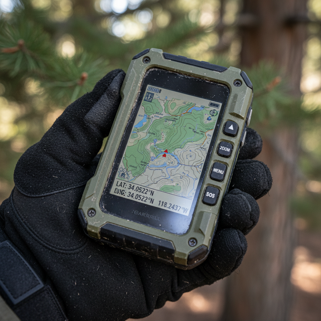
Five Ways to Track Beyond Cell Towers
Every non-cellular tracking method trades off between coverage, cost, power, latency, and complexity. None of them is universally best. Here’s what each actually delivers in the field.
Satellite communication
The broadest coverage available. Satellite trackers pair a GNSS receiver with a satellite modem (typically Iridium, Globalstar, or ORBCOMM) that can transmit coordinates from nearly anywhere on Earth with a view of the sky.
Garmin’s inReach Mini 2 is probably the most recognized consumer example. Its manual lists battery life of up to 14 days at a 10-minute send interval with full sky view, dropping to about 4 days under moderate tree cover. That’s a 70% reduction from trees alone. On the industrial side, operators like Iridium and ORBCOMM offer satellite asset-tracking services for remote fleets and equipment. Hybrid devices that pair LTE Narrowband with Iridium satellite and switch bearers automatically are becoming increasingly common in this space.
Satellite fits global assets, maritime operations, cross-border logistics, and emergency SOS. The trade-offs are real: subscription fees, higher power draw, message queuing during poor sky conditions, and an absolute requirement for unobstructed sky view.
Store-and-forward (cellular with buffering)
The simplest approach for assets that move in and out of coverage. The tracker calculates and stores GNSS fixes locally when no signal is available. When coverage returns, it uploads the buffered data in one burst.
The industry often calls this passive tracking: the system stores data locally when coverage is unavailable and transmits it when the device reconnects. This is the default behavior for most well-built cellular trackers, and it’s consistently underrated. For assets that reliably return to a depot, warehouse, or urban corridor, store-and-forward gives you a complete movement history without satellite subscription costs. Devices like the Oyster3 or Oyster Edge are built for exactly this pattern: rugged, long-battery cellular trackers that buffer positions through dead zones and sync when they reconnect.
The limitation is obvious. No live visibility during the gap. If an asset disappears in a dead zone and doesn’t come back, you only know where it was last seen.
LoRa and LoRaWAN
Long Range (LoRa) radio operates on unlicensed sub-GHz frequencies and can transmit small packets over several kilometers with very low power. A LoRaWAN deployment requires gateways (fixed receivers connected to the internet) to relay messages from tags to a cloud platform.
This works well on large private sites: ports, mines, farms, warehouses, airfields. The tag is cheap and lasts years on a single battery. But the infrastructure isn’t free. You need gateways, backhaul, and network planning. Without gateways, there’s no visibility. It’s a campus-scale or site-scale solution, not a global one.
Mesh radio
Meshtastic documents configurable position broadcasts across a local mesh network where each node relays messages to the next. No cell tower, no subscription. It’s popular with outdoor groups and tactical teams.
The catch: the mesh only works if enough nodes are in range to relay data. For a hiking group of four, it’s great. For tracking a container across an ocean, useless. Scaling beyond a small team requires infrastructure that starts looking like LoRaWAN anyway.
Hybrid cellular-satellite
The newest and most promising category. A single device (or SIM) uses cellular when available and falls back to satellite when cell coverage drops. This eliminates the forced binary choice between a cheap cellular plan and an expensive satellite-everywhere approach.
In January 2026, Skylo and Vodafone IoT announced a global hybrid service using a single SIM for both cellular and satellite IoT. Iridium’s NTN Direct, a 3GPP standards-based NB-IoT satellite service, is planned to go live this year. These services are still maturing in terms of module availability and real-world power performance, but the direction is clear: the device picks the cheapest available bearer instead of locking you into one network.
How to Pick the Right Architecture
Four questions cut through the noise:
-
Does the asset return to cellular coverage regularly? If yes, store-and-forward is your lowest-cost option. A solid cellular tracker with a good buffer handles most fleet scenarios. Satellite is overkill for a trailer that passes through a 30-mile dead zone twice a week.
-
Do you need real-time alerts from the gap? If a stolen container, a medical emergency, or a safety incident can’t wait until the asset returns to coverage, you need satellite or a local radio network. “Near real-time” through satellite typically means minutes, not seconds.
-
Is the asset on a fixed site or moving globally? Fixed-site assets (port equipment, yard containers, mining machinery) are better served by LoRaWAN or campus networks. Global movers need satellite or hybrid.
-
What’s the power budget? Satellite modems draw significantly more than cellular or LoRa radios. If you need five years of battery life on a compact tracker, satellite transmissions at 10-minute intervals will kill the battery in days. Match reporting frequency to both the battery and the operational need.
I’ll be direct: in my experience across hundreds of deployments, store-and-forward handles 70 to 80 percent of industrial asset-tracking scenarios. The remaining 20 to 30 percent, where the asset is truly remote, high-value, or safety-critical, justifies satellite or hybrid investment. Deploying satellite across your entire fleet because 5% of assets occasionally leave coverage is a budget decision you’ll regret within the first year.
Failure Modes Nobody Plans For
Buying a satellite-capable tracker doesn’t mean tracking works. Three failure modes kill more deployments than the technology choice itself.
Sky view obstruction
Both GNSS positioning and satellite communication need a view of the sky. Inside a metal container, under a vehicle chassis, in a dense urban canyon, or beneath heavy tree canopy, both layers degrade or fail entirely. Garmin’s own specs illustrate the impact: the same inReach device drops from 14-day to 4-day battery life under tree cover because it retransmits failed messages and recalculates positions more aggressively. In industrial deployments, antenna placement is often the difference between a working system and expensive dead weight.
GNSS interference
Satellite communication can’t fix a corrupted GPS position. The FAA’s GNSS Interference Resource Guide reports that GNSS loss per 1,000 flights increased 65% in the first half of 2024 compared with the same period in 2023. Jamming blocks the signal. Spoofing feeds the receiver a plausible but false position. Your tracker happily transmits a wrong location over a perfectly functional satellite link. For critical operations, this means you need cross-checks: multi-constellation GNSS, inertial sensors, or geofence logic that flags impossible movements.
Subscription lapses and configuration drift
This sounds administrative, not technical. It’s the number-one cause of “my satellite tracker stopped working” calls I’ve fielded. A device ships with an active plan. The plan expires, the billing contact changes, or someone reconfigures the reporting interval without understanding the battery impact. Suddenly you have 200 trackers in the field with dead subscriptions. Unlike cellular, where the device simply stops connecting, some satellite services fail silently: the device appears operational locally but nothing reaches the platform. An operations team that doesn’t audit subscription status quarterly is flying blind without knowing it.
The Hybrid Shift Happening Now
The industry is converging on a simple idea: the device shouldn’t care which network is available. It should pick the best one automatically.
Skylo and Semtech announced a single-vendor device-to-cloud solution spanning both terrestrial and satellite IoT in late 2025. Iridium’s NTN Direct targets 3GPP-standard NB-IoT over satellite. Apple and Google have already normalized satellite SOS on consumer phones, which raises user expectations across the board.
The practical impact for asset tracking: within the next two to three years, “cellular tracker” and “satellite tracker” will increasingly be the same device. One SIM, two bearers. LTE where towers exist, satellite where they don’t, at a blended cost below today’s dedicated satellite service. IoT Analytics forecasts 26% CAGR for satellite IoT connections through 2030, with legacy satellite module share falling from 98% in 2024 to 49% by 2030. The replacement isn’t more legacy satellite. It’s hybrid.
That shift doesn’t eliminate the architecture decisions above. You’ll still choose reporting intervals, manage power budgets, and handle antenna placement. But the binary choice between “cheap cellular that goes blind” and “expensive satellite for everything” is closing fast.
For operations that need asset visibility right now, the practical move is choosing hardware that supports firmware updates and multi-bearer capability, so you’re not locked into a single network as these services mature. If your container pool, ground support fleet, or equipment inventory disappears from the dashboard the moment it leaves cellular range, that’s the gap worth closing today.
We build tracking systems for exactly this terrain: assets that move between covered and uncovered areas, across airports, ports, oceans, and supply chains where a single network can’t follow. If that sounds like your operation, reach out to our team or drop a line to info@datanetiot.com.

Frequently Asked Questions
Does GPS work without cell service?
Yes. A GNSS receiver calculates position directly from satellite signals without any cellular connection. What doesn’t work without a network is transmitting that position to another person or platform. Your device knows where it is. Sharing that location remotely requires cellular, satellite, radio, or physical data retrieval.
Can I track a vehicle in real time without cellular coverage?
Only with a satellite-capable tracker or a local radio network such as LoRa or mesh. A cellular-only tracker stores positions locally and uploads them when coverage returns. You get a complete history after the fact, but not live visibility during the gap.
How long does a satellite tracker’s battery last?
It depends heavily on send interval, sky conditions, and device design. Garmin’s inReach Mini 2 lists up to 14 days at 10-minute intervals with clear sky, dropping to about 4 days under tree cover. Industrial satellite trackers vary even more. Always size the battery for your worst-case operating conditions, not the spec sheet headline.
Is LoRa the same as satellite tracking?
No. LoRa is a short-to-medium range radio protocol (typically a few kilometers) that sends data to local gateways you install. Satellite tracking transmits data to orbiting satellites with near-global reach. LoRa needs your own infrastructure. Satellite works anywhere with sky visibility but costs more per message and per device.
Will a satellite tracker work inside a shipping container?
Poorly, or not at all. Metal containers block both GNSS positioning signals and satellite communication uplinks. External antenna mounting or placement near container doors with partial sky exposure can help. Some ocean equipment trackers are designed specifically for this challenge with optimized antenna positioning.
What’s the difference between a satellite messenger and a satellite asset tracker?
A satellite messenger (like Garmin inReach or ZOLEO) is built for human communication: SOS, text messages, and personal location sharing. A satellite asset tracker is built for machine telemetry: automated position reports, sensor data, geofence alerts, and fleet-scale management. The satellite network may be the same. The device, software, and use case are fundamentally different.








 +1 508 292 2210

2 Responses