

GPS satellites don’t know your tracker exists. They broadcast timing signals into space, and your device listens, does the math, and calculates its own position from those one-way signals.
That’s the location layer. But “how does a tracking device work” is really four questions stacked together: How does it know where it is? How does that location reach your screen? How often does it update? And what actually happens with the data once it arrives?
The answers change dramatically depending on whether you’re finding lost keys, monitoring a delivery fleet, or tracking 10,000 reusable containers across a global supply chain. I’ve spent 15+ years deploying tracking systems across aviation, maritime, and industrial logistics. Here’s each layer, from satellite physics to operational ROI.
The Four-Step Chain Behind Every Tracking Device
Every tracking device, whether it’s a $29 Bluetooth tag or a DO-160-certified airfreight unit, follows some version of this sequence:
- The device receives positioning signals from satellites, cell towers, Wi-Fi access points, or nearby phones.
- Onboard electronics calculate coordinates from those signals. For GPS, this means comparing the arrival times of signals from at least four satellites to solve for latitude, longitude, altitude, and clock offset. The technical term is trilateration: estimating distances from signal travel times, not a satellite staring down at your truck.
- The device transmits that position to a server, app, or network. This could happen over cellular, satellite, Bluetooth relay to a passing phone, or simply get logged to internal memory for later download.
- Software displays the location and, in business-grade systems, triggers alerts, feeds dashboards, or integrates with tax, maintenance, or utilization workflows.
Steps 1 and 2 happen locally, on the device itself. Steps 3 and 4 are where products, costs, and capabilities diverge.
A Bluetooth tag like an AirTag has no cellular modem. It outsources Step 3 to the billion-plus devices in Apple’s Find My network. A fleet telematics device uses its own LTE connection and a monthly data plan. A container tracker on a trans-Pacific voyage may switch between cellular and satellite links as it moves in and out of terrestrial coverage.
The position fix is a solved engineering problem. What separates a useful tracker from a frustrating one is everything that happens after the fix: how the data gets to you, how often, and what you do with it once it arrives.
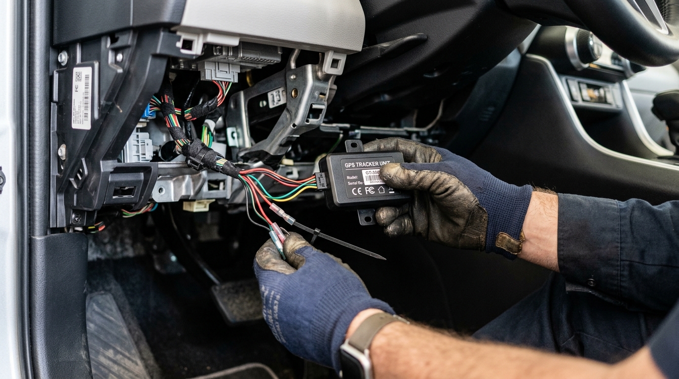
Six Positioning Methods (GPS Is Only One of Them)
Most articles treat “tracking device” and “GPS tracker” as synonyms. They’re not. GPS is the most familiar positioning method, but at least six approaches are in commercial use today. Each solves a different problem.
| Method | How it works | Best for | Main limitation |
|---|---|---|---|
| GNSS (GPS, Galileo, GLONASS, BeiDou) | Receiver calculates position from satellite timing signals | Independent outdoor positioning, worldwide | Blocked or degraded by buildings, tunnels, dense canopy |
| Bluetooth crowdsourcing | Tag broadcasts an identifier; nearby participating phones relay its approximate location | Personal items in populated areas | No update until a compatible phone passes nearby |
| UWB (Ultra-Wideband) | Radio time-of-flight measures precise distance at short range | Finding nearby objects, precise indoor positioning | Short range only; not a worldwide reporting network |
| RFID (passive or active) | Reader energizes a passive tag and reads its backscattered response; active tags self-power | Inventory checkpoints at instrumented locations | No continuous positioning between reader gates |
| Cellular (LTE, LTE-M, NB-IoT) | Device modem uploads position data to the cloud; cell towers can also assist positioning | Fleet vehicles, mobile asset tracking in covered areas | Requires SIM and data plan; no coverage at sea or in remote zones |
| Satellite backhaul | Device transmits to communication satellites when terrestrial networks are unavailable | Ocean containers, remote or wilderness assets | Higher power draw, higher data cost, requires sky visibility |
A warehouse might rely on passive RFID at dock doors for inbound and outbound counts. The same company might put GNSS + cellular trackers on its returnable containers once they leave the facility. Its employees track their car keys with Bluetooth tags. Three different technologies, three different problems, all called “tracking.”
Accuracy varies just as much. Under open sky, a GPS-enabled smartphone is typically accurate within a 4.9-meter radius. That degrades near buildings and under canopy. For nearby indoor items, UWB’s wide-bandwidth pulses support time-of-flight ranging that can reach centimeter-level precision at close range. These are different instruments for different environments, not interchangeable specs.
Hybrid trackers that combine cellular and satellite connectivity cover more of the earth, but according to a 2025 GSMA guide on integrated asset tracking, their modules cost roughly 25% more than standard cellular ones and draw more power. Reserve satellite reporting for assets whose value or remoteness justifies the premium.
Reporting Frequency and Battery Life Are the Same Decision
Once a tracker calculates a position, the next question is how often it tells you about it. That frequency determines battery life, data cost, and whether the device actually serves its purpose.
Active tracking means the device transmits position on a schedule or when triggered by events (movement detected, geofence crossed, temperature exceeded). You see where the asset is now, or within minutes of its last report. This is what fleet managers, freight forwarders, and operations teams require.
Passive tracking means positions get logged to internal memory. You retrieve the data later by USB or short-range wireless. Useful for post-hoc route analysis. Zero real-time visibility.
Most industrial applications demand active tracking. But “active” does not mean “constant.” The reporting interval is a strategic design choice with direct consequences:
- Report every 15 seconds: precise route replay, heavy battery drain, high data cost.
- Report every 15 minutes: solid operational visibility with manageable power draw. Hapag-Lloyd uses this cadence for its container tracking service, with vessel-position data updating every 24 hours during the ocean leg. Two intervals for two different risk profiles on the same journey.
- Report on events only (motion start, geofence breach, temperature threshold): maximum battery life, but gaps in the timeline between events.
The tradeoff is not abstract. Tractive’s DOG 6 pet tracker lasts up to 14 days with its Wi-Fi-based Power Saving Zone active, and roughly 6 days without it. Frequent live tracking shortens that further.
For battery-powered industrial assets (returnable containers, trailers, ULDs in aviation, ground support equipment), this tradeoff is not a minor spec on a datasheet. A tracker that dies mid-cycle creates false confidence. You think you have visibility. You don’t. The right approach is setting reporting frequency by the risk and movement pattern of each asset class, not by applying a blanket “update every X seconds” policy across the board.
Shipment Tracking vs. Asset Tracking: Where the Real Value Splits
This is the distinction I see most operations teams miss when they first explore tracking technology.
Shipment tracking follows a consignment from origin to destination. Package leaves warehouse, package arrives at customer, tracking job done. That model powers every “your order is out for delivery” notification you’ve ever received.
Asset tracking follows the physical asset through its entire lifecycle: deployment, transit, use, dwell, return, reuse, and repeat. The tracking job doesn’t end at delivery. In many cases, it’s just beginning.
Consider a pool of 10,000 returnable containers cycling between three plants and twelve customer sites. Shipment tracking tells you Container #4721 reached Customer X on Tuesday. Asset tracking tells you:
- That container has been sitting idle at Customer X for 22 days (dwell time creeping up).
- At this return rate, you’ll need to purchase 2,000 additional containers next quarter just to maintain pool size.
- Containers routed through Location Y consistently have a 28% longer cycle time than those through Location Z.
- 387 containers haven’t reported in 60+ days. Probably lost.
The first model gives you a delivery confirmation. The second gives you operational dollars back.
This isn’t theoretical. Liberty Energy deployed GPS-equipped asset gateways across 45 to 60 well locations, integrated location data with a tax-service provider, and reports expected savings exceeding $10 million annually from more accurate jurisdictional tax reporting. The mechanism: location data feeds a compliance workflow that used to run on guesswork. Fraley & Schilling used trailer dormancy reports to spot and redeploy underused trailers, estimating $150,000 per year in recaptured utilization plus up to $250,000 per year in avoided lost-inventory costs.
In both cases, the tracker hardware was table stakes. The value came from connecting location data to a business process that had a measurable cost when it ran blind.
Tracking Device Security and Privacy in 2026
A tracking device is a network endpoint. It has a radio, firmware, a cloud account, and a record of everywhere the tracked asset has been. Treat it like any other connected system that handles sensitive data.
Three developments from recent years illustrate why:
Bitsight identified six severe vulnerabilities in the MiCODUS MV720 vehicle tracker, including unauthenticated command access. A poorly secured tracker doesn’t just fail to protect your assets. It becomes a way for an unauthorized party to monitor or control them.
Georgia Tech researchers found static Bluetooth MAC addresses in Tile devices they tested, meaning the tags could potentially be identified and followed without access to the owner’s account. The Electronic Frontier Foundation reported that Life360 (Tile’s parent) said it had made improvements after disclosure, without public details on the specific changes.
On the regulatory side, the FTC finalized an order in January 2026 settling allegations that GM and OnStar collected and sold precise vehicle-location and driving data without adequate notice or affirmative consent. The result: a five-year restriction on certain data disclosures and a 20-year affirmative consent requirement for specified connected-vehicle data activities.
On the consumer safety side, Apple and Google shipped cross-platform unwanted-tracker alerts in 2024, helping people detect unknown Bluetooth tags that may be following them. Progress on both fronts (better finding tools and tighter anti-stalking protections) is happening in parallel.
If you’re deploying trackers at scale, ask your vendor how they handle firmware updates, data encryption (in transit and at rest), access controls, identifier rotation, and data retention after device decommissioning. If the conversation stops at battery life and coverage maps, keep asking.
How to Match the Right Tracker to Your Operation
Skip the spec sheet for a moment. If you’re wondering where can i buy a tracking device, first understand what you actually need by starting with four questions:
- What are you tracking? (Vehicles, containers, tools, cargo, ground equipment, animals)
- Where does it go? (Urban, rural, ocean, indoors, all of the above)
- How fresh does the data need to be? (Seconds for security alerts, minutes for logistics, daily for inventory)
- What decision will this data change? (Route optimization, theft response, cycle time reduction, regulatory compliance, utilization improvement)
Your answers determine the technology stack:
| Scenario | Recommended approach |
|---|---|
| Personal items in populated areas | Bluetooth crowdsourced tag (AirTag, SmartTag, Pixel Tag) |
| Pets or personal vehicles in cellular coverage | GNSS + cellular tracker with configurable reporting intervals |
| Commercial fleet vehicles | OBD-connected telematics device with LTE and diagnostic data |
| Reusable industrial containers, ground support equipment | Battery-powered GNSS + LTE-M or NB-IoT asset tracker |
| Airfreight ULDs, sensitive or certified cargo | DO-160-approved tracker with environmental sensors |
| Ocean containers, remote maritime assets | Hybrid cellular + satellite tracker |
| Warehouse and facility inventory | RFID at instrumented checkpoints; active RFID or BLE beacons for high-value items |
The GPS tracking device market alone is valued at $4.2 billion in 2025 and projected to reach $15.9 billion by 2035. Large enterprises already track more than 166,000 assets on an average day. This is not early-adopter territory. The question has shifted from “should we track?” to “how do we extract operational outcomes from the data?”
If your tracking needs go beyond consumer tags into industrial asset visibility (aviation, freight, containers, ground support), that’s the territory we operate in every day. We deploy end-to-end tracking solutions using certified hardware like the Thingfox T2 for airfreight and Digital Matter’s Oyster3 and Remora lines for ground and fleet assets. Understanding how much fleet tracking costs helps you budget appropriately for hardware, connectivity, and platform fees. If your container pool goes invisible after delivery, that’s exactly the gap asset tracking closes. Talk to our team or reach us at info@datanetiot.com.
Frequently Asked Questions
Does a GPS tracker need internet to work?
A GPS receiver can calculate position without any internet connection. The satellites broadcast freely. But to see that position remotely and in real time, the device needs a communication link: cellular, satellite, or Bluetooth relay to a nearby phone. Without connectivity, the tracker can still log positions internally for later retrieval.
How accurate are modern tracking devices?
Under open sky, standard GPS is typically accurate within about 4.9 meters. Dual-frequency or augmented receivers can reach centimeter-level precision. Indoors, GPS degrades significantly. UWB offers centimeter-level ranging at short distances but is not a global network. Accuracy always depends on the environment, receiver quality, and the number of satellites or reference points available.
What is the difference between a GPS tracker and an AirTag?
A GPS tracker calculates its own position using satellite signals and transmits it via a cellular or satellite modem. An AirTag has no GPS receiver and no cellular connection. It broadcasts a Bluetooth signal that nearby Apple devices detect and relay. GPS trackers report independently on a schedule. AirTags depend on the density of the Apple Find My network around them.
How long do tracking device batteries last?
It varies widely by reporting frequency, communication method, and conditions. A container tracker reporting every 15 minutes can last months. A pet tracker may range from 6 to 14 days depending on power-saving settings. An OBD-connected fleet device draws vehicle power and runs indefinitely. Always compare battery claims at the reporting interval and conditions you plan to actually use.
Can someone track me without my knowledge?
It’s technically possible with small, concealable devices. Apple and Google deployed cross-platform alerts in 2024 that notify you when an unknown Bluetooth tracker is detected moving with you over time. If you receive such an alert, treat it as a safety signal and follow the on-screen guidance. Note that these alerts cover compatible Bluetooth trackers but may not detect every type of device.
Do all tracking devices require a monthly subscription?
No. Bluetooth tags like AirTag have no subscription because they piggyback on the existing phone ecosystem. Cellular and satellite trackers typically require a data plan because they transmit over commercial networks. For business deployments, factor in the total cost: hardware, data service, software platform, integration, and the operational cost of not having timely data when you need it.







 +1 508 292 2210

2 Responses