

Eighty percent of fleet professionals now use GPS tracking, according to Verizon Connect’s 2026 industry survey. Yet most of them can’t explain what happens between the satellite overhead and the alert on their screen. That gap between “we have tracking” and “we understand how fleet tracking works” is where operational dollars disappear, quietly, every month. (See also: energy transport tracking.)
I’ve spent over 15 years deploying IoT solutions across aviation, logistics, and ground operations. The pattern repeats: a company buys a tracking device expecting a live map. Then it discovers a live map alone doesn’t cut fuel waste, prevent breakdowns, or explain why a $40,000 container sat idle for six weeks after delivery.
This article walks through the full signal path, layer by layer, including the parts most vendor pages conveniently skip: where signals degrade, where security breaks, and where tracking a vehicle is not the same as tracking an asset.
Five Layers Between the Satellite and Your Screen
Most explanations boil fleet tracking down to “GPS sends a signal, device sends it to the cloud, you see a dot.” That’s technically accurate. It’s also useless for making a procurement decision or diagnosing why your system isn’t delivering results. Five distinct layers are doing the actual work:
- Positioning: satellites determine where the vehicle is.
- Observation: an onboard unit captures what the vehicle and driver are doing.
- Transmission: cellular or satellite links move the data.
- Processing: cloud software turns raw records into operational intelligence.
- Action: the intelligence changes a workflow, or it doesn’t (and that’s the failure point).
Let’s break each one open.
Positioning
GPS is one satellite constellation among several. GLONASS (Russia), Galileo (EU), and BeiDou (China) all serve the same function. The umbrella term is GNSS. Each satellite broadcasts its position and a precise timestamp from medium Earth orbit. The receiver in your tracking device picks up multiple signals and calculates its own position through trilateration: measuring the distance to at least three known points, which in GPS are the satellites themselves. A fourth satellite removes receiver timing errors, producing latitude, longitude, altitude, and accurate time.
Open-sky accuracy for a GPS-enabled device is typically within a 4.9-meter radius. But “open sky” carries a lot of weight in that sentence. Buildings, bridges, tree canopy, tunnels, and atmospheric interference all degrade that number. More on failure modes shortly.
Vehicle and driver observation
GNSS tells you where. The telematics control unit tells you what’s happening there.
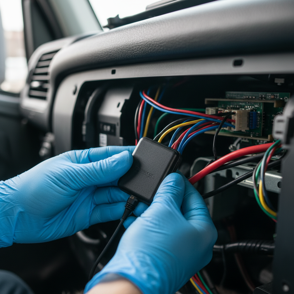
This unit connects to the vehicle’s diagnostic port (OBD-II on light vehicles, SAE J1939 CAN bus on heavy equipment) and reads ignition state, speed, engine hours, fuel level, fault codes, idle duration, and acceleration events. Advanced systems layer on cameras, temperature probes, tire-pressure sensors, cargo-door contacts, or Bluetooth beacons for nearby assets.
The U.S. Department of Energy describes telematics as collecting and transmitting near-real-time vehicle data, including diagnostics from OBD ports. The key word is “near-real-time.” There is always latency between the event on the road and the dot on your screen.
Transmission
The device packages timestamped records and sends them over a cellular network: 4G, LTE-M, NB-IoT, or 5G, depending on coverage requirements and power budget. Cross-border operations often rely on eSIM or roaming agreements. Vodafone describes global 4G/5G, LTE-M, NB-IoT, eSIM, and roaming as the connectivity foundation for transport telemetry. For routes with no terrestrial coverage, satellite-enabled IoT can extend reach, though at lower bandwidth and higher cost per message.
When a vehicle loses cellular signal (underground parking, dense urban canyons, remote terrain), a well-designed device buffers data locally and transmits on reconnect. A poorly designed one simply drops those records. This single behavior is one of the most underrated differentiators in hardware selection, and almost nobody asks about it during procurement.
Cloud processing
The platform authenticates the device, stores time-series observations, maps coordinates to roads and addresses, and joins events to vehicles, drivers, jobs, and customers. Then it applies geofences, route-deviation rules, maintenance thresholds, driver-scoring models, and ETA calculations.
This is where “tracking” becomes “fleet management.” Raw coordinates become dispatch decisions, maintenance triggers, compliance records, and customer notifications. Without this layer, you have data. With it, you have decisions.
Decision and action
A dashboard is the interface. The value lives downstream: dispatching the nearest vehicle, flagging unauthorized movement, generating a work order after a fault code, coaching a driver after repeated hard braking, producing an ELD record, or sending a customer an accurate arrival window.
If the tracking data doesn’t change a workflow, it’s a cost center with a nice map. I’ve seen companies spend $40 per vehicle per month and never open the platform past week two. The technology worked. The process around it didn’t.
Active vs. Passive Tracking (and Why It Barely Matters in 2026)
Every fleet tracking guide covers this, so let me be brief and honest.
Active tracking transmits data in near-real-time over cellular. Passive tracking stores records on the device, and you download them later via USB, dock, or short-range wireless when the vehicle returns to base.
For vehicle fleets, passive tracking is functionally obsolete. Cellular module costs have dropped. LTE-M and NB-IoT draw minimal power. No operations manager wants to wait until a truck returns to the yard to discover it idled for three hours in a parking lot yesterday.
Passive still plays a role in specific scenarios: battery-powered tags on unpowered equipment, containers sitting in deep storage, or trailers parked for weeks between moves. But for active vehicles, the question has shifted. It’s no longer “active or passive.” It’s “how frequently does the device report, and what happens during connectivity gaps?” A device that samples GPS every second but transmits every 60 seconds behaves very differently from one that streams continuously. Ask your vendor for both numbers, plus the offline buffer capacity.
Where Fleet Tracking Fails
This is the section most vendor pages omit. I think it’s the one that matters most for anyone about to commit budget.
Signal gaps are constant, not exceptional
GPS.gov identifies indoor use, underground environments, urban canyons, and multipath reflections as conditions that degrade or destroy positioning accuracy. A delivery truck entering a parking garage or loading dock can lose GNSS lock entirely. The system may display a stale position, attempt cell-tower triangulation, or go silent until the vehicle emerges.
Dead reckoning (accelerometers and gyroscopes estimating movement without satellite input) and map-matching algorithms help bridge the gap. They do not eliminate it. Any fleet relying on tracking for proof-of-presence at indoor facilities should understand that GPS alone cannot deliver it.
Cybersecurity is an operational risk, not a checkbox
Bitsight discovered six severe vulnerabilities in the MiCODUS MV720 GPS tracker, including hard-coded credentials and authentication flaws that could enable unauthorized real-time tracking, remote fuel cutoff, and supply-chain disruption. The devices were reportedly deployed across 169 countries by consumers, governments, and corporations. CISA assigned CVE references. Bitsight recommended discontinuing or disabling the devices until patched, with no known workaround.
A GPS tracker meant to protect a fleet became the vector for compromising it. Any device that reports vehicle location or controls vehicle functions must be treated as an operational technology endpoint. Encrypted communications, firmware update cadence, vulnerability disclosure policies, and device end-of-life plans belong in procurement requirements, not afterthoughts.
Privacy law is catching up fast
In January 2025, the FTC alleged that GM and OnStar had collected and shared precise location and driving-behavior data from millions of vehicles, sometimes every three seconds, without adequate notice or affirmative consent. The proposed order included a five-year restriction on data disclosure to consumer reporting agencies, plus requirements for consumer access and deletion mechanisms.
California Penal Code 637.7 separately restricts electronic tracking of a person’s location, with exceptions including vehicle-owner use and consent. Other states and countries apply different rules. The obligation for fleet operators: transparent disclosure, defined purpose, limited retention, access rights, and clear off-duty boundaries.
Driver resistance will sink your ROI
This one doesn’t appear in product specs, but I’ve watched it torpedo six-figure rollouts.
Drivers who feel surveilled rather than supported will find creative workarounds. They park in signal-dead zones deliberately. They report phantom device malfunctions. Morale drops. Turnover rises. The tracking system becomes a source of conflict rather than efficiency.
The fix is simple in concept, difficult in execution: explain what you collect, why, who sees it, and what’s off-limits before the first device goes in. Use the data for coaching and route improvement, not retroactive discipline. When drivers benefit from the system (fewer false-blame incidents, better dispatch support, faster job completion), adoption follows. When they don’t, no amount of hardware will save the project.
The ROI Numbers, Stripped of Vendor Spin
Let me be direct. Most fleet tracking ROI claims come from vendor-reported survey averages, not controlled experiments. That doesn’t make them useless. It makes them starting hypotheses for your operation, not guarantees.
Verizon Connect’s 2026 report, drawn from nearly 900 fleet professionals, shows average decreases of 11 to 19 percent across fuel, accident, labor, and maintenance costs. The DOE cites possible 10 to 25 percent fuel reductions from automated mileage tracking in federal fleets. IoT Analytics reports median spending of $110 per tracked asset per year, with 74 percent of projects meeting or exceeding ROI expectations.
Useful benchmarks. But your results depend on fleet size, route mix, vehicle age, baseline driver behavior, fuel prices, and (most importantly) whether you actually change workflows based on what the data shows.
The honest approach to measuring fleet tracking ROI:
- Measure your baseline before any device is installed. Fuel cost per mile. Idle hours per vehicle per day. Unplanned maintenance downtime. Average job cycle time.
- Deploy on a subset. Run it for 90 days with clear process changes tied directly to the data.
- Compare your own before-and-after numbers. Not vendor benchmarks.
- Scale what delivers measurable value. Cut what doesn’t.
A $15-per-month tracker that eliminates three wasted dispatches each week will outperform a $50-per-month platform that nobody opens after the first month. The technology is never the bottleneck. The process around it is.
But there’s a catch with these ROI numbers. They almost always measure what happens while the vehicle is in motion. They rarely account for what happens to the asset after the truck drives away.
Fleet Tracking Ends at the Truck. Asset Tracking Doesn’t.
This is the gap most fleet tracking conversations miss, and it’s where I hold the strongest opinion shaped by years of field deployments.
Fleet tracking, as the market defines it, follows a powered vehicle from point A to point B. Where the truck is, how fast it’s going, whether the engine has a fault code. In practice, that’s shipment tracking: the job ends when delivery is confirmed.
Asset tracking follows the physical thing through its complete lifecycle. Where is this container right now? How long has it been sitting at the customer’s facility? When is it returning? What’s its utilization rate across 200 cycles? Is it even still in the pool?
If you run reusable container pools, manage ground support equipment at airports, move ULDs through an airline network, or track MRO tooling across facilities, fleet tracking gives you half the picture. You see the vehicle that carried the asset. You lose visibility the moment that asset leaves the truck.
That “after delivery” blind spot is where the largest losses accumulate. Containers dwell for weeks at customer sites because nobody measures return cycles. Equipment disappears between facilities because tracking ended when the delivery vehicle drove away. Utilization drops below 40 percent on assets costing thousands each, and finance blames procurement for over-ordering when the real problem is cycle time.
This is the core of what we built Datanet around. Our asset tracking devices are designed for full-cycle visibility: deploy, ship, dwell, return, redeploy. Battery life measured in years. Form factors that survive aviation, maritime, and industrial environments. The Thingfox T2 carries DO-160 airfreight certification for airline operations, while our ocean equipment trackers handle the specific demands of port logistics and container pools, including full-cycle sea container tracking. Learn more about how to create an asset tracking system that addresses these lifecycle visibility gaps.
If your visibility ends when the shipment is delivered, you’re solving the wrong half of the problem.
What to Compare Before You Sign
Skip the feature matrix for a moment. Start here.
What problem are you solving first? Theft recovery is a fundamentally different product than dispatch optimization, which differs from ELD compliance, which differs from asset utilization. The device, platform, and price point change completely depending on the answer. A plug-and-play GPS tag on a trailer has nothing in common with a hardwired telematics gateway on a Class 8 truck.
What happens when the device goes offline? Does it buffer locally? How much data? For how long? This matters more than the headline reporting interval in every real-world deployment.
Who owns the data? Can you export raw timestamped records? In what format? What’s the API rate limit? If you switch providers in two years, does your history come with you? These feel abstract until you’re locked in.
How does it handle mixed fleets? Multiple vehicle makes, trailer types, unpowered equipment: you need a platform that normalizes across all of them. AEMP and ISO 15143-3 exist precisely because mixed-OEM telematics data fragments without a common standard.
What’s the total cost per asset per year? Hardware, subscription, installation, cellular, support, and the internal labor to act on the data. Compare that total to measurable outcomes: fuel per mile, idle hours, lost-asset replacement, dwell time reduction, avoided maintenance downtime. If the math doesn’t hold at the per-asset level, the platform isn’t the answer yet.

Frequently Asked Questions
How accurate is GPS fleet tracking?
Open-sky GPS accuracy is typically within 4.9 meters, according to GPS.gov. In practice, satellite geometry, signal blockage from buildings or tunnels, atmospheric conditions, and receiver quality all affect the result. Urban and indoor environments can degrade accuracy significantly or cause temporary position loss. Map matching and dead reckoning improve continuity but don’t eliminate uncertainty.
Does fleet tracking require a monthly subscription?
Almost always. The device needs cellular connectivity and cloud software, both carrying recurring costs. Typical range for vehicle telematics is $15 to $50 per vehicle per month, varying with features, reporting frequency, and camera options. Battery-powered asset trackers on LTE-M or NB-IoT networks can run lower, especially with infrequent reporting schedules.
What is the difference between fleet tracking and asset tracking?
Fleet tracking follows a powered vehicle in motion: location, speed, diagnostics, driver behavior. Asset tracking follows a physical object through its full lifecycle, including idle periods, customer dwell, return logistics, and reuse cycles. Containers, trailers, ULDs, and ground support equipment need asset tracking because their value depends on utilization and cycle time, not just transit visibility.
Can GPS fleet tracking work indoors or underground?
GPS signals weaken or vanish indoors, underground, and in dense urban canyons. Systems may fall back on cell-tower positioning, Wi-Fi, Bluetooth beacons, or inertial sensors, but accuracy degrades. Positions shown during coverage gaps should be treated as estimated or last-known, not precise.
Is it legal to track company vehicles?
Generally yes for company-owned vehicles during work hours, with proper employee disclosure. Restrictions vary by jurisdiction. California Penal Code 637.7 limits electronic tracking of a person’s location without consent. Off-duty tracking and personal-vehicle monitoring face stricter scrutiny. Always provide transparent written notice and consult local counsel before deploying.
How long does a fleet tracking deployment take?
Plug-and-play OBD-II devices install in minutes per vehicle. Hardwired telematics gateways take 30 to 90 minutes each depending on vehicle type. The larger timeline factor is platform configuration, geofence design, integration with dispatch or maintenance systems, and driver onboarding. Plan for weeks of operational rollout, not just hours of installation.
If your fleet visibility disappears when the truck parks and your asset utilization stays invisible after delivery, that’s the gap worth closing. Talk to our team, or reach us directly at info@datanetiot.com.








 +1 508 292 2210

2 Responses