

In 2024, 183.2 million TEUs were lifted globally. May, August, and December each crossed 16 million TEUs for the first time. Every one of those containers generated a tracking expectation. And in most cases, that expectation was wrong.
Not because the data was fake. Because the shipper assumed sea container tracking meant a GPS dot gliding across a blue map in real time. It almost never does. What you actually get depends on which layer of the tracking stack you are looking at. Most organizations see one or two layers and treat them as the whole picture.
That gap got expensive fast. When Red Sea rerouting added roughly 30% to voyage lengths and 11% to container TEU-mile demand, shippers relying on a single carrier portal for ETA were already weeks behind their inventory plans by the time the milestone data caught up. The Shanghai Containerized Freight Index averaged 2,496 points that year, up 149% from the prior year. Longer voyages, volatile rates, congested ports. The cost of bad tracking data compounds at every node.
I have spent more than fifteen years deploying IoT across aviation, maritime, and industrial supply chains. The pattern repeating in ocean freight today is the same one I watched unfold in aviation MRO a decade ago: organizations buy “tracking” and expect “visibility.” Those are two different products. Here is how to tell them apart, and how to pick the one that actually protects your operations.
What Sea Container Tracking Actually Delivers
At its simplest, sea container tracking means entering a container number (four-letter prefix plus seven digits), a booking number, or a bill of lading into a carrier portal. Maersk accepts all three reference types. Hapag-Lloyd supports container, booking, or B/L lookup with door-to-door detail. What comes back is a set of milestones: booking confirmed, gate-in, loaded, vessel departed, transshipped, discharged, gate-out, delivered. Maersk publishes up to nine milestones per shipment.
These milestones are contractual events, not physical measurements. “Loaded” means a terminal reported the box was craned onto a vessel. It does not tell you the container’s GPS coordinates, its internal temperature, whether the seal is intact, or how long it sat in the yard before loading.
Think of it this way: the airline says your bag was loaded. The AirTag shows the bag is in the cargo hold. Both are tracking. Only one proves the bag is where it should be.
That distinction scales. A freight forwarder managing 500 containers across six carriers needs normalized milestones, predictive ETAs, and exception alerts. A reefer carrying pharmaceuticals needs continuous temperature evidence. A fleet operator needs to know where empty containers sit idle. No single portal covers all three. “Sea container tracking” is a search term. In practice, it is a layered architecture.
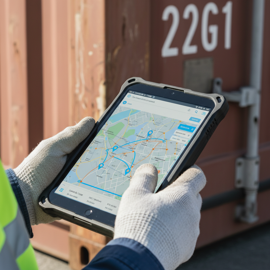
Six Data Layers Behind Every Container Ping
Understanding what you are buying requires separating six distinct layers. Each has its own source, latency, and failure mode.
Layer 1: Identity resolution. One physical container can appear under a container number, booking number, bill of lading, house bill, purchase order, and seal number simultaneously. A tracking system must map all of these to the same steel box. When identity resolution fails (wrong BL, rolled container, split shipment), every downstream data point attaches to the wrong journey. This is the layer nobody talks about, and it is where most tracking errors originate.
Layer 2: Carrier milestones. Events reported by the shipping line and terminal operators. Gate-in, loading, departure, transshipment, discharge, customs release, delivery. DCSA is standardizing these events into common data models and APIs so milestones from different carriers can be consumed through one interface. Until adoption reaches critical mass, each carrier’s event vocabulary is slightly different. “Discharged” at one carrier may or may not mean the same thing as “Unloaded” at another.
Layer 3: Vessel movement (AIS). The Automatic Identification System broadcasts a ship’s identity, position, course, and speed. IMO mandates AIS on SOLAS-class vessels. Visibility platforms use AIS to infer a container’s position while it is aboard a known vessel. The word “infer” matters. More on that shortly.
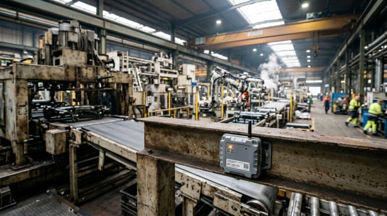
Layer 4: IoT sensor data. A smart container gateway installed on the box itself can report GNSS location, temperature, humidity, door events, shock, tilt, and movement. This is the only layer that observes the container’s actual physical state. It requires hardware, battery management, connectivity, and a plan for device recovery across cycles.
Layer 5: Predictive analytics. ETA models that combine carrier schedules, AIS, port congestion data, historical transit times, weather, and route changes. A good prediction includes a confidence interval and explains why it shifted. Without this layer, “your container departed Shanghai” tells you nothing about when it will reach Rotterdam.
Layer 6: Integration and governance. APIs, webhooks, TMS/ERP connectors, role-based access, and audit trails determine whether tracking data reaches the person who can act on it. The best sensor in the world is wasted if the alert goes to an inbox nobody checks.
Most carrier portals cover layers 1 and 2. Multi-carrier platforms add layers 3 and 5. Smart-container hardware adds layer 4. Very few organizations have built layer 6 well enough to close the loop between signal and action.
AIS Is Not a Container Sensor
This is the myth I correct most often in conversations with logistics directors: “We have vessel tracking, so we have container tracking.”
No. You have vessel tracking.
AIS tells you where the ship is. It does not tell you which containers are aboard, whether yours was actually loaded, whether it was offloaded at a transshipment port, or what condition the cargo is in. A container that was “rolled” to next week’s sailing still appears on the original vessel in most carrier-plus-AIS setups until someone manually updates the booking. For comprehensive vessel monitoring approaches, see our guide on how to track a boat at sea.
The reliability of AIS itself is worth scrutinizing. A study published in Nature, combining satellite imagery and deep learning across 53 billion AIS positions, found that 72 to 76% of industrial fishing vessels and 21 to 30% of transport and energy vessel activity were not publicly tracked. Those are vessels, not containers, but the gap between “AIS covers the ocean” and “AIS covers everything on the ocean” should concern anyone building a tracking architecture on a single signal.
Spoofing compounds the problem. AIS is not encrypted or authenticated. Kpler’s analysis found that 80.1% of ships caught spoofing their AIS signal were sanctioned within one year. If a vessel falsifies its position, every tracking system relying on that signal inherits the deception.
The practical takeaway: AIS is valuable context, not ground truth. Use it alongside carrier milestones, terminal events, and (where justified) physical IoT data. A confidence-ranked system that cross-references multiple sources will always outperform a single pretty map.
Smart Containers: When Hardware Earns Its Keep
If milestones and AIS leave gaps, the obvious question is: why not put a sensor on every container?
Cost. Battery. Connectivity at sea. Installation logistics. Device recovery across a global network of ports, depots, and inland facilities.
Hapag-Lloyd announced in 2022 that it would be the first major carrier to equip its entire fleet with real-time tracking devices, building on its reefer monitoring program and extending across roughly 3.1 million TEU. The economics work because the carrier benefits from asset utilization, maintenance scheduling, and customer differentiation across millions of containers over their full lifecycle. That is a fleet owner making an infrastructure investment, not a shipper instrumenting one voyage.
The industry is converging. The Smart Container Alliance, launched in February 2025 with ORBCOMM, Traxens, Nexxiot, Hoopo, Globe Tracker, and Arviem among its founders, is pushing interoperability, traceability, and customs collaboration. The direction is clear: the container is becoming a data source, not just a steel box.
For shippers and operators who do not own millions of containers, the ROI calculation is different. Smart hardware consistently pays for itself in four scenarios:
- Reefer and pharma cargo. A pharmaceutical shipment arriving out of spec can mean six figures in rejected product. Continuous temperature evidence prevents excursions through early alerts and supports claims with an unbroken sensor log. For humidity-sensitive cargo, a dedicated moisture tracker adds another layer of condition evidence.
- High-value or theft-prone corridors. Door sensors, GNSS, and geofencing create evidence trails for electronics, luxury goods, and industrial components.
- Regulated supply chains. Food safety, chemicals, defense materiel. The sensor record becomes compliance documentation, not just an operational nice-to-have.
- Owned or leased container pools. When you own the asset, tracking becomes a lifecycle question. Dwell time, cycle time, idle location, repositioning cost. This is where the money hides.
If you cannot quantify the cost of a temperature excursion, a lost container, or a demurrage charge that better data would have prevented, the hardware probably will not pass a business case. If you can, the numbers tend to be persuasive.
Shipment Tracking vs. Asset Tracking: The Distinction That Saves Money
This is the core distinction that gets collapsed in almost every ocean freight conversation, and the one I want you to carry away from this article.
Shipment tracking follows a cargo from origin to destination. The job ends at delivery. Your freight forwarder confirms the container reached the warehouse. File closed.
Asset tracking follows the container through its entire lifecycle: loaded, in transit, discharged, dwelling at port, on rail, delivered, emptied, repositioned, reloaded. The job never ends because the asset keeps cycling.
If you are a cargo owner shipping FCL on someone else’s boxes, shipment tracking is probably sufficient. If you are a carrier, a container lessor, a pool operator, or a company running reusable transport equipment, you need asset tracking. The financial difference is not marginal.
Consider a fleet of 10,000 reusable containers. Without continuous asset visibility, you know where containers are during a booked voyage. You do not know where they are during dwell time at ports, during inland repositioning, or sitting uncounted at a third-party depot. That invisible inventory drives two expensive outcomes: overprovisioning (you buy more containers than you need because you cannot find the ones you have) and underutilization (containers sit idle because nobody knows they are available). Comprehensive port equipment tracking addresses exactly this visibility gap during critical dwell periods.
UNCTAD reported that average port waiting times rose 23% to 6.4 hours in developed economies between late 2023 and early 2024. In developing economies, the figure reached 10.9 hours. Every hour a container sits untracked at a congested port is an hour it is not earning revenue. Multiply by a fleet of thousands and the cost of “not knowing” becomes a line item.
This distinction is the foundation of what we build at Datanet. The ocean equipment tracking conversation always starts the same way: “I want to know where my container is right now.” The conversation that actually delivers ROI is: “I want to know where all my containers are, all the time, and what I should do about the ones that are not moving.”
How to Build a Tracking Architecture That Actually Works
Based on what I have seen across deployments in maritime, aviation, and industrial logistics, here is the practical sequence:
Start with carrier events. For most ocean shipments, the carrier’s milestone data is your foundation. It is authoritative for that carrier’s bookings, and it is usually free. If you ship with one or two lines, their portals may be enough for basic visibility.
Add multi-carrier normalization when you outgrow portals. The moment you manage shipments across three or more ocean lines, a normalized API or visibility platform saves hours of daily manual lookup and gives you one ETA model instead of six different milestone vocabularies. DCSA’s standards are accelerating this, but carrier adoption remains uneven.
Add predictive ETA for disruption-prone corridors. Shanghai to Rotterdam via the Suez (or the Cape, depending on the quarter) is not the same planning problem as Busan to Long Beach on a direct service. Predictive models that incorporate port congestion, weather, and dynamic rerouting earn their cost on high-variability lanes.
Add sensors where the cargo or the asset demands it. Reefers. Pharma. Owned containers. Theft-prone corridors. If you can price the avoided loss, you can justify the device.
Connect tracking to workflow, not just dashboards. A beautiful map nobody checks is decoration. An alert that triggers a rerouted truck, a customer notification, a reefer intervention, or a customs pre-filing is operational visibility. Build the workflow integration before you add more sensors.
Here is a decision framework:
| Scenario | Primary data layer | Add when justified | Key metric |
|---|---|---|---|
| Standard FCL, low-value dry goods | Carrier milestones, multi-carrier API | Predictive ETA on volatile lanes | On-time delivery %, manual lookup hours saved |
| Reefer or pharma cargo | Carrier milestones + continuous temperature monitoring | Door sensors, humidity, geofencing | Temperature excursions prevented, claims cost avoided |
| High-value or theft-sensitive goods | Carrier milestones + GNSS + door/seal sensors | Satellite AIS, behavioral analytics | Theft incidents, recovery rate, insurance premiums |
| Owned or leased container fleet | Asset-level GNSS + dwell and cycle analytics | Condition monitoring, predictive maintenance | Cycle time, utilization rate, repositioning cost |
| Sanctions or compliance exposure | Multi-source AIS + port call verification | Satellite imagery, onboard cargo sensors | Compliance violations avoided, audit readiness |
The smart container market was valued at $4.2 billion in 2023 with a projected 19.6% CAGR through 2030. The growth is real, but the point is not that everyone needs hardware tomorrow. The point is that the tracking stack is disaggregating. You can buy each layer independently and assemble what your operations require, rather than accepting whatever a single carrier portal offers by default.
If your container pool feels invisible after delivery, that is the gap asset tracking closes. Our ocean equipment tracking devices are built for exactly this lifecycle problem, and our team can walk you through what a deployment looks like for your fleet size and corridor mix. Reach out at info@datanetiot.com.
Frequently Asked Questions
How do I track a sea container right now?
Enter your container number, booking number, or bill of lading on the carrier’s portal. Maersk, Hapag-Lloyd, MSC, CMA CGM, and most major lines offer free lookup. For multi-carrier shipments, use a normalized tracking API or aggregator platform that pulls milestones from multiple lines into one view. If you need onboard hardware, our guide on where can I buy a tracking device covers the options.
Is sea container tracking truly real time?
Rarely in the way people expect. Carrier milestones update only when a terminal or vessel reports an event. AIS provides vessel positions, not container positions. Smart-container IoT devices can report location and condition at set intervals (often every few hours, constrained by battery), which is the closest to continuous. Always ask: what is the source, the update frequency, and whether the position is observed or inferred?
What is the difference between AIS tracking and GPS container tracking?
AIS is a ship transponder system that broadcasts vessel identity, position, course, and speed to other ships and shore stations. GPS or GNSS in a container device reports the container’s own position. AIS can help infer a container’s route while aboard a known vessel, but it cannot confirm the container is actually on that ship, nor can it report cargo condition.
Do all shipping containers have tracking devices installed?
No. Carrier milestone tracking is widespread, but physical IoT hardware is not universal. Hapag-Lloyd’s fleet-wide program is the largest single deployment, and the 2025 Smart Container Alliance is pushing broader adoption. For most containers in global circulation, tracking still depends on carrier events and AIS inference rather than onboard sensors.
What data can a smart container actually provide?
Depending on the device: GNSS location, temperature, humidity, door open/close events, shock, tilt, light exposure, battery status, and movement detection. The exact sensor suite varies by hardware. For ocean equipment, devices need to handle long battery life, salt corrosion, limited cellular connectivity at sea, and ruggedized mounting.
Why does my container ETA keep changing?
ETA models respond to vessel speed changes, weather, port congestion, transshipment delays, blank sailings, customs holds, and inland capacity. The 2024 Red Sea rerouting increased voyage lengths by roughly 30%, so an ETA shift can reflect a real network disruption, not a tracking failure. A good system tells you why the ETA moved and gives a confidence range, not just a new date.





 +1 508 292 2210

2 Responses