

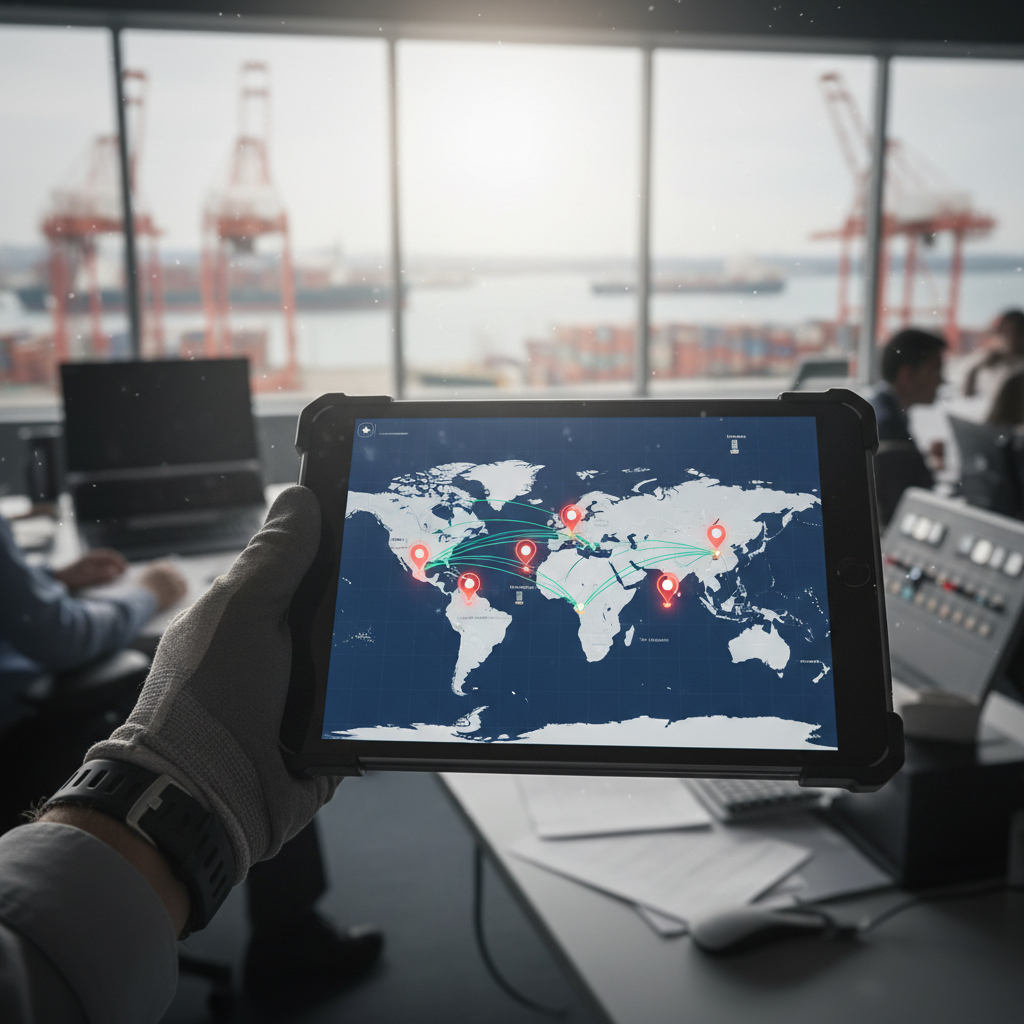
You enter a container number into a carrier portal. A dot appears on a world map, somewhere south of Sri Lanka. Feels like control. Except that dot is probably the vessel’s last AIS broadcast, not a GPS reading from the container itself. Most shipping containers carry no built-in GPS. The “real-time” position you’re looking at could be hours old, inferred from a milestone event, or simply the last place a terrestrial receiver picked up the ship’s signal.
So when you ask how to track ocean freight, the practical answer is: you’re not tracking one signal. You’re assembling carrier events, vessel positions, port feeds, and (for equipped cargo) sensor telemetry. Each has a different update interval, a different confidence level, and different blind spots. This article breaks down each layer, explains when to trust it, and covers what to do when the signal goes dark.
Start With the Right Identifier, Not the Ship Name
The single most common mistake I see from first-time importers: they Google the vessel name and assume a vessel-tracking map tells them where their cargo is. It doesn’t. A ship carrying 10,000 TEUs is not your container. What you need is a shipment-level reference.
Three identifiers unlock actual tracking data:
| Identifier | What it tells you | Best for |
|---|---|---|
| Container number | Equipment-level status: loaded, in transit, discharged, available for pickup | Single-container lookups once the box has been assigned |
| Booking number | Voyage association, vessel assignment, planned route | Pre-shipment and early-stage tracking before a container number exists |
| Bill of lading (B/L) | Commercial shipment record; may cover multiple containers | Full shipment view; aligning cargo with documentation |
MSC’s portal accepts container, B/L, and booking numbers. Hapag-Lloyd does the same and layers in live vessel position for the carrying ship. Maersk takes B/L, container, or parcel tracking numbers. The point: get the reference from your shipper, forwarder, or carrier before you search. Without it, you’re guessing from a ship map.
Three Layers of Ocean Freight Visibility
Tracking is not one technology. It’s three layers stacked on top of each other, each answering a different question.
Layer 1: Carrier milestone events
This is the backbone. When a carrier reports “gate in,” “loaded,” “departed,” “arrived,” “discharged,” or “available for pickup,” those are operational events recorded at specific custody points. They tell you what happened and when. They do not update continuously; they update when something happens.
The catch: event definitions vary between carriers. One line calls it “gate out.” Another calls it “equipment released.” DCSA’s Track and Trace standard addresses this by defining five shipment phases (pre-shipment, pre-ocean, ocean, post-ocean, post-shipment) and publishing common API definitions so systems from different carriers can speak the same language. As of 2026, DCSA members represent roughly 75% of global container trade. Standardization is underway, but it’s not complete.
Layer 2: AIS vessel positioning
AIS (Automatic Identification System) transponders broadcast a ship’s identity, position, course, speed, and navigational status. The IMO requires AIS on all cargo ships of 300+ gross tonnage on international voyages, which covers the vast majority of the 112,500-vessel, 2.44-billion-DWT global fleet recorded in January 2025. This gives you vessel context: where the ship is, how fast it’s moving, and its reported destination. For a fuller breakdown of the tools and limits involved when you track ships in the ocean, and for detailed guidance on vessel positioning technology, see our guide on how to track a boat at sea.
AIS has hard limits, though. Terrestrial receivers only pick up signals within range of coastal stations. MarineTraffic explains that vessels in remote ocean areas may drop off terrestrial AIS entirely; satellite AIS fills some of that gap, but with latency measured in hours, not seconds. More importantly, AIS tells you where the ship is. It does not confirm that your specific container was loaded on that ship, or that it hasn’t been offloaded at a transshipment port two days ago.
Layer 3: IoT sensors on the container
This is the only layer that tracks the box itself. A GPS or cellular device mounted on or inside the container reports position, and in many configurations temperature, humidity, shock, or door-open events. Maersk’s Remote Container Management system monitors GPS, temperature, humidity, and atmosphere on every one of its reefer containers, and has been approved for remote data submission to the USDA for Cold Treatment cargo.
For dry containers, the picture is different. Most don’t carry sensors. If your cargo is in an unequipped dry box, you’re relying entirely on Layers 1 and 2. That works for many shipments. But it means your “tracking” has event-shaped gaps, not continuous coverage. The smart-container market was valued at $4.2 billion in 2023 and is projected to reach $13.7 billion by 2030, which tells you where the industry is heading. It also tells you we’re not there yet for most dry freight.
How to Track Ocean Freight, Step by Step
- Get the reference. Ask your shipper or freight forwarder for the container number, booking number, or B/L number. A vessel name alone gives you ship context, not cargo status.
- Check the carrier portal first. Go directly to the operating carrier’s website. This is the most authoritative source for that carrier’s milestone events, voyage details, and ETA.
- Use an aggregator for multi-carrier shipments. If your supply chain involves multiple shipping lines, platforms like SeaRates accept container numbers, B/Ls, and booking references across carriers. Useful for freight forwarders and importers juggling dozens of lines.
- Add vessel-level context when it matters. An AIS-based service shows the ship’s position and route. This helps when carrier milestones haven’t updated and you need a read on whether the vessel is on schedule, rerouted, or anchored outside a congested port.
- Set up alerts. Most carrier portals and aggregators offer email or webhook notifications. Configure them for events that trigger action: “discharged,” “available for pickup,” “delayed.” Checking a portal manually every morning does not scale.
- For high-value or sensitive cargo, add condition monitoring. If you’re shipping perishables, pharmaceuticals, or anything where a temperature deviation costs more than the tracking device, install an IoT sensor. The data serves double duty: operational visibility in transit and evidence for claims after arrival.
These six steps cover shipment tracking. For companies managing reusable containers or equipment pools, there’s a seventh: keep tracking after delivery. More on that below.
Why Tracking Goes Dark Between Ports
If you’ve tracked ocean freight before, you know the feeling. The status says “departed” from Shanghai, and then nothing. For days. Maybe over a week. The map shows the ship somewhere in the Pacific, or it shows nothing at all.
This isn’t a system failure. It’s the architecture working as designed, just not as expected. Here’s what causes the silence.
Mid-ocean AIS gaps are the most common culprit. Far from coastal receivers, terrestrial AIS simply loses the signal. Satellite AIS covers some of the gap, but those positions can arrive hours late. For a vessel on a 14-day transpacific crossing, you might see only a handful of position updates between departure and the approach to destination.
The absence of container-level GPS compounds the problem. Unless your box has a sensor device, no signal exists to receive between port events. The carrier records “loaded” and “departed.” The next event might be “arrived” or “discharged” many days later. Everything in between is inference.
Transshipment adds another blind spot. A container moving through a hub port (Singapore, Colombo, Tanger Med) may be discharged from one vessel and loaded onto another. If the transshipment carrier differs or the terminal feed lags, the container can appear to vanish mid-route, which is exactly the kind of gap that reliable sea container tracking is built to close.
Then there’s the port itself. The IMO mandated Maritime Single Windows for electronic information exchange starting January 2024, yet an IMO-cited survey found that 64% of port calls still involved paper or mixed paper-and-digital submissions, with document preparation averaging 191 minutes per call. A ship can be AIS-visible at sea while its cargo workflow is stuck in a manual queue on shore.
Global disruptions magnify every gap. During the 2024 Red Sea crisis, container tonnage through the Suez Canal dropped 82%, and 586 container vessels were rerouted around the Cape of Good Hope. Rerouted ships travel longer paths, call at unplanned ports, and blow through scheduled ETAs. A tracking system that compares observed routes to planned corridors can flag this in hours. A basic portal echoing carrier milestones may not show the deviation until the ETA is already missed.
Carrier Portal vs. Aggregator vs. Enterprise Platform
The right tool depends on your shipment volume, the number of carriers you work with, and the cost of not knowing.
| Approach | Primary data source | Best for | Limitation |
|---|---|---|---|
| Carrier portal (Maersk, MSC, Hapag-Lloyd, CMA CGM) | First-party milestone events, voyage and booking data | Confirming status on a specific carrier’s shipments | One carrier per portal. Ten carriers means ten logins and ten different event vocabularies. |
| Multi-carrier aggregator | Container, B/L, and booking references across shipping lines | Freight forwarders and importers with multi-line exposure | “Real-time” often means event-based or inferred, not continuous GPS. |
| Enterprise visibility platform | Normalized carrier and forwarder feeds, predictive ETAs, APIs, exception alerts | High-volume shippers managing multi-modal flows and inventory integration | Integration overhead. ROI requires enough volume and exception cost to justify the investment. |
| AIS vessel intelligence | Terrestrial and satellite AIS | Route context, schedule monitoring, port congestion | Tracks the ship, not the container. Cannot prove cargo custody. |
| IoT condition monitoring | GPS, temperature, humidity, shock from a device on the container | Perishables, pharma, high-value, or claims-sensitive cargo | Requires hardware, connectivity, battery management, and a response workflow. |
A practical rule: start with the simplest layer that solves your problem. If you ship three containers a quarter, the carrier portal is enough. If you manage fifty containers a month across five lines, an aggregator saves real hours. If a missed ETA triggers a production shutdown or a six-figure demurrage bill, an enterprise platform earns its keep. And if you need to prove what happened to the cargo (not just where it went), only IoT gives you that evidence.
When Shipment Tracking Ends and Asset Tracking Begins
Here’s the distinction most logistics teams overlook, and it’s the one I spend the most time explaining in conversations with port operators and fleet managers.
Shipment tracking answers: where is my cargo right now, and when will it arrive? The job ends at delivery. The carrier’s obligation ends. The tracking reference goes cold.
Asset tracking asks a different question entirely: where is the container, the chassis, the pallet, or the ULD across its entire lifecycle? After delivery, after unloading, during dwell at a customer site, during repositioning, during reuse. The reference never goes cold because the asset doesn’t stop existing when the shipment closes.
For companies running reusable container pools, this gap is expensive. Containers sit idle at customer facilities for weeks because nobody measures dwell time after the “delivered” event. Cycle times stretch. The pool swells to compensate, tying up capital in assets that should be moving. I’ve seen operations where 30% of the container pool was effectively invisible at any given moment, simply because tracking stopped the instant the shipment record said “delivered.” Our article on how to track my fleet covers strategies for maintaining visibility across distributed asset pools.
A cellular or satellite tracker attached to the asset (not tied to a shipment reference) changes that equation. It reports position on a schedule regardless of custody. It measures cycle time, flags dwell anomalies, and gives you the data to right-size the pool instead of over-buying containers to cover the ones you can’t see. The same principles apply to energy transport tracking, where lifecycle visibility of moving assets matters just as much.
We build these systems at Datanet. If your container fleet goes dark after delivery, our ocean equipment tracking devices are designed to close exactly that visibility gap, from departure through return. Or reach out to the team and tell us what you’re trying to solve.
Frequently Asked Questions
What number do I need to track ocean freight?
A container number, booking number, or bill of lading number. The container number gives equipment-level status. The booking number links to the voyage and vessel. The B/L covers the commercial shipment and may span multiple containers. Get whichever your shipper or forwarder can provide. A vessel name alone gives you ship context, not cargo status.
Is ocean freight tracking truly real-time?
Rarely in the GPS-every-second sense. Carrier milestones update when operational events occur (load, departure, discharge). AIS vessel positions depend on receiver range and may lag by hours mid-ocean. Only IoT-equipped containers report near-continuous location. Always check the timestamp and source of the last update before treating it as current.
Why did my shipment disappear from the tracking map?
Most likely the vessel left terrestrial AIS range and satellite AIS hasn’t refreshed, or the container has no onboard sensor and the next carrier milestone hasn’t been recorded yet. Transshipment gaps and paper-based port processes also cause delays in updates. If the gap threatens a delivery window or customs deadline, contact your carrier or forwarder directly.
What is the difference between container tracking and vessel tracking?
Vessel tracking (AIS) shows the ship’s identity, position, course, and speed. Container tracking follows a specific box through carrier and port milestone events. They correlate, but a vessel’s position does not confirm that your container was loaded, offloaded at a transshipment hub, or released at the destination terminal.
When does an enterprise visibility platform make sense?
When you manage high volumes across multiple carriers and modes, when a missed ETA triggers production delays or demurrage charges, or when you need API integration with your TMS, WMS, or order management system. For a handful of shipments per quarter, carrier portals and a free aggregator cover the basics.
How do I track the condition of perishable ocean freight?
Use a reefer with built-in monitoring (Maersk’s Remote Container Management covers temperature, humidity, atmosphere, and GPS on all its reefers) or install an independent IoT sensor. The data provides early detection of temperature deviations in transit and documented evidence for claims. Without condition data, you only discover damage after the doors open at destination.





 +1 508 292 2210

2 Responses