

A construction company in Georgia estimates it avoided $2.5M in equipment losses by recovering assets before they vanished permanently. The geofence flagged the movement. A trained response workflow brought the equipment back. That gap between “alert fired” and “asset recovered” is where GPS geofencing for assets either delivers real operational value or quietly becomes another ignored notification.
GPS geofencing creates a virtual boundary around a physical area and triggers an event when a tracked asset crosses it. Entry, exit, or dwell too long. Simple concept. The operational chain behind it (which assets, what boundaries, how fast, how long the battery lasts, who responds) is where the real decisions live.
After 15+ years deploying IoT across aviation, freight, and industrial operations, I’ve seen this consistently: the boundary is the easy part. Everything that happens after the alert determines whether you get measurable ROI or just more noise in someone’s inbox.
How GPS Geofencing Works (and Where It Stops)
A GPS-equipped tracker captures its position using satellite signals. That position gets evaluated against a defined boundary, either onboard the device or in a cloud platform. When the position crosses the boundary, the system generates an event.
Three event types matter in practice:
- Entry: the asset arrives inside a defined zone
- Exit: the asset leaves the zone
- Dwell: the asset stays inside (or outside) beyond a set time threshold
Tracking tells you where something is. Geofencing tells you when something breaks a rule. A trailer sitting idle in your yard for four days isn’t a tracking issue. It’s a dwell event that should trigger a dispatch review. An excavator leaving a jobsite at 2 AM isn’t merely a data point. It’s an exit event that should reach the site foreman and, potentially, law enforcement.
That distinction between passive visibility and active rule enforcement is what separates useful geofencing from expensive map-watching.
Cloud evaluation vs. onboard evaluation
Most platforms evaluate positions server-side: the tracker reports its location, the cloud checks it against your boundaries, the system fires an alert. This works well when connectivity is reliable and you want central management of all fence definitions.
Some devices take a different approach. The Oyster3, for example, supports both server-side and downloadable onboard geofences, storing events when cellular coverage drops. Those records upload once connectivity returns. But here’s the distinction that matters: a stored record is not a real-time alarm. If your primary use case is theft response, onboard logging alone won’t get someone to the asset fast enough.
For assets moving through areas with inconsistent cellular coverage (rural construction sites, port yards, remote oil and gas infrastructure), the architecture choice between cloud-only and onboard evaluation directly affects how quickly you learn about a boundary crossing.
Where GPS stops working
GPS.gov identifies signal blockage and multipath (reflected signals bouncing off surfaces) as primary accuracy factors. Inside a warehouse, a maintenance hangar, or a multi-story parking structure, satellite signals degrade or vanish entirely.
This creates a specific problem for assets that move between environments. The same container that’s GPS-visible on a highway goes dark when it rolls into a warehouse. For indoor zone detection, technologies like RFID, BLE beacons, or UWB anchors handle boundary events more reliably. If your assets cross both environments, you need a platform that stitches those inputs together rather than two separate systems generating conflicting data.
The question isn’t “does GPS work?” It’s “does GPS work where my decision actually happens?” If the critical boundary is a warehouse door or a maintenance bay, GPS alone is the wrong tool.
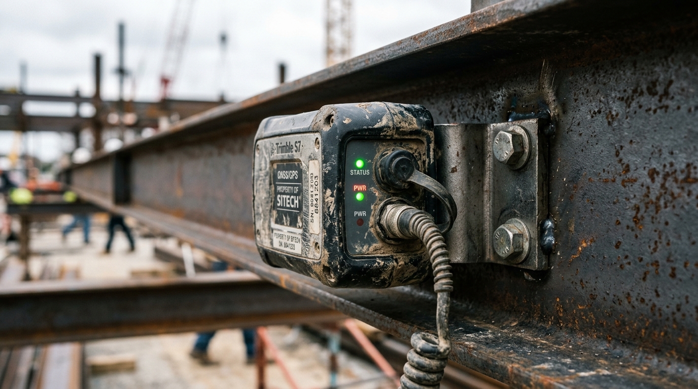
The Battery Question That Changes Everything
Here’s the tradeoff that rarely makes it into the sales demo: the more frequently a tracker checks its position and reports it, the faster the battery dies.
The Oyster3 datasheet makes this concrete. Daily position updates: estimated 10-year battery life. Hourly updates: 3.5 years. Nearly a 3x reduction in runtime from a single configuration change.
For geofencing, this creates a direct design decision.
A construction company that needs to know within minutes if an excavator leaves a site requires frequent positioning checks. A shipping company tracking reusable containers across a 30-day cycle can tolerate longer intervals. The detection speed you actually need should be the first conversation, not an afterthought once you’ve selected hardware.
Movement-based profiles offer a middle path. Instead of checking on a fixed schedule, the tracker uses an accelerometer to detect motion and activates GPS only when the asset moves. The Oyster3 estimates roughly six years on this adaptive profile. Most modern industrial trackers support some variation.
Then there’s recovery mode: a deliberate configuration increase in tracking frequency when an asset is flagged lost or stolen. It burns battery faster, by design. The tradeoff is intentional, using remaining battery aggressively when the asset’s value demands it.
The rule of thumb: never compare vendor battery claims without comparing the reporting profiles behind those claims. A “5-year battery” at daily pings and a “5-year battery” at hourly pings describe two completely different products.
When Geofencing Pays for Itself
Context first. CargoNet reports nearly $725M in estimated cargo theft losses across the U.S. and Canada in 2025, up 60% from the prior year. Confirmed thefts rose 18%, but the average value per incident rose even faster. The financial exposure is growing, and it’s concentrated in fewer, higher-value events.
But security isn’t the only payoff. The strongest GPS geofencing programs I’ve studied share a pattern: the value comes from the response system and operational discipline, not from the boundary itself.
Cable East: $2.5M in recovery because someone answered the alert
Cable East, a Georgia telecom construction firm, tracks over 400 assets with GPS transponders and geofences around jobsites. Their risk management director describes receiving alerts when equipment moves beyond defined zones, then coordinating with law enforcement using real-time location and ownership documentation.
The estimated $2.5M comes from successful recovery, not just detection. Strip the response workflow away and that same alert is noise. The geofence was necessary. It was not sufficient.
Summitt Trucking: $644K annually, and most of it isn’t about theft
Roughly $500,000 of Summitt Trucking’s reported annual savings came from eliminating driver searches for empty trailers. Another $144,000 came from a 3% reduction in idle trailer inventory. The system combined cargo sensing, yard-check reporting, and detention billing automation.
This is asset utilization, not theft prevention. For anyone managing reusable container pools or rental fleets, the utilization opportunity often dwarfs the security use case. When you can see cycle time, dwell time, and availability in real time, you stop purchasing assets you don’t need.
This is also where the distinction between shipment tracking and asset tracking becomes critical. Shipment tracking ends at delivery. Asset tracking follows the equipment through its full lifecycle: deployment, return, dwell, maintenance, redeployment. Geofencing plugs into every transition of that cycle. If your container pool turns invisible after delivery, you’re doing shipment tracking with asset tracking problems.
Pharma logistics: when location alone isn’t enough
A pharmaceutical courier reported $2.5M in temperature-related losses in a single year, with deviations affecting about 1% of orders. The solution wasn’t geofencing in isolation. It was multi-sensor devices combining location with temperature monitoring, enabling intervention while shipments were still at risk.
The principle transfers to any high-value cargo: a late arrival plus a temperature excursion demands a different response than a routine boundary crossing. Conditional escalation (combining geofence events with sensor data, schedule context, or asset status) produces far better outcomes than treating every alert identically.
Why Most Geofencing Programs Underperform
The most common failure mode is not bad hardware or inaccurate GPS. It’s alert fatigue.
When every boundary crossing generates a notification, the operations team learns to ignore all of them. Authorized departures, scheduled pickups, routine movements: they fire the same alert as an unauthorized 3 AM exit. Within weeks, alerts become background noise. Within months, nobody checks.
Solving this requires context built into the alert logic:
- Schedule awareness: distinguish a planned departure during work hours from an unauthorized overnight exit
- Role-based routing: send theft alerts to security, dwell alerts to dispatch, maintenance-zone entries to the MRO team
- Debounce rules: suppress exit alerts if the asset returns within a few minutes (GPS drift near a fence boundary will generate false crossings consistently)
- Conditional escalation: combine geofence events with time of day, asset status, work orders, or environmental data before deciding who gets notified and at what urgency
There’s also a subtler technical trap. AWS documents that geofence events can be delivered more than once and recommends deduplication using event IDs. If your integration skips this step, you’ll generate duplicate detention invoices or duplicate security escalations from a single physical crossing. Test for duplicate handling during the pilot, not after rollout.
Android’s geofencing documentation recommends a minimum radius of 100 to 150 meters and notes background alert delays that can average two to three minutes. These are specific to Android-based implementations, not universal limits for dedicated GNSS trackers. But they illustrate why tight boundaries around small areas often produce unreliable results in practice. If your fence hugs the property line of a small lot, expect some false crossings. Buffer accordingly.
The takeaway: design the alert architecture before you draw the first boundary. The technology to detect crossings is mature. The organizational discipline to respond correctly is where most programs need the real investment.
Privacy, Security, and the 2026 Regulatory Reality
An asset boundary can also be a people boundary. That tension surfaced in two federal enforcement actions that every asset-tracking buyer should understand.
The FTC’s January 2026 order against GM/OnStar addressed the collection and sale of precise geolocation data without adequate consumer consent. The order imposes a five-year ban on certain data disclosures and mandates explicit consent, access, and deletion mechanisms.
Separately, the Gravy Analytics/Venntel order targeted the use of geofencing specifically to identify people visiting healthcare facilities and places of worship, then selling those lists.
Neither case bans asset geofencing. But both establish that location data carries obligations well beyond “we own the equipment.” If your geofence reveals when an employee arrives, departs, or lingers near a sensitive location, you’re collecting behavioral data about a person, not just monitoring a piece of metal.
On the cybersecurity side, CISA’s June 2025 advisory on SinoTrack GPS receivers documented authentication weaknesses including default passwords never forced to change and enumerable device identifiers. Potential consequences included unauthorized vehicle tracking and remote fuel-pump disconnection.
Five practical guidelines for any deployment:
- Define the specific purpose of each geofence (security, utilization, billing, compliance) and document it
- Require unique credentials, role-based access, and audit logging on every platform
- Limit data retention to what the operational purpose demands
- Communicate tracking policies to employees, contractors, and partners before deployment
- Never let an unverified boundary event alone authorize disabling or immobilizing moving equipment
Choosing the Right Hardware and Architecture
Start with the event you need, not the device catalog. The right setup depends on three questions: where does the asset operate, how fast must you know about a boundary crossing, and how often can you service the tracker? For a detailed comparison of the best GPS tracker for assets across different use cases, we’ve documented key selection criteria and performance benchmarks.
| Asset Environment | Technology Fit | Key Consideration |
|---|---|---|
| Outdoor, wide-area transport | GNSS tracker with LTE-M or NB-IoT | Battery life vs. detection speed is the core tradeoff |
| Remote, offshore, or ocean-going | Satellite-capable hybrid module | Cellular gaps require a second communication path |
| Airfreight and aviation | DO-160 certified device | Regulatory compliance for air transport is non-negotiable |
| Indoor (warehouse, hangar, hospital) | RFID, BLE, or UWB infrastructure | GPS is ineffective; zone detection requires local readers |
| Hybrid indoor and outdoor | Multi-technology platform | Seamless handoff between GPS and indoor positioning |
For industrial and logistics assets moving across open areas, the Oyster3 handles harsh conditions with IP68 rating and configurable reporting profiles that let you dial in the exact tradeoff between battery life and detection speed. For airfreight, the Thingfox T2 carries DO-160 certification, meaning it’s cleared for use on aircraft without the regulatory friction that grounds non-certified devices.
Connectivity is evolving fast. Iridium’s 9604 module, commercially available since June 2026, combines satellite Short Burst Data with LTE-M and multi-constellation GNSS in a single component. This opens options for remote assets where cellular alone leaves gaps. But satellite communication addresses the transmission problem, not the sky-visibility problem. A module that can transmit from anywhere still needs a GPS fix to generate a meaningful geofence event.
On total cost of ownership: sum up hardware, mounting, monthly subscriptions, cellular or satellite data fees, battery replacement cycles, platform integration, and staff time handling alerts. A cheap tracker with a $10/month plan can cost more over three years than a more capable device with lower maintenance overhead. Run the math on your specific service intervals and asset volumes.
Berg Insight counted 13.8 million trailer and cargo container tracking devices installed globally at end of 2024, projecting 26.9 million by 2029. That growth means platforms, integrations, and connectivity options are maturing rapidly. Buyers in 2026 benefit from more interoperability than even two years ago. The risk is locking into a closed ecosystem that ties you to one vendor’s hardware, connectivity, and software indefinitely.
If you’re evaluating across asset types, our asset tracking device catalog covers the hardware side. For scoping the complete solution (devices, platform, integration, alert architecture), reach out to our team or email info@datanetiot.com. We build the full chain from device to decision, not just the dot on the map.

Frequently Asked Questions
Is GPS geofencing the same as GPS tracking?
No. GPS tracking provides location observations. Geofencing evaluates those observations against a virtual boundary and generates events: entry, exit, or dwell. You can track an asset without any geofence configured, and you can run geofence-like zone detection indoors using RFID or BLE instead of GPS. Tracking provides visibility. Geofencing provides rules.
How small can a GPS geofence be?
There is no universal minimum, but accuracy limits impose a practical floor. GPS accuracy under open sky is roughly 4.9 meters for smartphones in good conditions. Near buildings or in dense environments, reflected signals reduce precision further. For boundaries smaller than a few dozen meters, BLE or RFID typically outperform GPS. Always test your intended boundary size in the actual operating environment.
Does geofencing work without cellular coverage?
Some devices evaluate boundaries onboard and store events locally, uploading when connectivity returns. But local storage is not real-time notification. For assets in remote or offshore areas, satellite-capable modules can bridge the connectivity gap at higher per-message cost. Specify detection, logging, and notification delivery as separate requirements when evaluating solutions.
How does geofencing affect tracker battery life?
Substantially. More frequent position checks enable faster boundary detection but drain the battery proportionally. The Oyster3 illustrates this clearly: 10-year estimated life at daily updates, 3.5 years at hourly updates. Movement-based profiles offer a compromise by activating GPS only when motion is detected. Always compare battery claims at equivalent reporting intervals and in equivalent operating conditions.
Can I geofence assets that move between indoor and outdoor environments?
Yes, but not with GPS alone. Indoor zones require BLE, RFID, or UWB. The challenge is merging indoor and outdoor detection into a single coherent view. Some platforms handle multi-technology integration natively; others require parallel systems. Define whether your critical boundary is a warehouse door, a yard gate, or a geographic region, then match the technology to that specific threshold.
Is it legal to geofence company-owned equipment?
Owning the asset does not automatically resolve privacy obligations. Equipment location can reveal the movements of associated people. FTC enforcement actions in 2025 and 2026 established that location data practices require adequate consent, disclosure, and use limitations regardless of asset ownership. Develop a clear tracking policy, communicate it to all affected parties before activation, and limit data collection to the stated operational purpose.








 +1 508 292 2210

3 Responses