

Asset tracking geofencing pairs real-time location data with virtual boundaries to generate alerts when equipment enters, exits, or lingers where it shouldn’t. The concept is straightforward. The payback depends entirely on what happens after the alert fires.
Consider what’s at stake. Verisk CargoNet recorded 2,646 confirmed cargo thefts in 2025, with estimated losses near $725M, up 60% over the prior year. By Q2 2026, incidents dropped 26% year over year but estimated losses more than doubled to $304.6M. Fewer thefts, far higher value per event. The stolen assets weren’t invisible. Many were tracked. The gap sits between knowing where something is and acting fast enough when it moves where it shouldn’t.
That gap is what geofencing is built to close. Not by adding more dots to a map, but by converting location data into exceptions that trigger real responses. I’ve spent 15+ years designing tracking systems across aviation, freight, and industrial operations. What follows is a practical guide to how asset tracking geofencing works, where it pays for itself, what kills the ROI, and what a complete system actually costs.
What Asset Tracking Geofencing Actually Does
Tracking answers one question: where is this asset right now? Geofencing adds a second: should it be there?
A geofence is a virtual perimeter drawn around a physical location. A warehouse yard. An airport ramp. A customer site. A restricted storage zone. When a tracked asset crosses that boundary, the system generates an event. Four event types carry operational weight:
- Entry: the asset arrived at the defined zone.
- Exit: the asset left the zone.
- Dwell: the asset has remained inside the zone beyond a defined threshold.
- Absence: the asset was expected inside the zone but hasn’t been detected.
The shift is from continuous monitoring to exception-based operations. Instead of watching a live map and hoping someone notices movement, you define the conditions that require action and let the system surface them. A container sitting at a customer site for 15 days when the cycle target is 7? Dwell alert. A ground support vehicle leaving the airport perimeter at 2 AM? Exit alert worth investigating immediately.
Not all geofences are static, either. A mobile geofence can travel with a convoy, a vessel, or a field crew, defining a boundary around a moving reference point rather than a fixed coordinate. This is especially useful for high-value freight in transit: the fence moves with the truck, and the alert fires only when cargo separates from the expected route corridor.
The core principle remains the same in every case. Most operations don’t fail from lack of data. They fail from lack of timely, actionable exceptions.
Location Technologies and Their Geofencing Limits
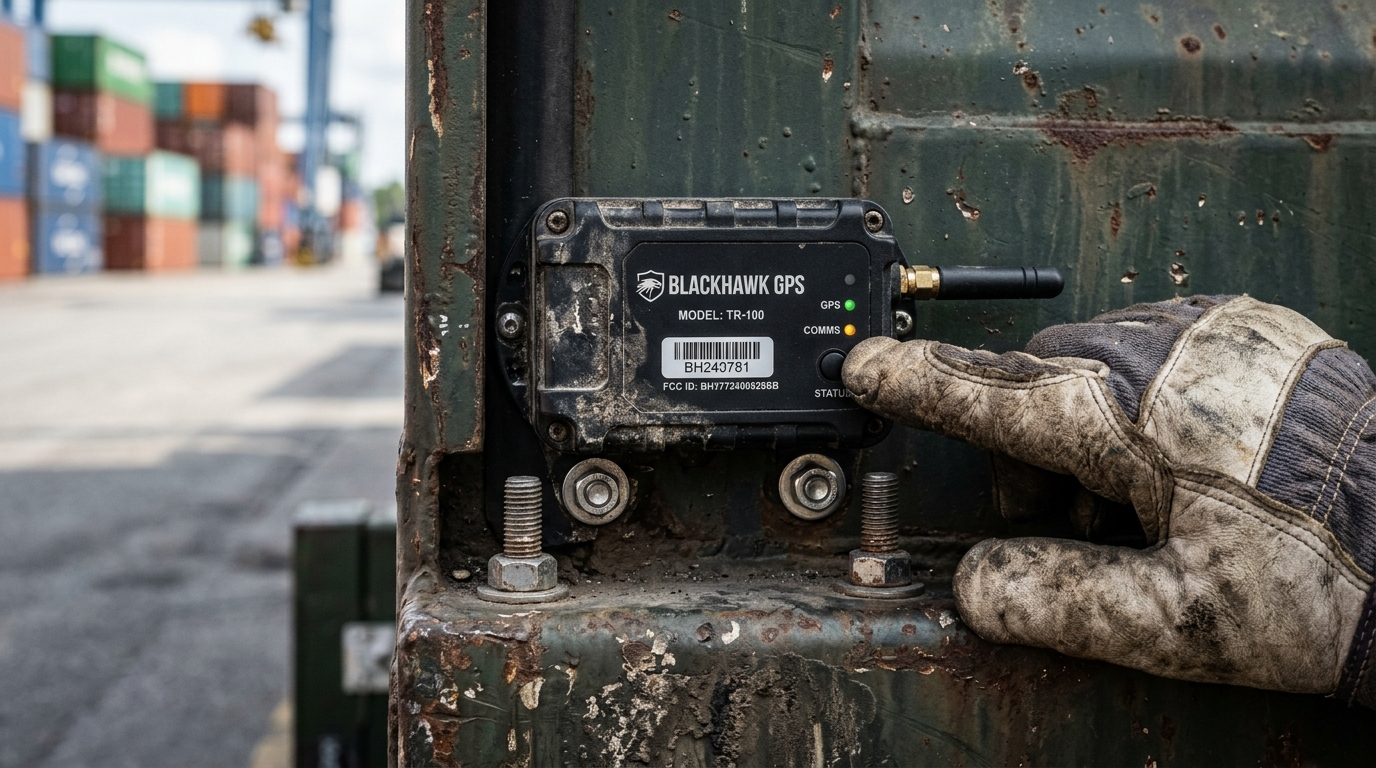
The radio technology you choose determines where you can draw a reliable geofence, how tight the boundary can be, and how fast you’ll learn about a crossing. Here’s what the physics actually support:
| Technology | How it locates | Best environment | Geofencing trade-off |
|---|---|---|---|
| GNSS/GPS | Satellite triangulation | Outdoor, open sky | Typical smartphone accuracy of 4.9m under open sky; buildings, containers, and metal structures degrade it |
| Passive RFID | Reader detects tag at a checkpoint | Dock doors, vehicle entry/exit, handoff points | Visibility only where readers are installed, not continuous |
| Bluetooth (BLE) | Signal strength or Channel Sounding (Bluetooth 6.0) | Indoor proximity, warehouse zones | RSSI-based ranging is noisy; Channel Sounding improves precision but remains sensitive to multipath and interference |
| UWB | Two-way radio ranging | Controlled indoor environments | Fine accuracy potential, but coverage depends heavily on infrastructure density |
| Wi-Fi RTLS | Building wireless infrastructure | Enterprise campuses, hospitals | Leverages existing networks; localized, not global |
One distinction gets overlooked constantly: positioning versus connectivity. GPS tells you where the asset is. Cellular, satellite, or Wi-Fi determines how (and how fast) the location data reaches someone who can act. A GPS tracker in a remote yard with no cellular signal knows its own position but can’t report it until reconnection. A passive RFID tag at a dock door doesn’t know its coordinates at all, but the reader knows exactly when it passed through.
This has direct implications for geofence design. Android’s developer documentation recommends minimum geofence radii of 100 to 150 meters, with alert latency averaging 2 to 3 minutes under background location limits. Fine for a delivery zone. Nowhere near adequate for a ramp-side equipment pen or a bonded cargo area.
For tighter boundaries, you need purpose-built hardware: dedicated GPS trackers with faster fix rates, BLE beacons defining specific zones, or RFID readers at physical chokepoints. The technology choice follows the boundary size and response time you need, not the other way around.
Where Geofencing Changes the Operational Math
Theory is useful. Documented outcomes are better.
Network-level visibility without per-item GPS
UPS announced in June 2026 that RFID is integrated across all U.S. delivery vehicles and facilities, backed by more than $100M in investment. Instead of strapping a GPS tracker to every package, they instrumented the handoff points. Readers at dock doors, vehicles, and over 5,500 UPS Store locations create a checkpoint network that captures entry and exit events at scale.
The principle applies broadly. If your assets move through controlled infrastructure (ports, warehouses, maintenance bays), checkpoint-based geofencing can deliver the visibility you need at a fraction of per-asset GPS cost.
Healthcare: equipment available in minutes, not hours
A 2025 radiology department study measured equipment scheduling time dropping from 12 to 5 minutes after RTLS implementation, with idle rates falling from 16% to 12%. At Mission Hospital in California, an infrared and active-RFID deployment reduced lost or stolen devices from 13.8% to 0%, saving an estimated $200,000 annually.
Neither case is primarily about drawing fences on maps. Both are about zone-level awareness: knowing which equipment is in which department, flagging when it leaves its designated area, and eliminating the hallway search that wastes clinical staff time every shift. This is the core promise of geofence asset monitoring: the boundary is the easy part, the response workflow is what delivers value.
Cargo security: alert by value, not by volume
The Verisk data tells a counterintuitive story. Total supply-chain crime events in 2025 were essentially flat year over year. But confirmed thefts climbed 18% and losses jumped 60%. The implication for geofencing strategy: prioritize high-value, high-vulnerability shipments over blanket coverage. A $50,000 pallet of electronics departing a distribution center at an unexpected hour deserves a different response workflow than a routine equipment transfer.
Container pools and reusable assets: the dwell problem
This is where I see the most untapped value. If you manage a pool of reusable containers, ULDs, or specialized packaging, your biggest problem usually isn’t theft. It’s dwell time. Equipment sits at a customer site or freight station for days or weeks past the target return date, shrinking your available pool and forcing additional purchases or leases. This is exactly where geofencing for equipment tracking earns its keep.
A dwell-based geofence at each customer location, triggered when a container hasn’t moved in X days, turns an invisible capital leak into a visible exception. The ROI math is direct: if each container costs $800 and tighter cycle times shrink your required pool by even 15%, that’s real capital freed.
Five Mistakes That Kill Geofencing ROI
I’ve seen more geofencing projects underperform from operational design failures than from hardware problems. These are the patterns.
1. Too many fences, no hierarchy. Every location gets a geofence. Every crossing generates a push notification. Within a week, the operations team ignores all of them. The fix: tier your fences. Critical zones (restricted areas, high-value storage) send immediate alerts to specific people. Routine zones (yard entry/exit) feed dashboards and reports, not phones.
2. Radius too small for the technology. A 20-meter GPS geofencing for assets around an outdoor cage sounds precise. In practice, signal bounce off nearby buildings triggers phantom entry and exit events every few minutes. Design the radius to match your actual positioning accuracy, then add hysteresis (requiring sustained presence before triggering) to suppress false crossings.
3. Alert fires, nobody owns the response. The notification reaches an email inbox. Or a Slack channel with 200 unread messages. Or a dispatcher who lacks authority to act. This is precisely why geofence alerts for equipment fail silently. Well-designed asset tracking alerts need three answers before they go live: who gets this alert, what are they authorized to do, and within what timeframe?
4. Battery economics ignored. A cellular GPS tracker reporting every 60 seconds burns through its battery in days, not months. If the asset is worth $300, the tracker costs $80 plus $5/month in connectivity, and battery replacement requires a field visit, the math collapses fast. Match reporting frequency to the actual decision cadence. An hourly update may be plenty for a container that moves once a week.
5. Data locked inside one platform. Your vendor captures years of movement history, dwell patterns, and exception data. When you need to switch providers or integrate with your ERP, you discover the data is trapped. GS1’s EPCIS/CBV 2.0 standard exists precisely to create interoperable event records: what moved, when, where, and why. A proper asset tracking API should expose geofence events, location history, and asset metadata through standard protocols. Ask about data portability before you sign, not after.
The True Cost of a Geofence System
Vendors quote per-tag prices. The number that matters is total cost of ownership per asset per year, weighed against the operational losses the system eliminates.
| Cost layer | What it includes | Where budgets break |
|---|---|---|
| Hardware | Trackers, tags, gateways, readers | Device attrition: 5 to 15% annual loss or damage is normal in field operations |
| Connectivity | Cellular data plans, satellite fees, LoRa/gateway infrastructure | Per-device monthly fees compound quickly at scale |
| Cloud and software | Platform license, storage, event processing, API access | Volume-based pricing punishes unnecessarily high reporting frequency |
| Integration | Connecting geofence events to ERP, TMS, or CMMS | Custom middleware often costs more than the platform itself |
| Maintenance | Battery replacements, firmware updates, hardware swaps | Field visits for battery changes can exceed the original tag cost |
| Response | The people who act on alerts | The most expensive and most overlooked line item in every proposal |
To put volume in perspective: 1,000 assets reporting once per minute generate 1.44 million location observations per day before any filtering. Cloud processing and storage for that volume is a real line item. Most operations don’t need per-minute updates. Matching report frequency to decision cadence (hourly for slow-moving assets, event-based for checkpoint crossings) can cut cloud costs dramatically without losing operational value.
Security and privacy are operational costs, not legal footnotes
A tracker is a network endpoint. If poorly secured, it becomes an attack surface. CISA’s advisory on the MiCODUS MV720 GPS tracker documented vulnerabilities with a CVSS score of 9.8 out of 10, describing potential access to location data, route history, and even fuel-cutoff commands. A cheap tracker with weak authentication isn’t a bargain if it exposes your fleet to remote interference.
On the privacy side, the FTC’s January 2026 settlement with GM/OnStar imposed a 20-year consent order over location data collected and shared without adequate notice. If your geofencing system tracks assets in employees’ possession (laptops, vehicles, portable tools), consent frameworks, access controls, and retention policies are operational requirements. Budget for them.
Team buy-in matters, too. Geofencing that employees perceive as surveillance breeds workarounds: devices left in lockers, trackers “accidentally” damaged, alerts ignored on principle. Communicating the operational purpose (finding equipment faster, reducing search time, protecting high-value assets) before deployment costs nothing and prevents a category of failure that no hardware fix can solve.
From Shipment Tracking to Asset Tracking
Most geofencing discussions stop at the delivery point. A shipment arrives, the fence registers entry, job done. For companies managing reusable assets (containers, ULDs, ground support equipment, MRO tooling, specialized packaging), delivery is just the midpoint of the cycle.
The real value of geofencing surfaces in the return loop. How long does equipment dwell at a customer site? When does it enter the repair bay? How many days between return and redeployment? These questions determine pool size, capital expenditure, and service levels. They go unanswered when geofencing only covers the outbound leg.
This is the core distinction between shipment tracking and asset tracking. Shipment tracking ends at delivery. Asset tracking follows the asset through its full lifecycle: deployment, use, return, maintenance, redeployment. Geofencing applied across that complete cycle produces fundamentally different intelligence than a one-way delivery confirmation.
In aviation, the requirements tighten further. Ground support equipment moves across ramp areas where GPS signals bounce off fuselages and terminal buildings. Airfreight containers need trackers that meet DO-160 airworthiness certification. MRO tooling travels between hangars, workshops, and flight lines, often across multiple airports. Similar constraints apply in military asset tracking, where geofencing must work across secure perimeters, remote deployments, and mixed-classification zones. The geofencing logic must accommodate these realities: mixed indoor/outdoor environments, regulatory constraints on hardware, and asset pools that span continents.
If your container pool or equipment fleet feels invisible after the handoff point, that’s exactly the gap full-cycle asset tracking with geofencing closes. Our team at Datanet IoT Solutions builds these systems across aviation, freight, and industrial operations, from hardware selection through platform integration. If you want to talk through what this looks like for your assets, reach out here or email info@datanetiot.com.

Frequently Asked Questions
What is asset tracking geofencing?
It combines real-time asset location data with virtual boundaries that trigger automated alerts. When a tracked asset enters, exits, or stays too long within a defined zone, the system generates an event. The goal is exception-based operations: responding to what matters instead of monitoring everything continuously.
How accurate is geofencing?
Accuracy depends on the positioning technology. GPS under open sky is typically accurate within 4.9 meters. Indoors, BLE, UWB, or RFID provide zone-level or room-level accuracy. Android’s geofencing service recommends minimum radii of 100 to 150 meters for reliable consumer-device performance. Purpose-built industrial trackers with faster fix rates and dedicated antennas support tighter boundaries.
Does GPS geofencing work indoors?
Poorly. GPS signals weaken significantly inside buildings, warehouses, and stacked containers. Indoor geofencing uses BLE beacons, RFID readers at chokepoints, UWB infrastructure, or Wi-Fi-based location systems. For assets moving between indoor and outdoor environments, hybrid approaches using multiple technologies provide the most reliable results.
What is the difference between geofencing and RTLS?
RTLS (Real-Time Location System) continuously locates assets within a defined area using installed infrastructure. Geofencing evaluates whether an asset has crossed a virtual boundary. They complement each other: an RTLS can feed position data into geofence logic for indoor zones, while GPS-based geofencing handles outdoor perimeters. RTLS answers “where exactly?” Geofencing answers “should it be there?”
Can geofencing prevent cargo theft?
It supports faster detection and response, not physical prevention. A geofence alert tells you an asset left an authorized zone. The value depends on who receives the alert, how quickly, and what authority they have to act. Poorly secured trackers can actually increase risk by exposing location data or remote control functions to attackers.
How much does an asset tracking geofence system cost?
Total cost includes hardware, connectivity, cloud/software, integration, maintenance, and response labor. Tag prices range from under $10 (passive RFID) to several hundred dollars (cellular GPS with long battery life). Connectivity runs $2 to $15+ per device monthly. Cloud costs scale with observation volume. The only meaningful comparison is total cost per asset per year versus the operational losses the system eliminates.







 +1 508 292 2210

2 Responses