

In Q2 2026, cargo theft losses hit $304.6 million despite a 26% drop in incidents. Fewer thefts, higher value per hit. That is the environment where geofence asset monitoring either earns its keep or becomes expensive noise.
Most articles on geofencing spend 80% of their word count explaining how to draw a virtual boundary. Drawing the boundary is the trivial part. The hard part, the part that determines whether you recover a stolen compressor or watch it vanish overnight, is what happens in the seconds and minutes after that boundary is crossed.
I have spent 15+ years deploying IoT tracking across aviation, freight, port operations, and industrial supply chains. The pattern is consistent: companies invest in the fence, then under-invest in the monitoring workflow behind it. This article is about fixing that ratio.
What Geofence Asset Monitoring Actually Does
A geofence is a software-defined perimeter. It can be a circle, a polygon, or a complex multipolygon shape. Amazon Location Service supports all three geometries and generates entry and exit events when a tracked position crosses one.
That is the entire mechanism. No physical barrier. No automatic immobilization. No magical theft prevention. A geofence converts a location reading into a discrete event: “Asset X entered Zone Y at 03:17.” What you do with that event is the monitoring part of the equation.
The architecture of smart asset monitoring breaks into five links:
- Identity: a durable asset record tied to the physical equipment. Standards like GS1 EPCIS formalize the “what, when, where, why” of asset events.
- Position: a tracker or reader supplies location observations (GPS, BLE, UWB, RFID, manual scan).
- Boundary: the geofence, defined in software.
- Event: the rules engine evaluates whether an observation crosses a boundary and generates a typed event (enter, exit, dwell).
- Action: the event routes to an accountable person or system who does something about it.
Most implementations nail links 1 through 4. Link 5 is where the money is made or lost.
One more thing worth noting: market forecasts that value “geofencing” at $3.22 billion include everything from retail push notifications to ride-sharing surge pricing. Industrial geofence asset monitoring is a narrower discipline with different economics. Do not mistake the marketing industry’s TAM for your operational budget.
The Latency Gap That Sales Decks Hide
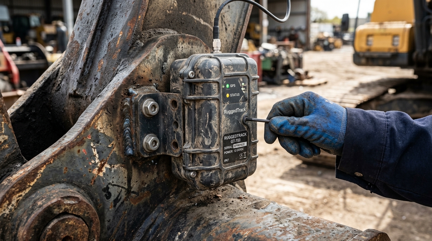
When a vendor says “real-time geofence alerts,” ask one question: what is the total elapsed time between an unauthorized move and a human being taking action?
That total includes five separate delays: the wait until the tracker wakes and captures a position, network transmission, server-side rule evaluation, notification delivery, and human response. Each adds seconds, minutes, or hours.
Consider a documented fleet case: a construction company’s skid steer was stolen overnight while its tracking service updated location only every 12 hours. By the time anyone knew it was gone, the equipment had traveled roughly 1,300 miles. The tracker worked. The monitoring cadence did not.
Even modern smartphone-based geofencing has documented constraints. Android’s developer documentation recommends minimum geofence radii of 100 to 150 meters and notes that background event delivery can take up to six minutes after prolonged stationary periods. Typical latency is under two minutes, but “typical” is not a guarantee at 2 AM when a $400,000 asset leaves a jobsite.
A precise historical coordinate showing where your equipment was stolen from is not the same as a timely warning that lets you stop it. Geofence asset monitoring only works when total latency (crossing to response) is shorter than the window an adversary needs to disappear.
Matching Positioning Tech to Your Monitoring Problem
The positioning technology you choose shapes what your geofence can actually detect. There is no universal “best.” There is only the right match for your operational question.
| Technology | Best Monitoring Question | Key Trade-Off |
|---|---|---|
| GNSS (GPS/GLONASS) | Has this asset left the yard or deviated from its route? | Smartphone GPS is accurate to about 4.9 meters under open sky; buildings, metal structures, and multipath degrade that fast |
| UWB (Ultra-Wideband) | Which specific zone in this facility holds this asset right now? | FiRa describes centimeter-level positioning, but it requires synchronized anchor infrastructure per building |
| Passive RAIN RFID | Which tagged items passed through this chokepoint or sit in this room? | Battery-free, bulk reading capability. Reader placement defines the observation boundary, not a map polygon |
| BLE (Bluetooth Low Energy) | Is this asset near a known gateway or reference point? | Bluetooth 6.0 adds channel sounding for centimeter-level distance measurement, but deployment geometry still governs useful accuracy |
| LoRaWAN | Can low-power network infrastructure deliver periodic check-ins? | The LoRa Alliance cautions that native TDoA geolocation is not well suited to real-time mobile asset tracking |
| Manual Scan (Barcode/NFC) | Did someone explicitly check this asset in or out? | Depends entirely on human compliance; inconsistent scanning creates invisible gaps |
The critical distinction is continuous position versus observed presence. A GNSS tracker can tell you an excavator left the fence at 03:17 and is heading east on I-95. An RFID reader can tell you 847 tagged tools were present at 17:00 and 843 at 06:00. Both qualify as geofence asset monitoring. They answer fundamentally different operational questions.
Do not buy centimeter-level UWB infrastructure for a depot-level question. Do not assume a twice-daily GNSS ping supports a meaningful security boundary. And for specialized environments like airfreight, where vibration, temperature swings, and certification requirements (DO-160) matter, purpose-built trackers exist for exactly that reason. Match the observation to the decision.
Alert Fatigue: The Silent Killer of Geofence Programs
Here is a pattern I see repeatedly: a company deploys 500 trackers, sets geofences around every site, enables every alert type, and within three months the operations team has learned to ignore all of them.
This is not a technology failure. It is a design failure.
Alert fatigue happens when notification volume overwhelms the ability to distinguish signal from noise. When the overnight security guard gets 47 alerts because authorized early-morning crews triggered entry events, the 48th alert (an actual unauthorized departure) gets the same treatment: ignored.
Effective monitoring requires filtering at the architecture level, not just the inbox level:
- Schedule-based rules: an asset leaving a construction site at 07:00 on a Tuesday is expected. The same asset leaving at 02:00 on a Sunday is not. Same geofence. Completely different events.
- Dwell rules: a delivery truck entering a customer’s yard is normal. That truck still sitting there 72 hours later is a dwell exception worth investigating.
- Distance filtering: AWS’s distance-based filtering ignores movements below 30 meters. That reduces noise and cost but can mask a slow, deliberate move through a narrow boundary.
- Escalation hierarchy: not every crossing needs the same response. Tier 1 (informational) goes to a dashboard. Tier 2 (unusual) goes to a supervisor’s phone. Tier 3 (high-value asset, unauthorized hours) triggers a call chain with named responders.
One more subtlety: Amazon Location treats the first observation inside a boundary as an ENTER event, even if no crossing was observed. And after 30 days without an update, the next observation resets state and fires a new entry event. If you do not account for startup, reconnection, and stale devices, your alert log fills with phantom entries that erode trust in the system.
The goal is not more alerts. It is fewer, better ones routed to people authorized and obligated to act.
Field Evidence: What Monitoring Gets Right (and Wrong)
Three documented cases show different dimensions of geofence asset monitoring. None proves that geofencing alone solves the problem. All reveal what happens when monitoring connects (or fails to connect) to operational response.
Cable East: $2.5 million recovered, but not by geofences alone
Cable East tracked more than 400 assets with GPS and reports approximately $2.5 million in recovered equipment over four years. Their Director of Risk Management attributes the recoveries to visibility the company previously lacked.
The operational lesson: recovery required GPS data plus law-enforcement coordination plus someone who owned the incident response process. The tracker supplied evidence. Humans and institutions supplied the recovery. Deploy trackers without assigning incident ownership and you get location history, not recovered assets.
Heath: the invisible $1.5 million
Heath tagged 1,600 field assets and discovered a previously unaccounted-for $1.5 million in equipment. A $35,000 component lost in shipping was recovered. $160,000 in unnecessary capital spending was avoided because they could find and redeploy existing equipment instead of buying replacements.
This is not a theft-recovery story. It is a visibility story. Most of that $1.5 million was not stolen. It was misplaced, forgotten, or sitting at the wrong site. Geofence monitoring in this context means knowing where your assets are so you stop buying duplicates of things you already own.
E.T.H. Cargo: condition data outweighs the crossing event
In a June 2026 case, E.T.H. Cargo describes monitoring 100% of its pharmaceutical shipments with combined location and temperature tracking. One shipment exceeded its validated five-day transit window. The tracker showed the product held at -19.67°C, within the acceptable range. That evidence avoided an unnecessary loss declaration and a costly investigation.
For pharma, cold chain, and condition-sensitive freight, the geofence event (arrival, departure, dwell) is only half the picture. Temperature, humidity, and shock data can be more valuable than the crossing event itself.
Privacy Is a Design Requirement, Not a Policy Add-On
Geofence asset monitoring generates location data. When the asset is a vehicle driven by an employee, that location data becomes personal data with regulatory consequences.
In January 2026, the FTC finalized its order against GM and OnStar for collecting and selling geolocation and driving-behavior data without adequate consent. The order includes a five-year ban on disclosures to consumer reporting agencies and 20-year obligations around consent and consumer controls.
A separate FTC action against Gravy Analytics and Venntel addressed the use of geofencing to identify people visiting healthcare facilities and places of worship, then selling those lists.
Neither case bans geofencing. Both demonstrate what happens when location data collected for one purpose gets repurposed without clear consent. For enterprise buyers, the guidance is direct:
- Separate equipment-location monitoring from employee-movement surveillance.
- Define retention periods. Delete what you do not need.
- Restrict access to the minimum number of people who require it.
- Prohibit secondary use of location data (selling, sharing, using for performance reviews) unless explicitly authorized.
- Disclose the monitoring to affected workers before deployment, not after an incident.
The Newark airport GPS jammer case adds a practical footnote. In 2013, the FCC proposed a $31,875 forfeiture against an employee who used a GPS jammer to block his employer’s vehicle tracker. The jammer interfered with the airport’s ground augmentation system. When monitoring feels covert or disproportionate, some people will actively resist it, creating risks that extend beyond the original tracking problem. Transparent policies are not a legal nicety. They are an operational prerequisite.
Building a Monitoring System That Survives the Field
After years of deploying these systems, my checklist for any geofence asset monitoring implementation starts with seven questions. Get these right before you compare vendors:
- What event matters? Unauthorized departure, late arrival, dwell beyond threshold, route deviation, zone intrusion. Define it precisely.
- What is the maximum tolerable detection delay? If a $500,000 asset leaves at 02:00, does the response need to start in 2 minutes, 20 minutes, or can it wait until 06:00?
- Who owns the response? Name the person, not the department. If nobody is accountable for acting on a Tier 3 alert at 3 AM, the alert is theater.
- What evidence do you need downstream? Insurance claim, law-enforcement report, customer dispute, regulatory proof of custody. Design data capture for the evidence requirement.
- Where does coverage fail? Underground parking, metal-clad warehouses, remote sites without cellular. Know your dead zones before they matter.
- What is the battery math? Faster reporting means shorter battery life. A tracker pinging every 15 minutes will not last 5 years. One pinging every 24 hours may not catch a theft in progress. Choose the trade-off consciously.
- Does this stop at delivery? Shipment tracking ends when the package arrives. Asset tracking follows the container, the ULD, the ground support equipment through its full cycle: deployment, use at the customer site, return, maintenance, redeployment. If your geofence strategy only covers the first mile, you are monitoring shipments, not assets.
That last point is the distinction I keep returning to. Most geofence implementations are designed for shipment tracking: origin to destination, done. True geofence asset monitoring means the boundary at the customer’s yard is just as important as the one at your depot, because that is where dwell time balloons, containers go missing, and cycle time quietly dies.
If your container pool or equipment fleet feels invisible after delivery, that is exactly the gap asset tracking closes. We build these monitoring systems at Datanet, from hardware selection through alert hierarchy design and response workflow. If you want to talk through what your specific operation needs, reach out to our team or email info@datanetiot.com.

Frequently Asked Questions
What is the difference between GPS tracking and geofence asset monitoring?
GPS tracking supplies position coordinates. Geofence asset monitoring evaluates those coordinates against defined boundaries and generates actionable events (entry, exit, dwell). You can have GPS tracking without geofences, and geofences can consume position data from technologies other than GPS, including BLE, UWB, and RFID.
How small can a geofence be?
It depends on the positioning technology. Android recommends minimum radii of 100 to 150 meters for smartphone-based geofences. UWB systems can define zones at centimeter-level precision but require dedicated anchor infrastructure. Test the smallest business-relevant boundary under real operating conditions before committing to a radius.
Does geofence monitoring work without cellular coverage?
Only if the system has an alternative reporting path or your workflow tolerates delayed observations. Satellite-enabled trackers extend coverage to remote areas, but verify reporting cadence, power consumption, and actual service availability for your specific device and geography before assuming coverage.
Can a geofence prevent theft?
A geofence alert is not a physical barrier. It detects an unauthorized event and notifies a responder. Prevention depends on response speed, law-enforcement coordination, and complementary physical security. Cable East recovered $2.5 million in stolen assets using GPS evidence plus police action, not geofences alone.
What causes alert fatigue, and how do I avoid it?
Fatigue sets in when too many low-priority notifications train people to ignore all alerts. Avoid it with schedule-based rules (different thresholds for business hours versus overnight), dwell conditions, tiered escalation to named responders, and distance filters. The goal is fewer alerts routed to accountable people, not more alerts broadcast to everyone.
How does geofence asset monitoring differ from shipment tracking?
Shipment tracking monitors cargo from origin to destination and ends at delivery. Asset monitoring follows the equipment through its full lifecycle: deployment, customer site, return, maintenance, redeployment. The operational value concentrates beyond the first delivery, where dwell time, misplacement, and cycle-time waste accumulate unnoticed.





 +1 508 292 2210

3 Responses