

Tracking offshore equipment should be simple. Tag it, ship it, watch it on a screen. In practice, operators lose 5 to 15 percent of their portable inventory every year. Not to storms or theft. To the inability to answer “where is it?” when a BOP, ROV, or set of drilling jars vanishes between a shore base and a rig 150 miles offshore.
The technology exists. The global asset tracking market hit $24.1 billion in 2024 and is projected to nearly double by 2030. But most of that technology was designed for warehouses, highway fleets, and construction sites. Places with cell towers. Places where GPS has clear sky. Places that are not a steel platform surrounded by open ocean.
Offshore environments violate every assumption those systems rely on, and the gap between “we have trackers” and “we have visibility” is where millions of dollars in equipment disappear. This piece covers what actually works at sea: the stack, the connectivity trade-offs, the compliance timeline, and the cost math that determines whether a tracking program survives budget review.
What Counts as Offshore Equipment (And Why It Moves Differently)
“Offshore equipment” is not one asset class. It spans at least six categories, each with its own movement pattern and tracking challenge:
- Drilling and completions tools: BOPs, drill bits, jars, motors, casing, tubulars
- DNV-certified cargo containers and baskets: the physical transport layer between shore and platform
- Subsea systems: ROVs, transponders, instrument packages, subsea tooling
- Safety and life-saving equipment: lifeboats, firefighting gear, gas detectors, PPE
- Lifting and rigging hardware: cranes, slings, shackles, spreader bars
- Wind farm components: turbine blades, nacelle parts, tower sections, cable arrays
A cargo basket leaves a supply base, rides a vessel for 12 hours, gets craned onto a platform, sits on deck for six weeks, then returns to a different port than it left from. A drilling jar ships from a service company in Houston, works on a rig in the Gulf, and ends up in storage at a third-party yard in Fourchon—scenarios that mirror challenges in rental equipment tracking where assets constantly move between operators and locations. An ROV deploys 2,000 meters below the surface, where satellite signals don’t exist.
This is where the distinction between shipment tracking and asset tracking becomes operational. Shipment tracking tells you a cargo basket arrived on the platform. Its job ends there. Asset tracking follows that basket (and everything inside it) through deployment, use, return, maintenance, recertification, and redeployment. Offshore, where equipment cycles between platforms and shore bases for years, you either track the full lifecycle or you track almost nothing useful.
The Dead Zone Problem: Steel, Salt, and Signal Loss
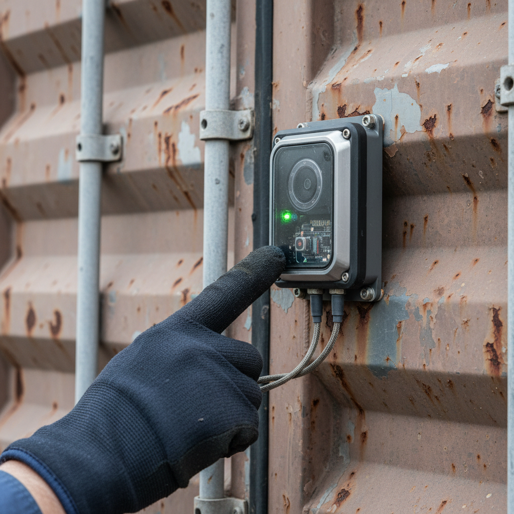
A deepwater platform is, electromagnetically, one of the hardest environments on earth. Steel deck plates stacked three or four levels high. Equipment bays enclosed in metal walls. Pipe racks overhead. Cargo baskets nested inside container frames. Every layer of steel attenuates satellite signals. Place a GPS-only tracker inside a cargo basket sitting two decks below the drill floor, and you get zero data. Not weak signal. Nothing.
GPS works for assets on an open deck or riding a supply vessel topside. It fails for the majority of offshore equipment, which spends most of its lifecycle surrounded by metal. This is why choosing an industrial gps tracking device built for harsh conditions matters. Vendor marketing consistently shows the happy path: a dot moving on a map, real-time updates, clean dashboards. The happy path assumes clear sky. On a working platform, clear sky is the exception.
Layer in the environment. Salt spray corrodes exposed electronics, sometimes within weeks. Vibration loosens connections. Temperatures swing from minus 40°C in Arctic operations to 65°C on sun-baked decks in the Gulf. Consumer IoT hardware has a half-life measured in days out here, which is why environmental monitoring equipment rated for these extremes matters. Anything you deploy must be rated for the abuse.
The design principle that separates offshore-grade tracking from everything else: assume signal loss as the default condition, not the edge case. The system must store data locally, sync when it can, and still deliver value when it can’t phone home for hours or days at a time.
A Four-Layer Stack Built for Offshore
No single technology solves offshore tracking. The systems that work combine four layers, each handling a different piece of the problem.
The first layer is identification. Every tracked asset gets a tag matched to how and where it moves. Active RFID tags carry their own battery, broadcast at 30 to 100 meters, and cost $20 to $100 per tag. These go on BOPs, ROVs, large tooling. Passive RFID costs under a dollar, powers itself from the reader’s signal, and works within 10 meters. It’s for consumables moving through choke points: tool rooms, gangway scanners, manifesting stations. BLE beacons handle last-meter proximity. UWB delivers sub-meter accuracy in confined spaces like engine rooms and nacelles. GNSS receivers paired with satellite modems cover outdoor assets in transit.
The second layer is connectivity, which determines whether data ever leaves the platform. This is the most consequential design choice in any offshore deployment, and it deserves its own section.
The third layer is edge compute. Gateways and tags on the platform collect, buffer, and pre-process data locally. When satellite bandwidth costs real money per kilobyte, you do not stream raw telemetry. You transmit exceptions: a geofence breach, a threshold crossing, a missed check-in. Hardware at this layer must survive 3 to 10 years on battery, endure salt, vibration, and temperature extremes, and meet certifications such as DNV 2.7-1 for offshore containers or ATEX/IECEx for hazardous areas.
The fourth layer is cloud analytics. Position data, geofence events, sensor readings, and maintenance records converge into a single view. The real value is not a map with dots. It is cycle-time visibility, utilization rates, and audit trails that turn raw location pings into procurement decisions and compliance documentation.
Connectivity at Sea: Satellite, Cellular, and the Cost Gap
The connectivity decision determines both capability and cost. It is also the variable that gets the least transparent treatment in vendor literature.
| Connectivity | Range | Monthly Cost / Device | Best For | Key Limitation |
|---|---|---|---|---|
| Satellite IoT (Iridium, Globalstar, LEO) | Global | $15 to $50+ | High-value assets far offshore, cargo in transit | Bandwidth limited; sky view required |
| Cellular (LTE-M, NB-IoT) | ~20 NM from shore | $2 to $10 | Port yards, supply bases, coastal platforms | Zero coverage far offshore |
| Private LoRaWAN or LTE | Platform-wide (1 to 3 km) | Gateway CAPEX; near-zero per device | On-platform tool tracking, intra-rig movement | No coverage beyond the installation |
The effective approach combines all three. A cargo basket carries a satellite GPS tag for transit visibility between shore and rig. Once it lands on the platform, a LoRaWAN gateway picks up the BLE or RFID tags on individual items inside. Near shore, cellular handles the backhaul at a fraction of satellite cost.
The math is worth running. Tracking 500 assets on satellite at $30/month each costs $180,000 per year in airtime alone. Move on-platform tracking to a private LoRaWAN network (one-time gateway cost of $2,000 to $5,000) and reserve satellite for assets in transit. The annual bill drops 60 to 70 percent. That’s the difference between a tracking program that gets budget approval and one that dies in a spreadsheet.
Compliance Is Closing the “Optional” Window
Five years ago, offshore equipment tracking was a best practice. Today, it is becoming a contractual and regulatory requirement. Several forces pushed this shift simultaneously.
BSEE Safety Alert 426, issued in September 2021, documented repeated dropped-object hazards found during risk-based inspections on Gulf of Mexico platforms. The alert stopped short of mandating specific tracking technology. But it made clear that operators who cannot demonstrate equipment accountability face escalating scrutiny and enforcement action.
In offshore wind, the pressure is more acute. Dropped-object incidents jumped 41% in a single year to 113 events, with high-potential incidents up 88%. As the G+ Global Offshore Wind Health & Safety Organization now tracks DROPS data systematically, turbine operators are writing equipment traceability requirements directly into maintenance contracts.
Certification standards govern what hardware you can deploy. DNV 2.7-1 and 2.7-3 specify shock, vibration, and drop-test requirements for offshore containers and portable units. ATEX and IECEx zoning (Zone 0, 1, 2) dictates which electronics can enter hazardous areas. A GPS tracker that isn’t intrinsically safe is a compliance violation the moment it enters an explosive atmosphere.
Personnel tracking is converging with equipment tracking, too. Olympic Subsea has forecast that POB (Persons on Board) tracking will become a requirement on all offshore energy contracts. The same RFID infrastructure used for personnel musters (gangway readers, zone detection, emergency muster automation) can track tools and equipment through the same access points. One system, two compliance boxes checked.
The ROI Is Documented, Not Theoretical
The argument for tracking offshore equipment is not speculative. Published case data puts numbers on three outcomes that repeat across deployments.
An Australian offshore operator deployed digital tracking and cut its un-locatable asset rate from 8% to under 2%. That is a fourfold improvement in visibility across a pool where individual items run into six and seven figures.
The downstream effects:
- Replacement procurement dropped 30%. When you can locate equipment you already own, you stop buying duplicates. For an operator running $50 million in portable assets, that is $15 million in avoided spend.
- End-of-quarter stock reconciliation collapsed from 5 to 7 working days per platform to a few hours. Across a multi-platform operation, the recovered person-hours are significant on their own.
- Audit readiness shifted from a quarterly scramble to a standing state. Certification records linked to asset location data mean compliance documentation is always current, not reconstructed on deadline.
The payback period is typically short. A single avoided BOP replacement or one recovered ROV pays for the entire system. The ongoing savings in procurement avoidance, audit labor, and insurance documentation compound from that point forward.
Where Tracking Data Goes Next
Knowing where equipment is solves the immediate problem. Knowing where it is, what condition it’s in, and how long it has been in service changes the operational model entirely.
Vattenfall announced in 2024 that digital-twin technology would drive profitability across its offshore wind portfolio. The concept: a virtual replica of every physical asset, fed by live tracking and sensor data, capable of predicting failures before they happen. The Society of Petroleum Engineers has published AI and ML-based predictive maintenance frameworks for offshore rotating equipment, documenting 5 to 10 percent reductions in unplanned downtime. Both start with the same prerequisite: a foundational tracking layer that provides continuous asset identity, location, and condition data.
Two additional shifts are worth watching. LEO satellite constellations (Astrocast, Swarm/SpaceX) are compressing airtime costs, making per-tag satellite tracking viable for lower-value items that were never worth a $30/month connection. The addressable pool of tracked assets expands. Simultaneously, GNSS spoofing and jamming (documented with increasing frequency in commercial shipping lanes) are pushing procurement teams toward multi-constellation receivers and anti-spoofing firmware. A tracking system built on a single GNSS constellation carries a single point of failure in an environment where interference is only growing.
The trajectory points to tracking as the data foundation for a much larger operational shift. Operators investing in that foundation now will have a structural head start when predictive maintenance and digital twins become baseline contract requirements.
If your offshore asset pool goes dark between the dock and the platform, that is exactly the gap purpose-built tracking closes. We build ocean equipment tracking and industrial asset tracking solutions designed for environments that destroy consumer hardware. If you want to talk specifics, reach us at info@datanetiot.com or through our contact page.

Frequently Asked Questions
What is the best technology for tracking equipment offshore?
No single technology covers the full offshore environment. Effective systems combine active RFID for high-value mobile assets, passive RFID for consumables at choke points, GNSS with satellite backhaul for assets in transit, and BLE or UWB for last-meter positioning on platforms. The right mix depends on what you track, where it moves, and how far from shore it operates.
How much does an offshore equipment tracking system cost?
Hardware ranges from under $1 for passive RFID tags to $200 to $500 for rugged satellite GPS trackers. Satellite airtime runs $15 to $50 per month per device. Private LoRaWAN gateways on a platform cost $2,000 to $5,000 one-time with near-zero ongoing per-device fees. Most operators see payback within the first mobilization cycle, since a single recovered high-value asset can exceed the entire system cost.
Does GPS work inside offshore platforms?
Not reliably. Steel decks and enclosed modules block or severely attenuate satellite signals. GPS is effective for topside assets and equipment in transit on supply vessels. For interior tracking, RFID, BLE, or UWB paired with on-platform gateways provide the visibility GPS cannot.
What certifications does tracking hardware need to operate offshore?
At minimum: DNV 2.7-1 or 2.7-3 compliance for hardware mounted on offshore containers. ATEX or IECEx certification (Zone 0, 1, or 2) for electronics entering hazardous areas. In the US, BSEE oversees inspection and reporting. Australia uses NOPSEMA. The IMO governs vessel equipment traceability under SOLAS and the ISM Code.
What is the difference between shipment tracking and asset tracking offshore?
Shipment tracking ends at delivery: a cargo basket arrived on the platform. Asset tracking follows equipment through its full lifecycle: deployment, use, return, maintenance, recertification, and redeployment. Offshore equipment cycles between platforms and shore bases for years. Shipment tracking gives you one data point per trip. Asset tracking gives you continuous operational control.
How does tracking reduce equipment procurement costs?
Operators typically discover that 5 to 8 percent of their portable inventory was “lost” but physically present at another location. One documented deployment cut replacement purchasing by 30% simply by making existing assets findable. When individual items cost six to seven figures, visibility pays for itself many times over.







 +1 508 292 2210

5 Responses