

Here is a number that should bother anyone running marine operations: 576 containers were lost at sea in 2024. That is up from the record low of 221 in 2023. And “lost” is the polite word. Most sank. Only about a third get recovered in a good year.
The strange part? We live in an era where a $1.3 billion vessel tracking market exists, millions of ships broadcast their positions via AIS every few seconds, and LEO satellite constellations blanket the planet. Yet the equipment ON those ships, the containers, the offshore gear, the reusable transport assets, routinely goes invisible the moment it leaves a controlled environment.
Marine equipment tracking is not the same problem as vessel tracking. Confusing the two is where most of the money leaks. I have spent 15+ years in IoT deployments across aviation, logistics, and maritime, and the pattern repeats: organizations invest in knowing where the ship is, then act surprised when the asset riding on that ship disappears from their system. This article breaks down what actually works, what does not, and where the real ROI sits.
Vessel Tracking Is Not Equipment Tracking
This is the single most expensive conflation in maritime operations.
Vessel tracking tells you where the ship is. AIS (Automatic Identification System), mandated by the IMO under SOLAS for ships over 300 gross tonnage, broadcasts identity, position, course, and speed every 2 to 10 seconds while underway. More than 1.64 million vessels were transmitting AIS signals as of 2021, and that number keeps climbing. Platforms like MarineTraffic and VesselFinder aggregate this data into real-time maps. It works. For ships.
Equipment tracking is a different animal. The container sitting in stack position row 12, bay 42. The offshore buoy deployed 80 nautical miles from shore. The reusable ULD cycling between port warehouses. The ground support cart that left the terminal and never came back. None of these assets broadcast AIS. None of them show up on MarineTraffic. And many of them carry five or six figures of value.
Vessel tracking answers “where is the ship right now?” Equipment tracking answers a harder set of questions: where is this specific asset in its lifecycle? How long has it been sitting idle? Is it still where it should be, or did someone move it? What condition is it in?
If your visibility ends when the vessel berths, you are doing shipment tracking at best. Asset tracking follows the equipment through the entire cycle: deployment, transit, dwell, return, reuse. That distinction drives everything that follows.
The Five Technology Layers (And Where Each One Fails)
No single technology covers every marine tracking scenario. The real world uses a stack, and understanding each layer’s limits matters more than understanding its specs.
Layer 1: AIS
Mandatory for large commercial vessels. Excellent for traffic management, port scheduling, and collision avoidance. Useless for tracking individual pieces of equipment. AIS is also a cooperative system, meaning vessels can spoof their position, clone another ship’s MMSI, or simply go dark. Thousands of spoofing incidents have been documented globally in just the past two years, driven largely by sanctions evasion. AIS tells you what the ship wants you to know. Not always the same thing as truth.
Layer 2: GNSS/GPS
The passive positioning backbone. Every tracker, every AIS transponder, every satellite terminal uses GNSS to fix its own location. Standard accuracy is 5 to 10 meters; with augmentation (WAAS, EGNOS), that drops to 1 to 3 meters. The limitation is not accuracy. It is power. A GPS receiver on a battery-powered device chews through energy fast, which is why most marine asset trackers use duty-cycling: wake up, get a fix, transmit, sleep. The trade-off between fix interval and battery life defines most deployment decisions.
Layer 3: Cellular IoT (LTE-M, NB-IoT)
Cheap, reliable, high-bandwidth when you have coverage. That last part is the catch. Cellular works in ports, coastal waters (roughly 10 to 20 nautical miles offshore under good propagation), and along major inland waterways. Beyond that, nothing. For equipment that spends most of its life in or near ports, cellular is often the smartest choice. For anything that goes to open ocean, it is one piece of a hybrid solution.
Layer 4: Satellite IoT
This is where marine equipment tracking became viable at scale. LEO satellite networks like Iridium, Astrocast, and Kineis now offer low-power, low-cost connectivity from anywhere on the planet, including mid-ocean. Hardware runs $100 to $500 per device. Airtime runs $5 to $30 per month for low-cadence position reports (a few pings per day). Compare that to legacy VSAT at thousands per month, and you see why IoT-on-container adoption is accelerating.
The newer entrants (Astrocast, Kineis, OQ Technology, Sateliot) are pushing costs even lower by using nanosatellite constellations purpose-built for small messages. A container does not need to stream video. It needs to send 50 bytes of position and sensor data a few times a day. That is exactly what these networks optimize for.
Layer 5: Short-range (BLE, RFID, UWB)
Inside port terminals, shipyards, and warehouses, Bluetooth Low Energy beacons, RFID tags, and UWB provide the last meter of identification. An RFID portal at a gate can log every container entering or leaving. A BLE beacon on a piece of ground equipment can report its position within a yard to a few meters. These technologies are cheap, passive (in the case of RFID), and essential for closing the visibility loop that satellite and cellular cannot cover indoors or in dense metal environments.
How the layers combine
A well-designed marine equipment tracking deployment does not pick one layer. It uses the right layer for each phase of the asset’s journey:
- RFID or BLE identifies the asset inside the terminal.
- Cellular IoT reports position while in port and coastal transit.
- Satellite IoT activates at sea, pinging every few hours.
- GNSS provides the position fix at every stage.
- All data feeds into a single SaaS dashboard where the operator sees the full lifecycle.
The failures I see most often come from deploying one layer and expecting it to cover all phases. Cellular-only trackers go silent at sea. Satellite-only trackers burn money in port when a $2 cellular message would do. AIS-only strategies track the vessel, not the equipment. Matching layer to phase is the engineering problem that separates working deployments from expensive disappointments.
Where Marine Equipment Actually Goes Missing
The dramatic losses (containers falling off ships in a Pacific storm) get the headlines. But the quiet losses are where most of the money goes.
Container dwell and ghost assets
Of the roughly 250 million container movements per year globally, fewer than 5% of the global container fleet carries active tracking devices. That means the vast majority of containers are invisible between port scans. “Dwell time” (how long a container sits idle at a depot, terminal, or customer site) is one of the largest hidden costs in intermodal logistics. A reusable container that should cycle every 30 days but actually cycles every 55 days because nobody can find it costs 83% more per rotation than planned. Multiply that across a pool of 10,000 units and the number gets serious fast.
Offshore equipment
Buoys, subsea markers, recovery equipment, temporary moorings. The offshore energy sector deploys expensive hardware into environments where retrieval is not guaranteed. Companies like Horizon Marine build self-contained, waterproof tracking beacons specifically for this use case because standard commercial trackers cannot survive the conditions. If you deploy a $50,000 piece of oceanographic equipment without a satellite beacon, you are betting on being able to find it again by memory and GPS waypoint alone. Knowing what works for tracking offshore equipment when GPS fails matters here, because that bet fails often enough to fund a tracking program many times over.
Small boat and recreational theft
On the consumer side, more than 1,000 boats are stolen every month in the United States according to NICB data. Most of those are outboard-powered recreational vessels under 26 feet. A $200 satellite tracker (SPOT Trace, for example) with a $10/month plan would provide recovery coordinates. Yet adoption remains low because most owners assume the marina is secure. Insurers are starting to change that calculus with premium discounts for tracked vessels.
The regulatory push
The IMO’s Maritime Safety Committee adopted mandatory container-loss reporting requirements under MSC 108, taking effect January 1, 2026. You cannot report what you cannot measure. This single regulation is expected to accelerate smart-container adoption significantly, because carriers now face accountability for losses they previously wrote off quietly.
Why Satellite IoT Changed the Math
Five years ago, tracking a container across an ocean voyage cost hundreds of dollars per trip in satellite airtime alone. The hardware was bulky, fragile, and expensive. The business case only closed for high-value reefer cargo.
That math has broken in favor of tracking.
The vessel tracking market is projected to reach $3.1 billion by 2035, growing at 8.9% CAGR, and the broader asset tracking market sits at $32.45 billion in 2026. What is driving that growth is not new demand. The demand was always there. What changed is cost.
Nanosatellite IoT constellations (Kineis, Astrocast, Swarm/SpaceX) brought the per-message cost down by an order of magnitude compared to legacy Iridium SBD. A device pinging its GPS position four times a day over a 30-day ocean voyage now costs single-digit dollars in total airtime. Hardware costs have dropped below $150 for basic satellite-capable trackers.
Meanwhile, SpaceX’s Starlink Maritime has connected more than 75,000 vessels as of 2024, including over 300 cruise ships. Starlink is not an IoT network in the traditional sense; it is broadband. But it turns every connected vessel into a mobile edge node. A ship running Starlink can aggregate data from dozens of BLE and RFID-tagged assets on board and relay it to shore in real time. That was not possible at reasonable cost three years ago.
The convergence of cheap LEO satellite IoT for standalone asset trackers and broadband LEO for ship-as-gateway architectures means the “too expensive to track” excuse now applies to almost nothing in a professional marine operation. The economics behind this shift are covered in depth in our look at maritime logistics technology.
AIS Spoofing: Why Ship-Level Visibility Is Not Enough
Even if your primary concern is vessel-level tracking (where is my chartered ship right now?), AIS alone has a credibility problem.
The shadow fleet phenomenon has exposed how fragile cooperative tracking systems are. Sanctioned oil tankers routinely broadcast false positions, clone MMSI numbers from legitimate vessels, or simply turn off their AIS transponder entirely. Kpler has documented thousands of spoofing incidents across 2023 and 2024, concentrated in sanctioned trade routes but spreading into mainstream commercial shipping as a compliance risk.
This matters for equipment tracking because it undermines the assumption that “I know where the ship is, therefore I know where my cargo is.” If the ship is spoofing its position, your container tracking that relies on vessel AIS data inherits that lie. This is exactly why independent cargo monitoring at sea matters more than trusting the vessel’s reported position.
Independent, asset-level tracking (a satellite IoT device bolted to the individual container or piece of equipment) eliminates that dependency. Your asset reports its own position, from its own GNSS receiver, through its own satellite uplink. The ship’s AIS behavior becomes irrelevant to your visibility.
Detection technologies exist. Windward, Pole Star, Kpler, and Spire all apply machine learning to identify spoofing patterns. The IMO is working on encrypted AIS (via the VHF Data Exchange System). But for an operator who needs to know where specific equipment is right now, waiting for systemic fixes is not a strategy. Device-level tracking is, and independent satellite tracking for vessels removes the dependency on spoofable AIS entirely.
What a Working Deployment Looks Like
Theory is cheap. Here is how marine equipment tracking actually works in practice, from hardware selection to data flow.
Hardware selection criteria
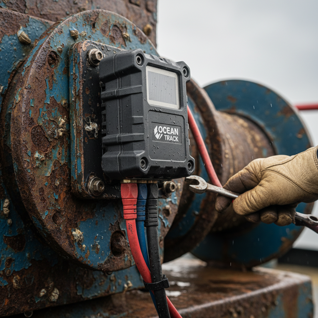
Marine environments punish weak hardware. Saltwater corrosion, UV exposure, vibration, impact, temperature swings from tropical sun to refrigerated holds. The minimum requirements for a marine asset tracker:
- IP67 or IP68 rating (submersible, not just splash-proof)
- Operating temperature range of at least -20°C to +60°C
- Battery life measured in months or years, not days (most marine assets do not have access to charge points)
- Multi-mode connectivity: cellular for port, satellite for ocean, or a hybrid that switches automatically
- Mounting that survives movement: magnetic mounts for steel containers, bolt-on brackets for ground equipment, adhesive for composites
Devices like the Oyster3 and Oyster Edge from Digital Matter are designed for exactly this profile: rugged, long-battery, multi-network. For specialized port and intermodal use cases, the device catalog matters less than the integration: can the tracker feed data into your existing logistics platform, or does it create yet another dashboard to check?
Platform integration
The tracker is the sensor. The value lives in the software layer that aggregates position reports into actionable intelligence: cycle time analysis, dwell alerts, geofence violations, utilization rates. Major carriers are building this in-house. Hapag-Lloyd frames IoT sensor technology as the foundation of “smart shipping”, integrating container-level data into their digital business platform. WiseTech Global and Hapag-Lloyd launched an IoT container tracking pilot in February 2026 to push this further.
For operators who are not Hapag-Lloyd (meaning most of the market), a SaaS tracking platform that ingests data from multiple device types, across multiple connectivity networks, with API access to your TMS or ERP, is the practical path to real supply chain visibility for shipping. It is also the layer that finally delivers true ocean freight visibility instead of blind spots. The device vendor matters. The platform vendor matters more.
Deployment phasing
Do not try to instrument everything at once. Start with the assets that have the highest loss rate, the highest value, or the longest untracked dwell time. Measure the baseline (average cycle time, loss rate, utilization) before deploying trackers, then measure again 90 days after. That before/after comparison is your business case for the next phase, and it maps directly onto fleet monitoring for shipping companies at scale.
Three Outcomes That Justify the Investment
Marine equipment tracking is not a technology purchase. It is an operational one. The ROI comes from three measurable outcomes:
- Reduced cycle time. When you can see where every asset is in real time, you stop over-purchasing to compensate for uncertainty. A container pool operator who reduces average cycle time from 45 days to 32 days needs 29% fewer containers to maintain the same throughput. On a pool of 5,000 units at $2,500 each, that is $3.6 million in avoided capital.
- Lower loss and theft rates. Tracked assets get recovered more often. Insurers report 50 to 80% higher recovery rates for vessels and equipment with active GPS tracking. Even a modest reduction in shrinkage (2 to 3% annual loss rate dropping to under 1%) pays for the entire tracking program in year one for most fleets.
- Compliance readiness. The IMO’s mandatory container-loss reporting (2026), the upcoming mandatory MASS Code (January 1, 2028), and EU FuelEU Maritime regulations all require granular data on asset movements, conditions, and events. Retrofitting tracking after a regulatory deadline is always more expensive than building it in advance.
The question is not whether marine equipment tracking pays for itself. It is how long you can afford to operate without it before the invisible costs accumulate past the point of easy recovery.

Frequently Asked Questions
What is the difference between marine equipment tracking and vessel tracking?
Vessel tracking (typically via AIS) tells you where the ship is. Marine equipment tracking follows individual assets: containers, offshore gear, ground support equipment, buoys. The ship is the transport layer. The equipment is the thing you actually need visibility on through its full lifecycle, including when it is not on a ship at all.
Does AIS work for tracking containers and marine equipment?
No. AIS is installed on vessels, not on individual containers or equipment. It broadcasts the ship’s identity and position. To track specific assets, you need dedicated GPS/satellite IoT devices attached to each piece of equipment, reporting independently of the vessel’s systems.
How much does it cost to track marine equipment via satellite?
Hardware ranges from $100 to $500 per device depending on ruggedness and features. Satellite airtime for low-cadence tracking (a few pings per day) runs $5 to $30 per month. A 30-day ocean voyage can cost under $10 in total airtime on newer nanosatellite networks. Costs have dropped by roughly 10x over the past five years.
What IP rating does a marine tracker need?
Minimum IP67 (dust-tight, submersible to 1 meter for 30 minutes). For persistent offshore deployment or deck-mounted applications, IP68 or a purpose-built waterproof housing is recommended. Saltwater corrosion resistance matters as much as the IP rating itself.
Can I track marine equipment without cellular coverage?
Yes. Satellite IoT networks (Iridium, Globalstar, Astrocast, Kineis) provide global coverage, including open ocean and polar regions. Devices switch between cellular (when in port or coastal range) and satellite (when at sea) automatically in hybrid configurations.
Why are containers still lost at sea if tracking technology exists?
Because fewer than 5% of the global container fleet carries active tracking devices. Most containers are only scanned at port gates. Between ports, they are effectively invisible. The IMO’s new mandatory loss-reporting requirements (effective 2026) are expected to push smart-container adoption significantly higher.
If your marine equipment feels invisible once it leaves the dock, that gap is exactly what asset-level tracking closes. We build these deployments end to end: hardware, connectivity, platform integration, scaled to your fleet. Explore our ocean equipment tracking devices, or reach out directly at info@datanetiot.com.






 +1 508 292 2210

6 Responses