

On March 22, 2026, a CRJ900 touched down at LaGuardia and collided with an ARFF truck sitting on the runway. Both pilots were killed. Thirty-nine people were injured. The airport had a surface detection system. ASDE-X was running. And the NTSB confirmed that the system never generated an alert.
That fact should keep every GSE operations manager awake at night.
Tracking airport support vehicles is not a new concept. Most large airports do it in some form. But “having a system” and “having visibility” are not the same thing. Ramp accidents still injure roughly 243,000 people per year and cost airlines at least $10 billion annually. Belt loaders vanish between gates. GPUs worth six figures sit idle in the wrong place while a turnaround waits. Pushbacks stack up at one terminal while another terminal radios for help.
The root cause is simpler than it looks: “tracking” means at least three different things depending on who you ask. ATC needs surface awareness. The dispatcher needs to find the tug. The safety officer needs collision prevention. Most airports solve one of those and call it done. That gap is where the $10 billion lives.
What airport support vehicle tracking actually covers
“Airport support vehicles” means everything that moves airside but doesn’t fly. That includes tugs, pushbacks, belt loaders, cargo loaders, passenger stairs, boarding bridges, ground power units (GPUs), fuel trucks, catering vehicles, de-icers, ARFF trucks, water trucks, and lavatory service vehicles. At a busy hub, the count reaches hundreds of units spread across terminals, hangars, maintenance areas, and remote stands.
Each of these assets serves the turnaround: the window between an aircraft arriving at the gate and departing again. A tight turnaround at a major airline runs 25 to 45 minutes. Every vehicle in the chain must be in position, charged or fueled, and operated by someone who knows where they’re going. When one piece is missing, the sequence stalls.
The tracking challenge splits into three distinct needs:
- The control tower needs to see every vehicle on taxiways and runways, the same way it sees aircraft. That’s ATC surface surveillance. It’s a safety-of-flight concern, and it’s what ASDE-X and A-SMGCS systems are designed to deliver.
- The ramp dispatcher needs to know where each belt loader, GPU, or tug is right now, whether it’s available, and how to route it to the next gate. That’s operational asset visibility. It’s a turnaround and utilization concern.
- The safety officer needs collision alerts, geofence enforcement, speed monitoring, and event reconstruction after incidents. That’s safety analytics and compliance. It’s a risk-mitigation concern.
These three needs share the same vehicles but require different technology, different data, and different dashboards. Treating them as a single procurement decision is common. It’s also how airports end up with blind spots big enough to park an ARFF truck in.
Why GPS alone breaks down on the ramp
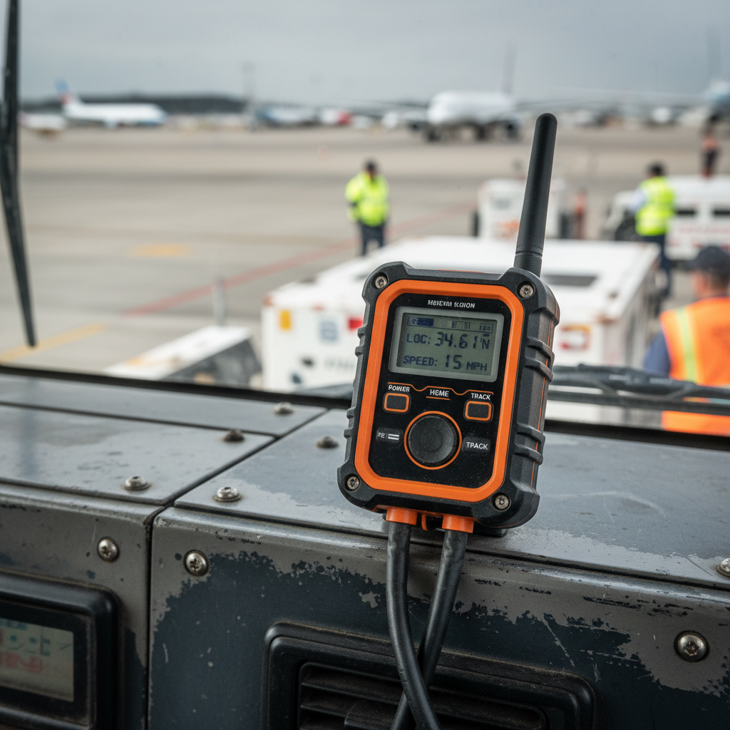
GPS is the backbone of outdoor vehicle tracking and forms the foundation of most geolocation tracking deployments. It works well on open taxiways, remote parking areas, and perimeter roads. But airports are not open fields.
Between terminal buildings, under jet bridges, inside maintenance hangars, and in narrow stands flanked by aircraft on both sides, GPS signals scatter and degrade. Accuracy drops from 3 meters to 10 or more. In covered areas, signals vanish entirely. A tug that rolled under the terminal roof five minutes ago becomes invisible to a GPS-only platform.
That invisibility has two consequences. Operationally, dispatchers can’t route equipment they can’t see. A GPU parked 200 feet from the gate it’s needed at might as well be at another terminal if nobody knows it’s there. The search-and-find ritual (walking the ramp, radioing colleagues, visually scanning rows of parked equipment) eats 30 to 40 minutes per shift at busy airports.
The safety consequence is sharper. When ATC’s surface picture has gaps near runway crossings, vehicles can enter the movement area without triggering an alert. At LaGuardia, ASDE-X alert thresholds had been set so low for years that a fire truck on an active runway didn’t register as a conflict. The technology was installed. The alert logic didn’t match the reality on the ground.
GPS is necessary. It is not sufficient. Every effective deployment I’ve seen layers additional positioning technologies on top of it.
Three technology layers, three different problems
Modern airport vehicle tracking works as a stack. Each layer serves a different user and covers a different gap. No single technology handles all three.
Layer 1: ADS-B and MLAT for ATC surface surveillance
ADS-B transponders mounted on vehicles broadcast position data on 1090 MHz, the same frequency aircraft use. ATC sees every equipped vehicle on the same display as landing and departing aircraft. MLAT (multilateration) fills in non-cooperative targets by triangulating signals received at multiple ground stations.
In November 2025, the FAA awarded a contract to deploy surface awareness systems across 55 additional ATC towers. It was the largest single expansion of ground-vehicle ADS-B coverage in U.S. history. By 2027, most towered U.S. airports will have this as a baseline capability.
Limitation: this layer serves safety-of-flight decisions, not fleet dispatching. It tells ATC where a vehicle is. It does not tell a dispatcher whether that GPU is available, charged, or due for maintenance.
Layer 2: Indoor RTLS for operational visibility
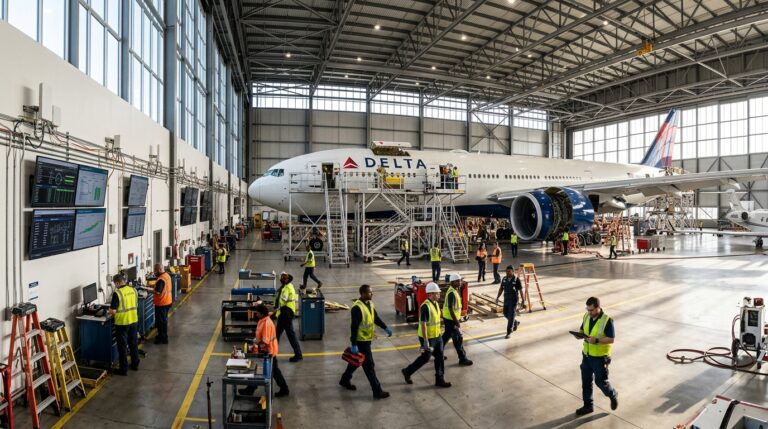
Real-Time Location Systems using Bluetooth 5.1 Angle-of-Arrival (AoA), ultra-wideband (UWB), or RFID tags resolve positions to sub-meter accuracy inside hangars, under terminal roofs, and in workshop areas where GPS goes dark. Tags on GSE assets communicate with fixed gateways, and the platform shows dispatchers exactly which bay a belt loader is parked in.
SkyLink International Airport’s deployment of BLE 5.1 AoA gateways tracked GPUs, belt loaders, tugs, and carts across indoor and apron-edge zones, delivering the strongest public ROI case in the category. I’ll break down those numbers in the next section.
Limitation: indoor RTLS requires fixed infrastructure (gateways, anchors). Coverage stops at the boundary of the installed zone. It doesn’t help ATC, and it doesn’t extend to the open apron.
Layer 3: Telematics and AI cameras for fleet management
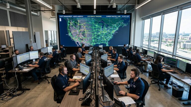
This is what most people picture when they hear “vehicle tracking.” A cellular GPS unit on each vehicle streams location, speed, engine hours, fuel level, and idle time to a cloud dashboard. Newer platforms add AI-connected cameras that flag pedestrian proximity, unsafe cargo loading, and near-miss events in real time.
This layer handles the broadest set of use cases: utilization reporting, geofence alerts, driver identification, maintenance scheduling, and post-incident reconstruction. It works outdoors reliably. It gives fleet managers a whole-fleet view.
Limitation: accuracy degrades near buildings (same GPS problem). AI cameras require power and connectivity, which rules out non-motorized assets like baggage carts or dollies.
| Layer | Technology | Primary user | Best for | Where it falls short |
|---|---|---|---|---|
| ATC surface surveillance | ADS-B / MLAT | Tower controllers | Runway and taxiway safety | No fleet ops or utilization data |
| Indoor operational RTLS | BLE 5.1 AoA / UWB / RFID | Ramp dispatchers | Hangars, gates, covered areas | No open-apron outdoor coverage |
| Fleet telematics + AI | Cellular GPS + cameras | Fleet and safety managers | Utilization, compliance, behavior | Weak indoors, no ATC integration |
The airports getting this right deploy all three as complementary layers, not competing options. GPS outdoors, BLE or UWB in covered zones, ADS-B for ATC, and AI analytics riding on top of the telematics stream. The hardware stack differs at each layer, but the dispatcher dashboard should fuse them into a single, coherent picture of the fleet.
The ROI airports actually see
The business case for tracking GSE runs on two rails: cost avoidance and penalty avoidance.
Cost avoidance is direct. A single ground power unit costs between $40,000 and $150,000 and is shared across multiple gates per shift. Lose track of three GPUs for half a day, and the replacement cost argument writes itself. Scale that across belt loaders, tugs, and cargo loaders, and you’re looking at millions in capital tied up in assets nobody can find when they’re needed.
Penalty avoidance is less visible but often larger. Airlines impose delay penalties on handlers when turnarounds exceed contractual windows. An 11-minute delay caused by a misplaced belt loader doesn’t just push one flight; it cascades through the rotation. Industry data from Airlines for America puts U.S. airline delay costs at roughly $33 billion per year. Even a small fraction recovered through faster GSE dispatch justifies the tracking investment.
The SkyLink case study is the most transparent public example. After deploying Bluetooth 5.1 AoA tracking for their GSE fleet, SkyLink documented EUR 1.96 million in annual cash benefit and a 15-month payback:
- EUR 1.1 million from avoided GSE purchases (better utilization of existing assets meant fewer new units needed)
- EUR 540,000 from reduced airline delay penalties
- 61% internal rate of return
- 18% reduction in late off-block incidents
- 40 minutes of search time eliminated per shift
That last number is the one that resonates with every ramp manager I talk to. Forty minutes per shift, three shifts a day, 365 days a year. Spent walking the ramp looking for a specific piece of equipment that’s sitting exactly where someone left it, just not where anyone expected it to be.
One more data point that rarely shows up in vendor case studies: the insurance angle. With 243,000 ramp injuries per year globally, insurers increasingly ask for evidence of GSE tracking and driver identification before renewal. A documented system with event logs and geofence compliance data is becoming a prerequisite, not a differentiator.
Electric GSE changes what tracking must do
The shift to electric ground support equipment is accelerating fast, and it rewrites the tracking requirement from the ground up.
Airlines and terminal operators have deployed 1,504 pieces of electric GSE across JFK, LaGuardia, and Newark as of 2025. JFK’s new Terminal 1 launched the world’s first centralized all-electric GSE fleet in January 2025. Terminal 6 followed with a pooled e-GSE program. Major European hubs are right behind.
Diesel GSE runs until the tank is empty, and refueling takes minutes. Electric GSE needs charging windows that last hours. A belt loader at 15% state-of-charge can’t be dispatched to Gate B7 for a quick turnaround. If the tracking platform doesn’t know battery status, it will route uncharged equipment to positions where it strands. This is a failure mode that didn’t exist with diesel fleets. A system that only reports location is now missing the single most important variable: whether the asset can actually do its job when it gets there.
The economics are shifting too. A 2025 study published in Case Studies on Transport Policy found that increasing the number of electric vehicles can actually reduce total traveled distance, though e-GSE is more expensive over its lifetime despite a lower initial purchase price. The tracking platform becomes the tool that closes that gap: maximizing utilization of every charged unit, minimizing empty repositioning, and scheduling charges around operational peaks rather than after them.
The regulatory clock is ticking
Two regulatory forces are converging on GSE fleet operators, and both carry deadlines.
The first is IATA’s Enhanced GSE Recognition Program, launched in 2024 with mandatory fleet declarations at all ISAGO-registered locations from April 2025. The program targets the four equipment types responsible for 40% of all ground damage incidents: belt loaders, cargo loaders, passenger stairs, and boarding bridges. IATA’s stated goal is 75% fleet conversion to Enhanced (anti-collision) specification, which they project could reduce per-turn damage costs by 42%. Qatar Aviation Services’ base at Hamad International was the first major operation to earn certification, in October 2024.
The second is the FAA’s surface awareness expansion. The 55-airport ADS-B rollout means regional U.S. airports will soon have ground-vehicle tracking capability that was previously limited to major hubs. This raises the baseline. Airports that aren’t equipping their vehicles for cooperative surveillance will increasingly look like outliers to regulators and airline partners alike.
Then there is the LaGuardia aftermath. The ongoing NTSB investigation into the March 2026 collision is widely expected to produce recommendations around minimum surface-alert thresholds for Part 139 airports. If your ASDE-X parameters were last calibrated years ago (as LaGuardia’s were), expect scrutiny sooner rather than later.
The direction is unambiguous. Tier-one handlers should align procurement to IATA Enhanced GSE specs within the next 18 months to protect preferred-handler status. U.S. airports should plan for ADS-B vehicle equipage as a near-term standard, not a distant wish list item.
Choosing the right tracking architecture
There is no universal answer, but there is a reliable decision framework. Start with your most expensive failure mode and work backward.
If your highest cost is runway incursions or near-misses, you need ATC-grade surface surveillance: ADS-B transponders on every vehicle that enters the movement area, with properly calibrated alert thresholds in the tower. This is a safety-of-flight investment, and it’s where the FAA is expanding coverage fastest.
If your highest cost is delayed turnarounds because dispatchers can’t locate equipment, you need operational RTLS with indoor coverage. BLE 5.1 AoA gateways in hangars and under terminal roofs, combined with cellular GPS on the open apron, give dispatchers a complete asset map. The SkyLink payback numbers come from this layer.
If your highest cost is vehicle misuse, unreported damage, or fleet overcapacity, you need telematics with utilization analytics. Engine hours, idle time, speed, geofence compliance, and driver ID give fleet managers the data to right-size the fleet and enforce operational standards.
Most airports above 10 million annual passengers need all three. The question is sequencing and budget. Start with one layer, prove ROI, expand. Regardless of approach, a few principles hold:
- Track the four equipment classes behind 40% of incidents first: belt loaders, cargo loaders, stairs, and boarding bridges.
- Insist on documented APIs and data export from day one. Vendor lock-in is real in this space, and switching costs compound over time.
- Plan for battery telemetry now. Even if your fleet runs diesel today, e-GSE transitions are accelerating. Your platform needs to be ready.
- Demand dual-KPI reporting: safety metrics (near-misses, geofence violations) alongside commercial metrics (utilization rate, turnaround contribution, delay-penalty reduction).
This is the kind of architecture work we do at Datanet every day. We help airport operators and ground handlers build multi-layer tracking stacks that start with the right hardware for the operation and scale as the fleet evolves. If your GSE goes dark between the gate and the hangar, take a look at our asset tracking device catalog or reach out directly. We’ll talk ramp problems, not product specs.

Frequently asked questions
What types of vehicles are tracked at airports?
Any vehicle operating airside: tugs, pushbacks, belt loaders, cargo loaders, GPUs, fuel trucks, catering vehicles, passenger stairs, boarding bridges, de-icers, ARFF trucks, water trucks, and lavatory vehicles. Non-motorized assets like baggage carts and dollies are increasingly tracked using passive BLE or RFID tags.
Is GPS enough for airport ground vehicle tracking?
No. GPS works on open taxiways and aprons but degrades near buildings, under jet bridges, and inside hangars. Effective airport tracking layers GPS outdoors with indoor positioning (BLE AoA, UWB, or RFID) and, where required, ADS-B for ATC-grade surface surveillance.
What ROI can an airport expect from GSE tracking?
The most detailed public case (SkyLink International) shows EUR 2.4 million in annual benefit, a 15-month payback, and a 61% IRR. Savings came primarily from avoided equipment purchases and reduced delay penalties. Results depend on fleet size, traffic volume, and current visibility gaps.
What is the IATA Enhanced GSE Recognition Program?
Launched in 2024, it requires ISAGO-registered ground handling locations to declare their GSE fleet status. It targets belt loaders, cargo loaders, stairs, and boarding bridges with anti-collision specifications. IATA projects that 75% fleet conversion to Enhanced GSE could cut per-turn damage costs by 42%.
How did the LaGuardia 2026 accident change the tracking conversation?
The NTSB found that ASDE-X failed to alert when a fire truck entered an active runway, contributing to a fatal collision with a landing aircraft. The investigation showed that having tracking technology installed is not the same as having it properly calibrated, and is expected to drive stricter FAA guidance on minimum alert thresholds at Part 139 airports.
What is the difference between ADS-B and RTLS for airport vehicles?
ADS-B broadcasts a vehicle’s position on 1090 MHz to the ATC tower, letting controllers see ground vehicles on aircraft displays. RTLS uses BLE, UWB, or RFID to position assets indoors with sub-meter accuracy. ADS-B solves the safety-of-flight problem. RTLS solves the operational dispatching problem. Most large airports need both working together.


 +1 508 292 2210

3 Responses