Every time you open a map app, hail a ride, or get a weather alert on your phone, geolocation is doing the work. It is the process of identifying a device’s geographic position using satellite signals, WiFi networks, cell towers, Bluetooth beacons, or IP addresses.
Simple concept. Massive economic footprint. The global location-based services market is projected to reach $133.93 billion by 2033, growing at 14.9% annually. The GPS market alone crossed $109 billion in 2024.
But here is what most explanations miss: geolocation is not a single technology. It is a family of methods with wildly different accuracy, power draw, and use cases. Choose the wrong one and you are not off by a few meters. You could be off by 200 kilometers. This article breaks down how geolocation actually works, where each method fits, and why the tension between accuracy and privacy defines the technology’s future.
How Geolocation Works: Five Methods, One Goal
All geolocation methods share one objective: turn a device’s relationship with surrounding infrastructure (satellites, cell towers, routers, beacons) into a set of coordinates. The differences lie in what infrastructure they depend on, how much power they consume, and how precise they get.
GPS (Global Positioning System)
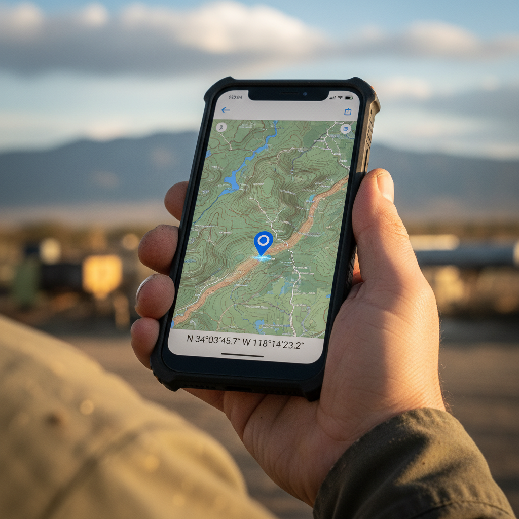
A constellation of roughly 30 satellites orbits the Earth, each broadcasting a time-stamped signal. Your device receives signals from at least four satellites, calculates the time delay for each, and uses those delays to triangulate its position. The result: outdoor accuracy of 5 to 15 meters. GPS is the gold standard for outdoor positioning, but it fails indoors because satellite signals cannot penetrate roofs and walls. It also draws significant battery power.
A bit of history adds context. The first satellite navigation system, Transit, launched in 1960 for military use. GPS development began in the 1970s, with the first satellite going up in 1978. Until May 2000, the U.S. government intentionally degraded civilian GPS accuracy to about 100 meters through a policy called Selective Availability. When SA was turned off, civilian accuracy jumped to roughly 5 to 15 meters overnight. That single policy change unlocked the consumer mapping revolution.
WiFi Positioning
Instead of satellites, WiFi positioning uses known locations of wireless access points. A device scans for nearby networks, matches them against a database of access-point locations, and estimates its position. Accuracy reaches about 10 meters indoors and 35 to 100 meters for desktop browsers. The real advantage: it consumes roughly one-tenth the energy of GPS, making it viable for always-on tracking in battery-constrained devices.
Bluetooth Low Energy (BLE)
BLE beacons are small, low-cost transmitters placed in known locations. A device detects beacon signals and estimates proximity based on signal strength. Range is limited to about 10 meters per beacon, but with dense deployment, accuracy is excellent. Power consumption is remarkably low (about one-fifteenth of GPS), which is why BLE dominates indoor tracking in warehouses, airports, and retail stores.
Cellular (Network-Based) Positioning
Your phone is always connected to at least one cell tower. By measuring signal timing and strength from multiple towers, the network can estimate your position. Accuracy depends heavily on tower density: good in cities, poor in rural areas. The upside is that it works both indoors and outdoors with almost no additional power draw beyond the phone’s normal radio connection.
IP Geolocation
Every internet-connected device has an IP address, and databases map IP ranges to approximate locations. No hardware is required on the device side. This makes it the only method that works on any connected device, including desktops with no GPS chip. The catch is accuracy, which I will cover in detail below.
Hybrid Positioning: How Modern Devices Actually Work
No single method excels everywhere. Modern smartphones and IoT trackers use hybrid positioning: they switch dynamically between GPS, WiFi, BLE, and cellular depending on environment, movement, and battery state. Step outside, GPS kicks in. Enter a warehouse, the device falls back to WiFi or BLE. This adaptive approach is what makes geolocation feel seamless to end users, even though the underlying technology keeps changing in real time.
| Method | Accuracy | Power Draw | Works Indoors? | Range |
|---|---|---|---|---|
| GPS | 5 to 15 m | High | No | Global |
| WiFi | 10 to 100 m | Low (1/10 of GPS) | Yes | ~100 m |
| BLE | ~10 m (beacon-dependent) | Very low (1/15 of GPS) | Yes | ~10 m |
| Cellular | Variable (tower density) | Minimal | Yes | Regional |
| IP Geolocation | City-level at best | N/A | N/A | Global |
The Accuracy Gap Most People Underestimate
When someone says “geolocation,” most people picture a blue dot on a map that is a few feet from where they are standing. That is GPS on a smartphone. It is not what you get from IP geolocation, and the difference is enormous.
A comparative study of IP geolocation providers found that metropolitan-area accuracy (within 50 km) ranged from roughly 50% to 75%. Tighten the requirement to city-level (within 10 km) and accuracy drops to 15% to 35%. For mobile carrier IPs, maximum deviations exceeded 15,000 km when the provider geolocated the IP to a carrier headquarters on a different continent.
This matters because mismatched expectations cost money. If you are using IP geolocation to personalize a landing page by country, the accuracy is probably fine. If you are using it to locate a missing container or verify that a high-value asset is where it is supposed to be, you need GPS or at minimum cellular triangulation. IP geolocation tells you approximately where a connection originates. GPS tells you where the device physically is, within a few meters.
For anyone managing physical assets, that distinction is not academic. It is the difference between knowing your container is “somewhere in Belgium” and knowing it is sitting idle at gate 14 in the Port of Antwerp.
Where Geolocation Creates Real Value
Geolocation is foundational infrastructure for industries worth hundreds of billions. Here are some of the most concrete examples.
Gaming and Augmented Reality
Pokémon GO remains the most commercially successful geolocation application ever built. Launched in July 2016, it generated $207 million in its first month alone. Lifetime player spending exceeded $7.5 billion by end of 2024, with monthly active users peaking at 232 million. The game proved that fusing geolocation with augmented reality could create an entirely new product category. It also proved that retention is hard: annual revenue fell from $1.23 billion in 2020 to $545 million by 2024.
Food Delivery and Logistics
DoorDash used location intelligence to capture 56% of the U.S. food delivery market. Every step depends on geolocation: matching orders to nearby drivers, generating dynamic ETAs, and letting customers track their food in real time. Without sub-minute location updates, the dispatch algorithm collapses.
Fraud Prevention
Banks match a customer’s phone location against card transaction locations to flag suspicious activity. If your phone is in Chicago and your card is used in São Paulo three minutes later, geolocation catches that. Insurance companies use geolocation to verify claims, and beacon technology lets banking customers access ATMs after hours based on their proximity.
Fleet Management and Asset Tracking
This is the space I work in every day. Geolocation underpins the entire asset tracking industry, from airline ground support equipment and MRO tooling to reusable containers in maritime logistics. Real-time traffic data enables route optimization. Geofencing triggers alerts when assets leave designated zones. And 95% of executives now say geospatial data is directly tied to business results.
The pattern across all these use cases: geolocation becomes most valuable when it moves from static lookup (where was this thing an hour ago?) to continuous awareness (where is it right now, and where is it heading?).
Privacy: From Strava to the Supreme Court
Geolocation data is extraordinarily sensitive. A stream of coordinates over time reveals where a person lives, works, worships, and sleeps. That sensitivity has triggered litigation, legislation, and a fundamental rethinking of how location data should be collected.
The Google Settlements
In 2022, Google paid $391.5 million to 40 U.S. states over deceptive location tracking practices. The core issue: users who turned off “Location History” were still being tracked through a separate “Web & App Activity” setting. Arizona extracted an additional $85 million in a separate settlement. The lesson for any company collecting location data is straightforward. Consent mechanisms must be genuinely transparent, not buried behind two layers of settings menus.
The Strava Heatmap Incident
In 2018, Strava published a global heatmap aggregating over 1 billion activities and 3 trillion GPS data points. The data was “anonymized.” It did not matter. Analysts quickly identified the outlines of secret military bases in Afghanistan, Syria, and even patrol routes around classified facilities. The incident demonstrated a principle that still holds: individual data points may seem harmless, but when millions of them are overlaid, sensitive patterns emerge. Anonymization alone is not enough.
Carpenter v. United States
In 2018, the U.S. Supreme Court ruled in Carpenter v. United States that police generally need a warrant to access historical cell-site location information. The decision established that location data held by third parties (like your phone carrier) still enjoys Fourth Amendment protection. It was a landmark ruling, but it left a major question unanswered.
Geofence Warrants and the Unsettled Law
A geofence warrant works in reverse. Instead of targeting a specific suspect, law enforcement asks a company (usually Google) to identify every device within a geographic boundary during a specific time window. In 2020, Google received more than 11,500 such warrants. Federal courts are now split on whether this practice is constitutional. The Fourth Circuit and Fifth Circuit reached opposite conclusions, creating a conflict that may eventually reach the Supreme Court.
GDPR and CCPA
Under GDPR, IP addresses qualify as personal data, meaning any IP-based geolocation triggers full data protection obligations. The California Consumer Privacy Act (CCPA) explicitly lists precise geolocation as personal information, giving consumers the right to know what location data is collected and to request its deletion. For businesses operating globally, compliance is not optional. It is the cost of using geolocation at all.
Indoor Positioning: The Fastest-Growing Frontier
GPS dominates outdoors. Indoors, it is useless. And people spend most of their time indoors.
That gap is driving massive investment. The indoor location market reached $11.9 billion in 2024 and is projected to grow to $31.4 billion by 2029, at a compound annual growth rate of 21.4%. That makes it the fastest-growing segment in the entire geolocation ecosystem.
Three technologies are filling the indoor gap:
- BLE beacons provide the best balance of cost, accuracy, and battery life for environments like retail floors, hospital wings, and warehouse aisles.
- WiFi fingerprinting uses existing wireless infrastructure to estimate position without additional hardware, though accuracy depends on access-point density.
- Magnetic field positioning (used by companies like IndoorAtlas) leverages the unique magnetic signature of a building’s steel structure. No beacons needed, but it requires initial mapping.
For anyone managing physical operations in enclosed spaces (warehouses, ports, airport terminals, MRO hangars), indoor positioning is not a future technology. It is available now, and it closes the visibility gap that outdoor-only geolocation leaves wide open.
What Geolocation Means for Asset Tracking
Most people encounter geolocation through consumer apps: navigation, ride-hailing, food delivery. The technology is the same in industrial settings, but the stakes are different.
In consumer apps, a few meters of inaccuracy is an inconvenience. In industrial operations, losing track of a ULD, a reusable container, or a piece of ground support equipment means delayed flights, missed SLAs, and operational dollars burned on searching for things that should be visible. This visibility directly impacts aircraft maintenance efficiency, where knowing asset location can reduce downtime by hours. This is the world I operate in at Datanet IoT Solutions, and it is where the distinction between geolocation methods matters most.
Shipment tracking ends at delivery. The package arrives, the tracking number goes dark, and the job is considered done. Asset tracking follows the full cycle: deployment, transit, dwell time, return, maintenance, reuse. That cycle depends on continuous geolocation, not a point-in-time scan.
The hardware choices reflect this. A DO-160 certified airfreight tracker needs to survive vibration, altitude, and temperature extremes while reporting position through GNSS. Similar durability requirements apply to asset tracking in aircraft manufacturing, where components and tooling move through production facilities with varying signal environments. A maritime container tracker needs cellular and satellite fallback because GPS alone loses coverage mid-ocean. A warehouse tag relies on BLE or WiFi because GPS signals never reach it.
The geolocation method is not a spec sheet decision. It is an operational decision driven by where your assets go, how long they stay there, and what happens when you cannot find them.
If your asset pool feels invisible after the delivery scan, that is the gap continuous geolocation closes. We help companies close it. Talk to our team, or browse our full range of tracking devices to see what fits your operation.

Frequently Asked Questions
What is geolocation in simple terms?
Geolocation is the process of determining the physical location of a device or person using technology. It typically relies on GPS satellites, WiFi access points, cell towers, Bluetooth beacons, or IP addresses to produce geographic coordinates (latitude and longitude) or a readable address.
What is the difference between GPS and geolocation?
GPS is one method of geolocation, not a synonym for it. GPS uses satellite signals and delivers 5 to 15 meter outdoor accuracy but fails indoors. Geolocation is the broader category that also includes WiFi, BLE, cellular, and IP-based methods, each with different accuracy and power profiles.
How accurate is IP geolocation?
Less accurate than most people assume. At the metropolitan level (within 50 km), IP geolocation is correct roughly 50% to 75% of the time. At city level (within 10 km), accuracy drops to 15% to 35%. For mobile carrier IPs, errors can exceed thousands of kilometers. It is useful for approximate regional targeting but not for locating physical assets.
Can geolocation work indoors?
GPS cannot, but other methods can. WiFi positioning reaches about 10-meter accuracy indoors. BLE beacons provide precise proximity detection in beacon-equipped facilities. Cellular triangulation offers rough indoor positioning. The indoor location market is growing at 21.4% annually as businesses invest in these alternatives.
Is it legal for companies to track my location?
It depends on jurisdiction and consent. Under GDPR, location data is personal data requiring explicit consent. The CCPA classifies precise geolocation as personal information with consumer rights to access and deletion. The U.S. Supreme Court ruled in Carpenter v. United States that government access to cell-site location data requires a warrant. Companies must obtain informed consent and provide clear disclosure.
What is the difference between geolocation and geotagging?
Geolocation is the process of determining a position. Geotagging is the act of attaching location metadata (coordinates, altitude, timestamp) to a piece of content like a photo, social media post, or sensor reading. Geolocation produces the data; geotagging stores it alongside other information.